Page 8 of 10
Re: Planning map and history
Posted: Mon Apr 15, 2024 3:10 pm
by goranw
If you find it worth to test.
First make a new WitE-2 game folder at a new place.
Just change things in that new place.
Then you risk nothing. If for any reason things are not functional just delete everything.
I think that nothing is changed regarding game play but I am not having the computer knowledge to guarantee that.
To download the GW mods;
https://we.tl/t-pDgxKGTyyE
(Must add that the base map is much influenced by the The Generals map by Overkill01)
Then;
In generic data change the w.hexart.dat and w.maptext.dat files
In the common folder change the GuiFonts file
In Art folder change the Tiles and Units folder.
Here yoy can compare the base game map and the new one with small units marks and more historical information.
Only done in Max zoom. More towns/villages and german font type and naming. Long. and Lat. The units are colour marked after level/type. Formation colour. Airfields are graded after type. Occupation dates resp. in east and west.
New names and airfields are of course not ingame. (That would be another thing)
Please inform if functional!
Goran
- WitE-2.jpg (3.57 MiB) Viewed 2132 times
Re: Planning map and history
Posted: Mon Apr 22, 2024 3:49 pm
by goranw
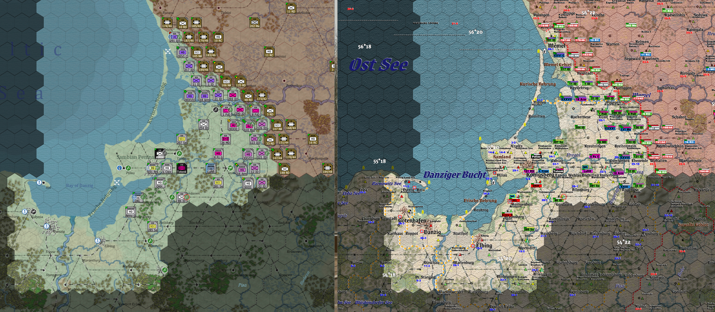
End of january-45. Warschau taken 17/1.
Here in the game attack NW of Lomscha.
Deutsch Eylau reached 22/1. Radom 16/1.
Otherwise broad attack with armour in the front north and south of Warschau.
Many german routed units behind the frontline.
Goran
- Fall of Warschau 17 jan-45.jpg (3.6 MiB) Viewed 2076 times
Re: Planning map and history
Posted: Mon May 13, 2024 5:08 pm
by goranw
War in the East map with historical vegetation.
From Deutsche Heereskarte scale 1:1 000 000.
Goran
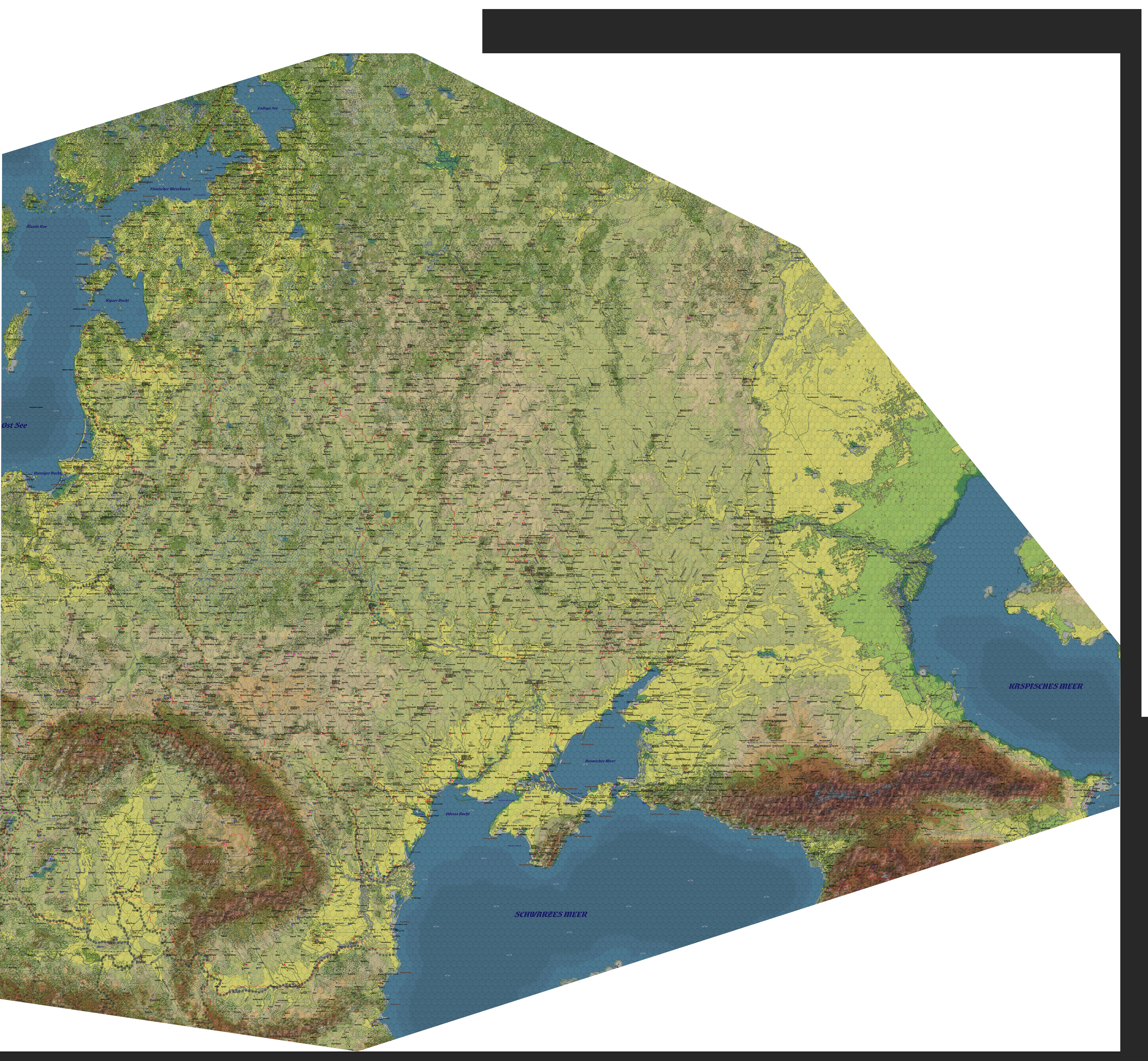
- Vegetation.jpg (9.9 MiB) Viewed 2000 times
Re: Planning map and history
Posted: Sun May 19, 2024 7:06 pm
by goranw
German prewar estimation of russian waterways.
Goran

- Gewässer WitE-2.jpg (9.77 MiB) Viewed 1960 times
Re: Planning map and history
Posted: Thu May 23, 2024 4:53 pm
by goranw
Maps to download if wished.
1. Planning map WitE-2
https://we.tl/t-lctIRCA40x
2. Detailed map Europäisches Russland scale 1:2 500 000
(borders start Barbarossa -41.)
https://we.tl/t-Lzgj58CYNy
Goran
Re: Planning map and history
Posted: Thu Jun 13, 2024 7:22 pm
by goranw
Game map.
Ai-Ai play. Weichsel to Berlin scenario.
Kurland pocket and Samland attack around Königsberg.
Memel still holding.
Goran
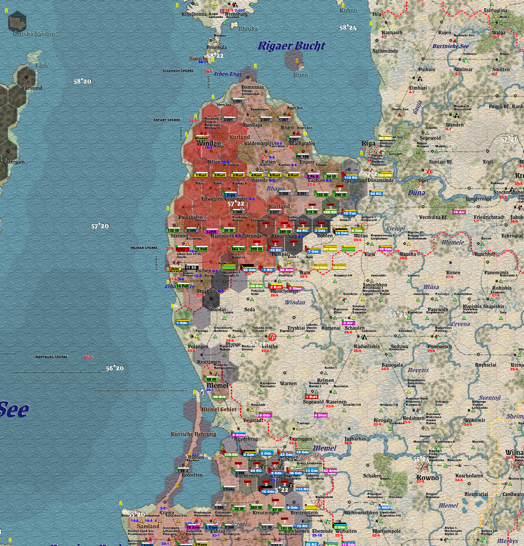
- Vistula-Berlin scenario.jpg (3.55 MiB) Viewed 1854 times
Re: Planning map and history
Posted: Fri Jun 14, 2024 5:27 pm
by goranw
New WitE-2 planning map. Bigger area and some new added information.
https://we.tl/t-XZc71APc26
Goran
Re: Planning map and history
Posted: Sat Jun 15, 2024 11:03 am
by goranw
Road to Moscow ( We-Go system game that never was) and John Tiller planning map.
Area Stalingrad. (Different zoom). In the Road to Moscow game you draw the plans on the map.
John Tiller games were very detailed and ambitious. He sadly died in young age 2021.
Goran

- RtM and Tiller Stalingrad planning map.jpg (4.6 MiB) Viewed 1804 times
Re: Planning map and history
Posted: Mon Jun 17, 2024 11:07 am
by goranw
Perhaps a bit off topic but for the sake of map interest.
Early TOAW versions of all for that time made Barbarossa scenarios.
Made myself 2 maps with 6-resp.7 km per hex.
One was used by Brian Topp to make a good Barbarossa scenario.
The big and most used scenario I think was Fire in the East.
Added also one Europe scenario and the smallest playable Barbarossa scenario.
Believe it or not but it was playable.
Of course also the TOAW map with river hex sides.
Goran

- TOAW-variantes.jpg (9.55 MiB) Viewed 1774 times
Re: Planning map and history
Posted: Fri Jun 28, 2024 4:47 am
by Niedowidek_slith
Goran,
I stumbled upon this book just yesterday. I wonder do you know about it?
https://www.amazon.com/dp/1472843924?re ... 0ZRTD2N6MT
Barbarossa: An Atlas of German Army Situation Maps (by Kevin Boylan)
It will be available (Kindle and hardcover) in August.
Artur
Re: Planning map and history
Posted: Fri Jun 28, 2024 7:39 pm
by goranw
Hi!
Very interesting. I knew nothing of it.
Thanks for the tip.
Many years ago a german Verlag printed an atlas of ArmeGruppeMitte. 22-6---6-12-41.
Also based on situation maps-Lagekarten. AG Nord and Süd were planned but I think they never were finished
Goran
Re: Planning map and history
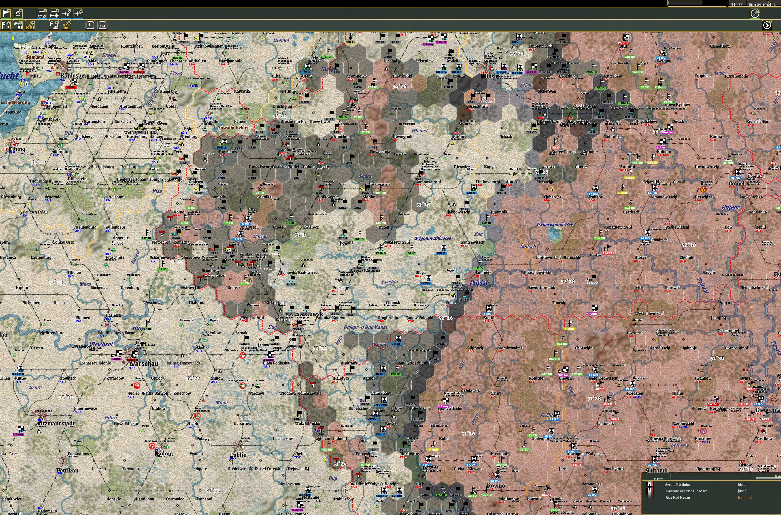
Posted: Sat Jun 29, 2024 1:28 pm
by goranw
Just to finish the "off-topic" maps.
Famous board games with Barbarossa subject.
Goran

- Barbarossa board games.jpg (2.62 MiB) Viewed 1674 times
Re: Planning map and history
Posted: Mon Jul 01, 2024 3:03 pm
by goranw
Ai-Ai.
Up to turn 15.
28 sept.-41.
41-scenario and Road to Karelia.
Quite historical.
ex. Hangö, Frontlines in Karelia, near Neva and along Svir.
Oranienbaum fortress,occ. of the Baltic islands. Front near Chrimea etc.
Less historical is the too big german advance towards Moscow.
Historical frontlines Turn 10, 15 and 20.
Thats to say 24-aug, 28-sept. and 2-nov.
Most historical airfields graded after german typing.
Lat. Longs. German airfield signs. Ferrys and mine fields-start-41
Added naming. German style fonts. Occupation dates.
Counters colormarked after level and formation belonging.
Goran

- 28-sept.-41.jpg (9.22 MiB) Viewed 1648 times
Re: Planning map and history
Posted: Wed Jul 03, 2024 10:14 pm
by goranw
Study of railway dates up to turn 5 20 july.
Arme Gruppe Nord.
Goran
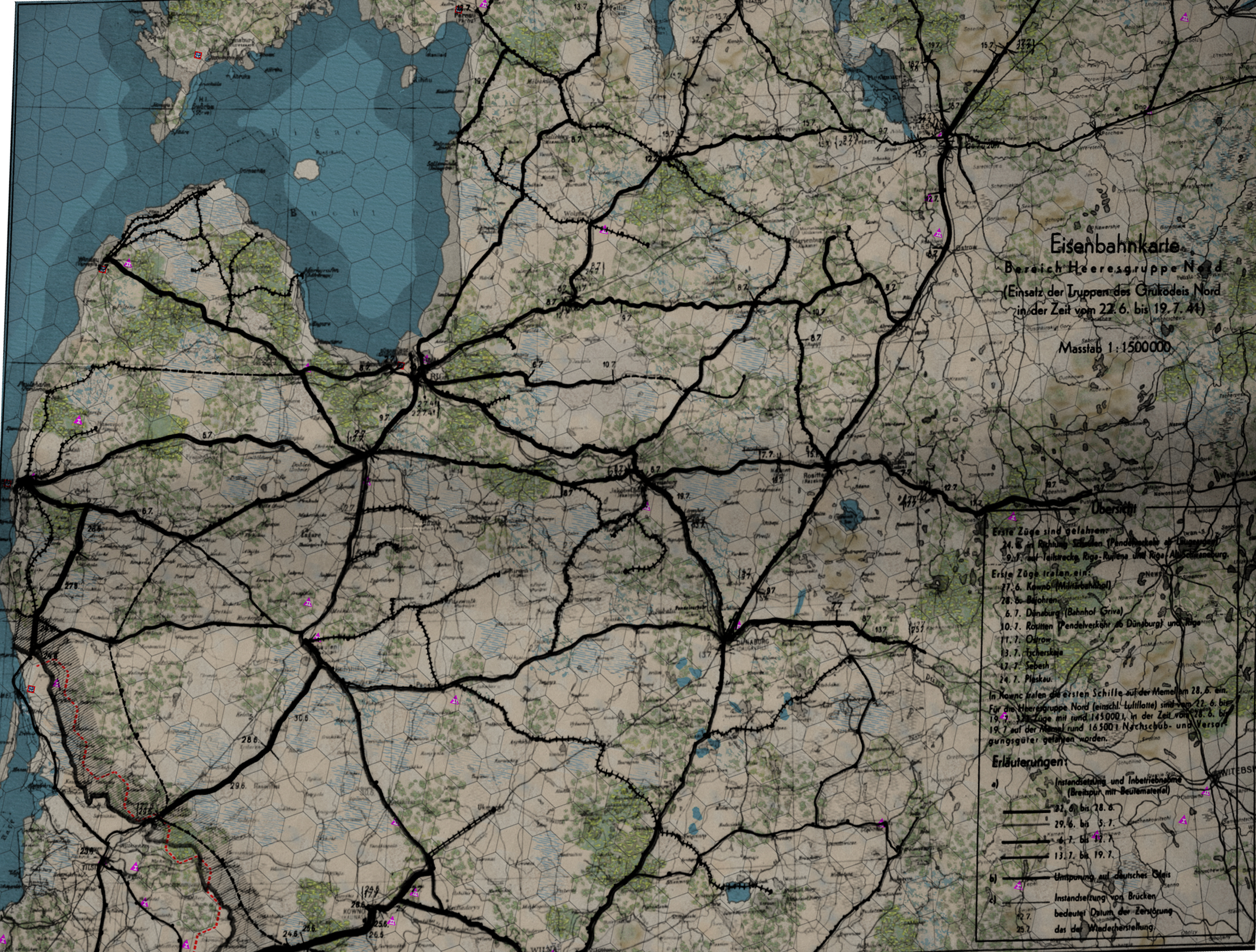
- Railway dates up to turn 5 20 july.jpg (3.27 MiB) Viewed 1611 times
Re: Planning map and history
Posted: Thu Jul 11, 2024 9:25 pm
by goranw
Road to Karelia scenario. Ai-Ai.
Start turn 5 20-july. Ongoing attack on Dorpat-Tartu.
Possibility to evaluate the rail construction in the game up to
date above.
Goran
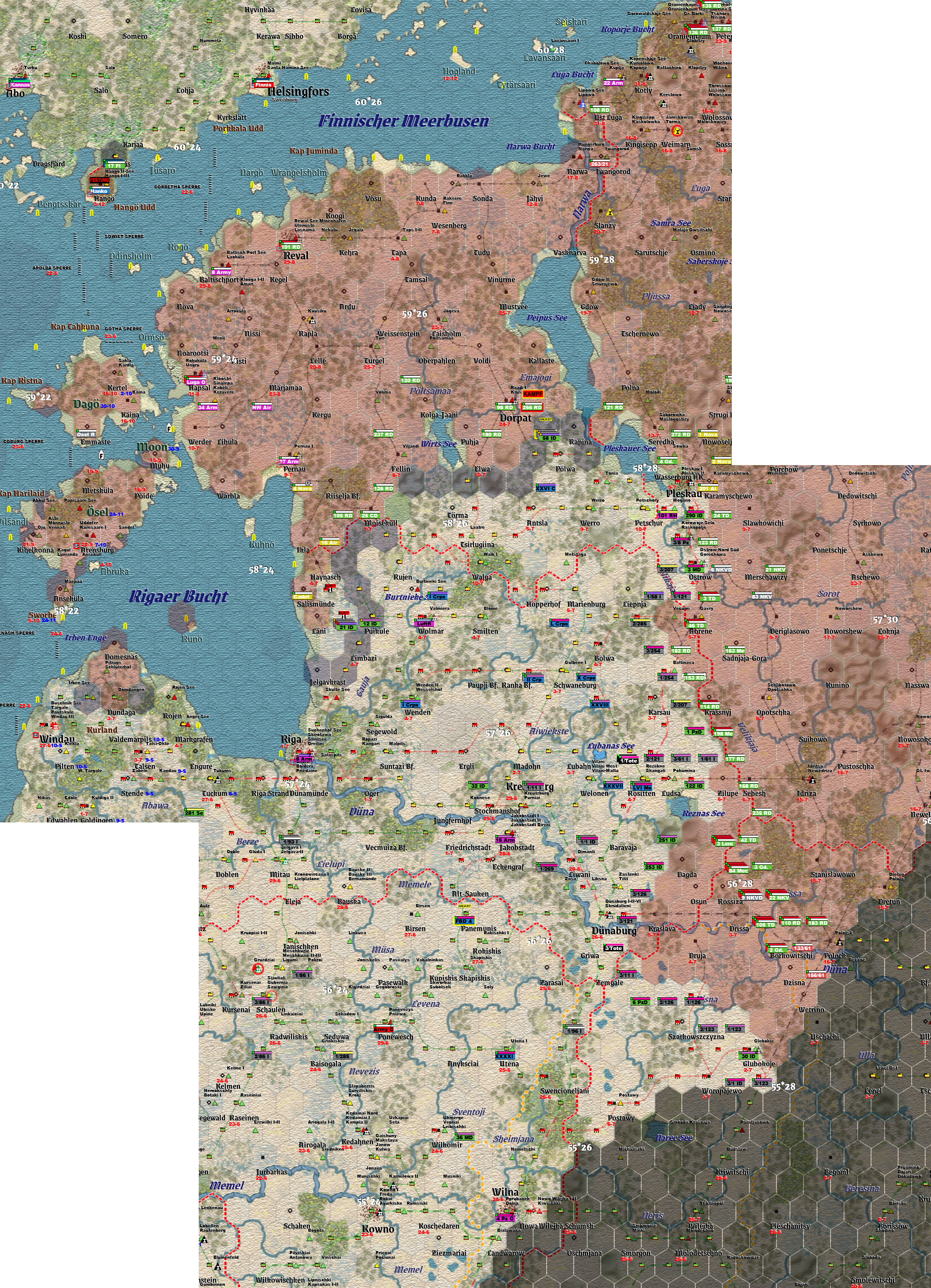
- Start turn 5 20 july..jpg (6.02 MiB) Viewed 1576 times
Re: Planning map and history
Posted: Sat Jul 13, 2024 11:12 am
by goranw
To rniles1149.
Crimea. From WitE-2 gaming map.
Some information added compared to original map.
Goran
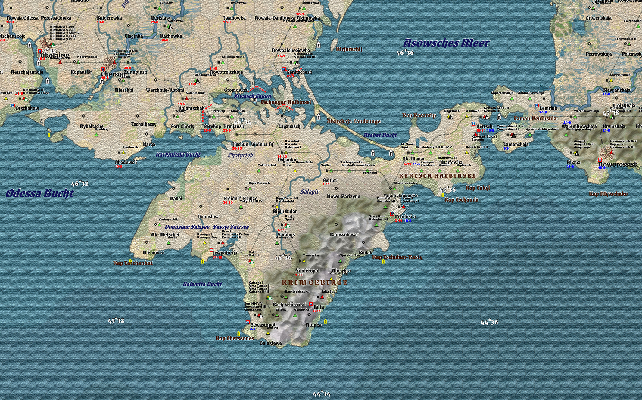
- Crimea.jpg (2.97 MiB) Viewed 1562 times
Re: Planning map and history
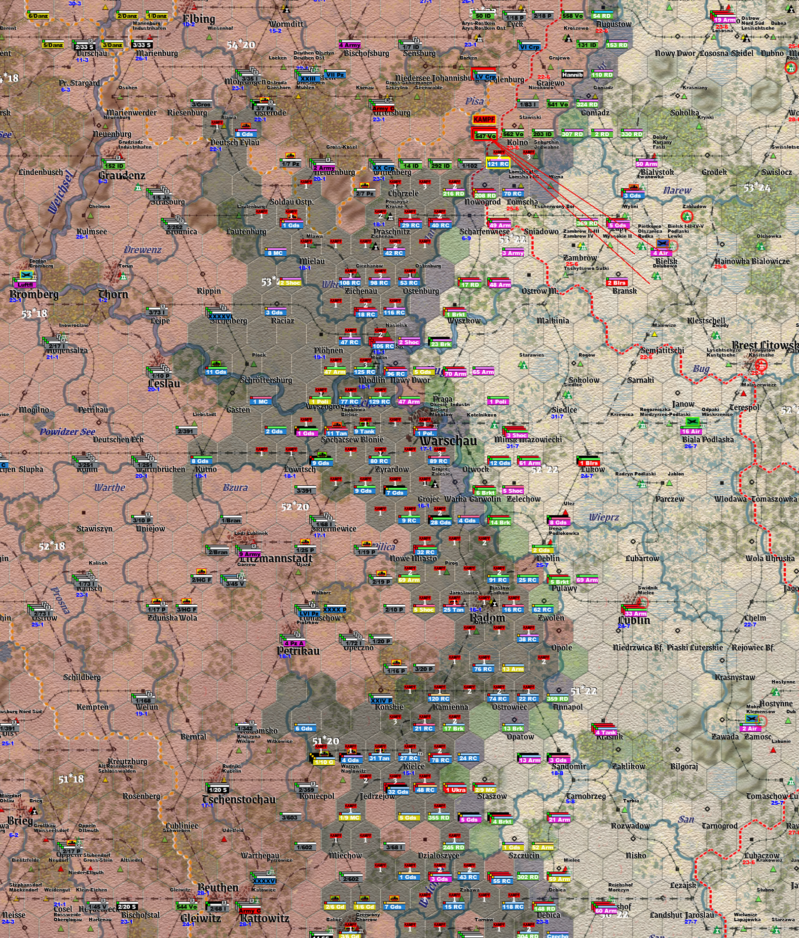
Posted: Mon Jul 22, 2024 12:25 pm
by goranw
Magnitude of soviet attack 20-27 jan -45.
Vistula (Weichsel)- Berlin scenario
Goran
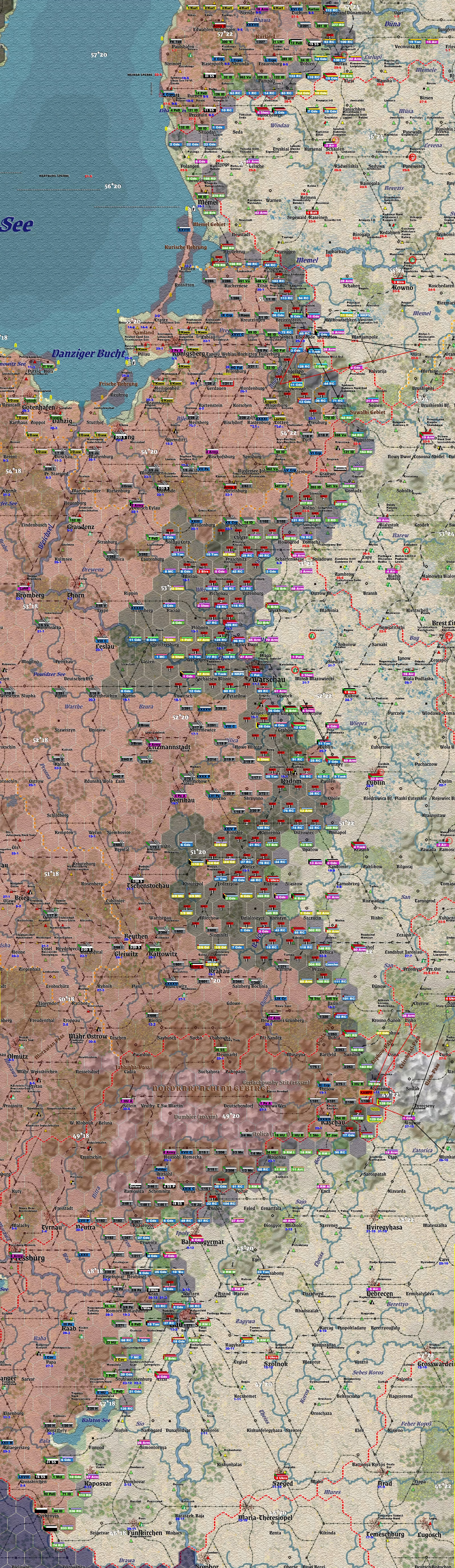
- 20-27 jan -45.jpg (8.77 MiB) Viewed 1502 times
Re: Planning map and history
Posted: Thu Aug 01, 2024 1:49 pm
by goranw
Ai-Ai -41-scenario.
Unit mods by mrhu401.
Attacks late june in relation to Bialystok pocket.
Goran
- Bialystok pocket.jpg (5.89 MiB) Viewed 1448 times
Re: Planning map and history
Posted: Fri Oct 18, 2024 1:37 pm
by zebrazwo
Hi
Huge appreciation for your maps! (all of them!)
Would it be possible to refresh the file you mention above? I followed the lnk but it said the file has expired.
Re: Planning map and history
Posted: Sat Oct 26, 2024 8:04 pm
by goranw
Hi! To zebrazwo!
To load files.
https://we.tl/t-lWkZu07YMj
After wish select all or some of them.
Upload into a new game folder so its easy
to eliminate if not wished.
( as said before; historical airfields, map lat.long. for easier localisation,
some initial mine fields, important light houses, german airfield and ferry marks,
german time-true font, some added borders, extended overall naming corresponding to german war maps,
occupation dates in the east 41-42 and in the west 44-45, Some effort to make the map look as a paper map,
Unit counters smaller, coloured after type and level, colours for formation belonging,
soft factors at will.
No change in gameplay. All added information just for historical purpose
Goran