Page 3 of 4
RE: Serious Issue with COTA maps
Posted: Thu Apr 06, 2006 7:11 am
by sterckxe
ORIGINAL: MarkShot
Hmm ... maybe PG should start a new promotion where each customer for a game is entered into a drawing. The grand prize is a trip to visit the battlefield upon which the game is based.

Now, THAT'S an idea !
ORIGINAL: MarkShot
Actually, one of the beta testers, Coralsaw, was in Greece when we started COTA, but I think he dropped out.
And there was Eddy and Grouchy, beta testers, from the low countries while HTTR was being developed.
Actually I got drafted just after HTTR was released. But there's a Bulge game coming up or so I've heard ... [:D]
Greetz,
Eddy Sterckx
RE: Serious Issue with COTA maps
Posted: Thu Apr 06, 2006 2:54 pm
by PyrosLambert
ORIGINAL: sterckxe
ORIGINAL: MarkShot
Hmm ... maybe PG should start a new promotion where each customer for a game is entered into a drawing. The grand prize is a trip to visit the battlefield upon which the game is based.
Now, THAT'S an idea !
Greetz,
Eddy Sterckx
Let me tell you an even better idea...
The above proposition grand prize with the addition (in COTA) of a WW2 battle that took place on any Greek Aegean island... [:D][:D][:D]
This way not only you will visit that "battlefield", but you may also enjoy the following :

RE: Serious Issue with COTA maps
Posted: Thu Apr 06, 2006 3:28 pm
by sterckxe
ORIGINAL: PyrosLambert
Let me tell you an even better idea...
The above proposition grand prize with the addition (in COTA) of a WW2 battle that took place on any Greek Aegean island... [:D][:D][:D]
Guessing here : Leros ? - it saw some action in 1943
Greetz,
Eddy Sterckx
RE: Serious Issue with COTA maps
Posted: Thu Apr 06, 2006 5:19 pm
by PyrosLambert
ORIGINAL: sterckxe
ORIGINAL: PyrosLambert
Let me tell you an even better idea...
The above proposition grand prize with the addition (in COTA) of a WW2 battle that took place on any Greek Aegean island... [:D][:D][:D]
Guessing here : Leros ? - it saw some action in 1943
Greetz,
Eddy Sterckx
No,
These should be under the "hypothetical" scenarios...
Invasion of Myconos or the battle of Santorini... [:D]
cheers,
Pyros
RE: Serious Issue with COTA maps
Posted: Thu Apr 06, 2006 11:27 pm
by Arjuna
[:D][:D]
RE: Serious Issue with COTA maps
Posted: Fri Apr 07, 2006 6:12 am
by sterckxe
ORIGINAL: PyrosLambert
These should be under the "hypothetical" scenarios...
Invasion of Myconos or the battle of Santorini... [:D]
I've been to Santorini - back when it wasn't overrun by tourists - didn't recognize it from the pictures - apart from the strategic necessity of capturing it : good luck trying to invade that one - it's basically a lava rock with no natural harbours or water springs
- did it even have an airfield back then ?
Greetz,
Eddy Sterckx
RE: Serious Issue with COTA maps
Posted: Fri Apr 07, 2006 11:50 am
by PyrosLambert
Yes,
Santorini (ancient) Thira is a unique volcanic island...
A lot of scientists believe that the ancient eruption of the volcano of Santorini is connected with the myth of Atlantis. [8D]
Anyway, I am already collecting material for making this hypothetical COTA scenario, "Battle of Santorini". [:D][:D]
p.s look at the road network (again a mule trail [:D]) in the center of the image and the ultra modern elevation map!


RE: Serious Issue with COTA maps
Posted: Fri Apr 07, 2006 1:14 pm
by sterckxe
ORIGINAL: PyrosLambert
Santorini (ancient) Thira is a unique volcanic island...
A lot of scientists believe that the ancient eruption of the volcano of Santorini is connected with the myth of Atlantis. [8D]
I've visited the excavations on it - note for those unfamiliar with the subject : Santorini is not considered to be "Atlantis", Crete is. Vulcanic eruption on Santorini causing a tidal wave which hits Crete then the ultimate civilization but past it's prime causing an economic collapse which in turn causes a civic/society collapse. Most plausable of all the theories out there.
ORIGINAL: PyrosLambert
Anyway, I am already collecting material for making this hypothetical COTA scenario, "Battle of Santorini". [:D][:D]
The Germans versus the British, just like last summer [:D]
ORIGINAL: PyrosLambert
p.s look at the road network (again a mule trail [:D]) in the center of the image and the ultra modern elevation map!
It's not very clear from the pictures you've provided, but there's a lot of flat terrain there, so glider units could be employed. And even panzers. Provided you can get the panzer on that terrain first and I've got no clue how you're going to do that save timewarping in a Hercules/Galaxy cargo plane [:D]
The pictures brought back a lot of good memories - scootering around the island was a blast [:D]
Greetz,
Eddy Sterckx
RE: Serious Issue with COTA maps
Posted: Fri Apr 07, 2006 1:43 pm
by PyrosLambert
If I make an analysis of the Thira - Atlantis topic then this thread will get completely OFF-TOPIC [:D][:D] and I am afraid that COTA will be remembered not as Conquest of the Aegean, but as Conquest of the ATLANTIS...[:D][:D]
But I will give you a very brief (and over-simplified) thesis according to PLATO scripts [8D]
Thira was the center of a very prosperous Aegean civilization as Crete was the center of the Minoan Crete civilization.
The explosion of the volcano destroyed half the island and the Tsunami wave destroyed the north Cretan shores (up to 14 kilometers); this is why the new Minoan capital of Knossos was built several kilometers away from the shores.
According to Plato, Atlantis landscape was characterised by a double ring formation (usual landscape of volcanic cones) and this was a fact in Thira (before its destruction).
In the following satellite picture, the red circle defines the missing land and the cyan circle defines the volcanic caldera (cauldron).
cheers,
Pyros

RE: Serious Issue with COTA maps
Posted: Fri Apr 07, 2006 2:28 pm
by sterckxe
ORIGINAL: PyrosLambert
According to Plato, Atlantis landscape was characterised by a double ring formation (usual landscape of volcanic cones) and this was a fact in Thira (before its destruction).
Continuing this WAAAAAAAY OT part of the thread - I'll risk the wrath of the administrators for it [:D]
Ok, but other stuff Plato wrote about it (springs, building descriptions, ...) point more to Crete than to Thira so the story is probably garbled a bit. Practically every scholar now agrees that everything mentioned above (eruption, tidal wave, Santorini and Crete) mixed and mingled form the core of the Atlantis story. Why is all OT stuff so wildly fascinating ? [:D]
Oh, and the Cretenzers firmly believe they're Atlantis - been there - heard the stories [:D]
Greetz,
Eddy Sterckx
RE: Serious Issue with COTA maps
Posted: Fri Apr 07, 2006 4:39 pm
by PyrosLambert
ORIGINAL: sterckxe
ORIGINAL: PyrosLambert
According to Plato, Atlantis landscape was characterised by a double ring formation (usual landscape of volcanic cones) and this was a fact in Thira (before its destruction).
Continuing this WAAAAAAAY OT part of the thread - I'll risk the wrath of the administrators for it [:D]
Ok, but other stuff Plato wrote about it (springs, building descriptions, ...) point more to Crete than to Thira so the story is probably garbled a bit. Practically every scholar now agrees that everything mentioned above (eruption, tidal wave, Santorini and Crete) mixed and mingled form the core of the Atlantis story. Why is all OT stuff so wildly fascinating ? [:D]
Oh, and the Cretenzers firmly believe they're Atlantis - been there - heard the stories [:D]
Greetz,
Eddy Sterckx
I would love to do this discussion [:)] but I am afraid that we should postpone this story for another place & another time!
Currently I am preparing a campaign, designing 10+ maps, participating in 3 BETAs and much more...

cheers,
Pyros
RE: Serious Issue with COTA maps
Posted: Sun Apr 09, 2006 12:08 pm
by PyrosLambert
Here is a section of an Italian 1941 map of Greece (with info concerning the road network around Olympus mountain).

RE: Serious Issue with COTA maps
Posted: Sun Apr 09, 2006 12:10 pm
by PyrosLambert
Here is an Australian map of Greece (with info concerning the road network).

RE: Serious Issue with COTA maps
Posted: Sun Apr 09, 2006 12:14 pm
by PyrosLambert
Here is a second (to third) class road

RE: Serious Issue with COTA maps
Posted: Mon Apr 10, 2006 9:23 am
by Agema
Well, technically Atlantis was reported to be beyond the pillars of Hercules (i.e. Straits of Gibralter). Although many myths are supposed to be combinations of various stories (often with embellishments), so Crete/Santorini is a likely a major part of it. On the other hand, Plato might have just made the whole thing up to illustrate a point.
RE: Road Network in COTA maps
Posted: Mon Apr 10, 2006 8:14 pm
by PyrosLambert
Here are two photos (one from Platamon ridge) :
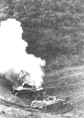
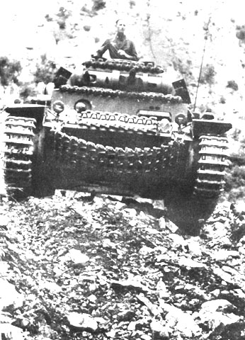
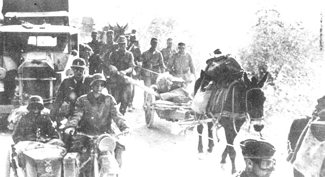
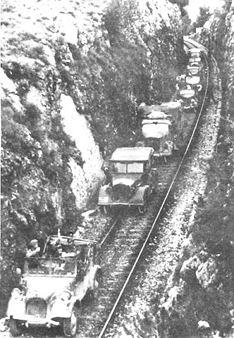
Here are more photos related with the road network in Greece:
Traffic jam in the "Highway"
The railtrack-way
The Speed-way

RE: Road Network in COTA maps
Posted: Wed Apr 12, 2006 4:11 am
by Arjuna
Pyros,
I have to take my hat off to you...you score 120% for persistence.

OK I reviewed the original maps we're using ( 1940 1:100,000 GSGS ) and have changed the road leading from Panteleemon south east across the Castle ridge from a "minor road" to a "track" ( which is now only of benefit to foot units. The picture below shows a motorised movement path being generated from Panteleemon to a point SE across the ridge. Note that the route now goes via the tunnel. Movement is still possible across the ridge, albeit extremely slowly, so motorised will tend to ignore that as an option.
I also reduced the move rates for minor roads quite savagely.[:)]
Now that's all I'm going to do on this map for now. I need to focus back on this ScenMaker Manual. Please hang fire on any further comments on this Pyros until you have actually played the game. Then you will be able to see how it works in practice and we can then talk turkey. Bye for now.[:)]

RE: Road Network in COTA maps
Posted: Wed Apr 12, 2006 5:13 am
by JeF
ORIGINAL: Arjuna
I also reduced the move rates for minor roads quite savagely.[:)]
Not to savagely I hope. We still need to be able to play this thing...
... one day. [;)]
JeF.
RE: Road Network in COTA maps
Posted: Wed Apr 12, 2006 7:04 am
by PyrosLambert
ORIGINAL: Arjuna
Pyros,
I have to take my hat off to you...you score 120% for persistence.
OK I reviewed the original maps we're using ( 1940 1:100,000 GSGS ) and have changed the road leading from Panteleemon south east across the Castle ridge from a "minor road" to a "track" ( which is now only of benefit to foot units. The picture below shows a motorised movement path being generated from Panteleemon to a point SE across the ridge. Note that the route now goes via the tunnel. Movement is still possible across the ridge, albeit extremely slowly, so motorised will tend to ignore that as an option.
I also reduced the move rates for minor roads quite savagely.[:)]
Now that's all I'm going to do on this map for now. I need to focus back on this ScenMaker Manual. Please hang fire on any further comments on this Pyros until you have actually played the game. Then you will be able to see how it works in practice and we can then talk turkey. Bye for now.[:)]
Dave,
I salute you

From your actions and your personal concern toward the quality control of your game, I am persuaded that COTA will have all the characteristics of an accurate and well done historical simulation.
I wish you the best success for COTA.
cheers,
Pyros
RE: Road Network in COTA maps
Posted: Wed Apr 12, 2006 2:41 pm
by PyrosLambert
Dave
Btw, if someone read carefully the various AARs concerning those battles he may find EXTREMELY useful information concerning the road-network.
For example by reading this section of the Anzac AAR:
This regiment, commanded by Lieutenant-Colonel Decker,5 had been ordered up from north of Katerini that morning. The roads were crammed with traffic, but the tank battalion rushed up, ‘disregarding all obstacles in its path… a few other vehicles learnt by experience that their mud guards and radiators are not so hard as tanks’. The tanks reached Katerini at two-thirty in the afternoon and Platamon just before six o'clock.
You may conclude that 100 tanks needed three and a half hours to travel a distance of 35 Km (Katerini - Platamon) on a third class (cart) road.
If you make the division you will obtain that a tank regiment formation should travel at an average speed of 10 km per hour on a heavy traffic third class road.
The above clue is an excellent point of reference for defining the movement cost on every type of road.
And now I promise that I will

cheers,

Pyros