Page 1 of 1
Palu "Donggala" Celebes
Posted: Fri Dec 12, 2014 8:01 pm
by el cid again
Stock location 68,99 - location slot 1178 - should be Palu. It is
well shown as a port on the Makassar Strait - not from the Eastern
side of Celebes (Suluwese if you want to look up the island today).
It is at least a potential port build of 4, and a potential airfield
build of 4 (because it has a level 7 airfield today). It should
be a population center with industry appropriate to one - including
a level 1 repair shipyard. The SURROUNDING PROVINCE is called
Donggala - but Palu itself is a city and apparently was never known
by that name. The stock map is remarkably correct in terms of
road infrastructures (or lack of them) on this island. It is a
seaport driven infrastructure even now - but much more in the WW2 era.
A map marking for the nearby province may have been the source of
calling this city Donggala.
RE: Palu "Donggala" Celebes
Posted: Sat Dec 13, 2014 5:17 pm
by JeffroK
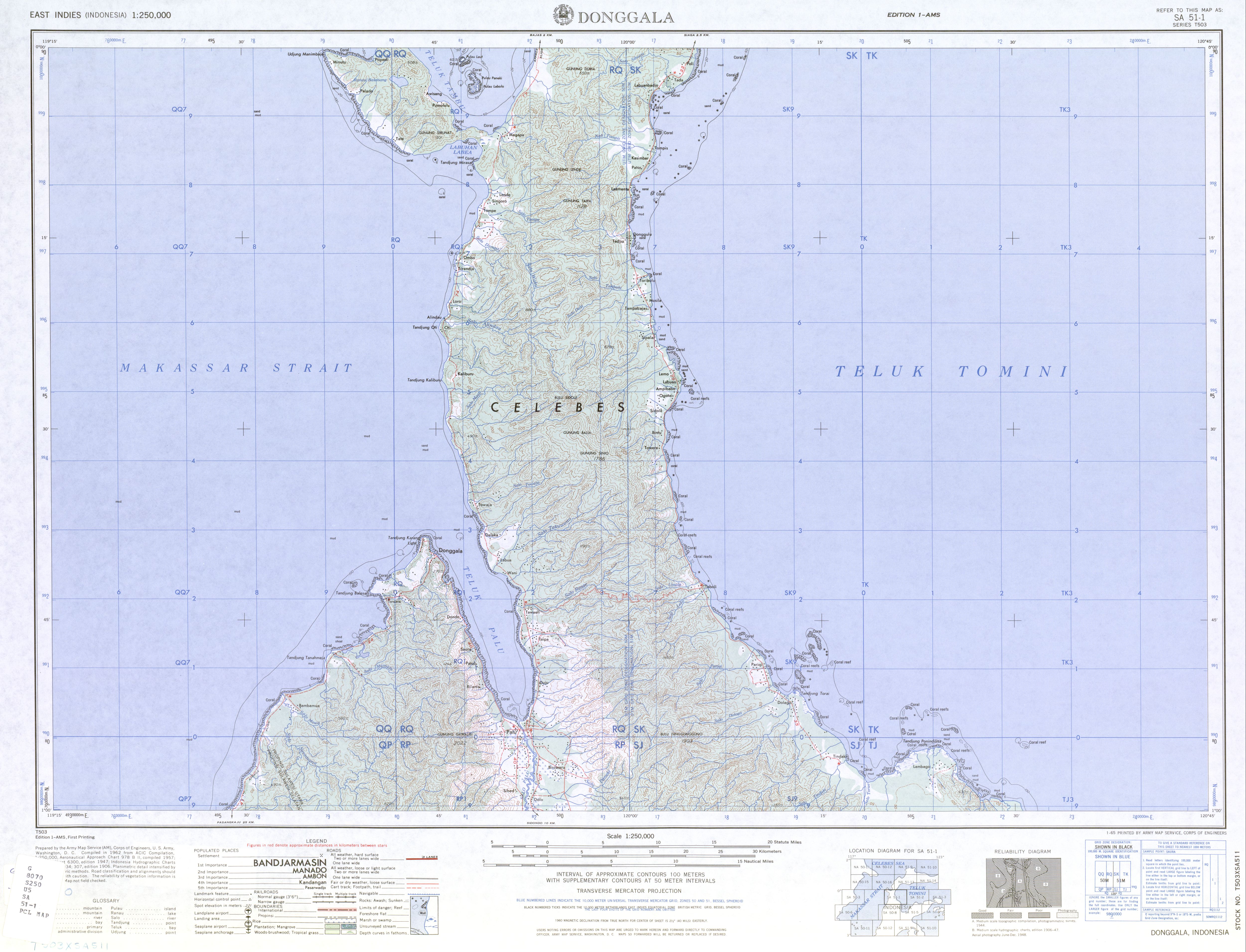
Maybe half right, Donggala is on the west of the island, and from 1950's maps appears as a big village on a sheltered harbour.
Palu is at the head of this harbour but while looking to be bigger does not appear to have any port or airfield infrastructure.
http://www.lib.utexas.edu/maps/ams/indo ... sa51-1.jpg
From below, Palu seems to have been developed post war, and while your port/airfield sizes might be correct are also helped by modern machinery.
http://indahnesia.com/indonesia/CENDON/ ... _north.php
Donggala and the north
Old harbor and the northern neck
Forty kilometers north of Palu along a good road is the old, picturesque harbor of Donggala. Across the huge Teluk Palu there is a large narrow stretch of island. This area is often only seen as a needed piece of land to connect Central Sulawesi with North Sulawesi, but in fact it is very interesting as center point between contrasting cultures of the highlands and lowlands.
Picturesque, dreamy town
Donggala has always been an important seaport, mainly for the traders from South Sulawesi and the eastern coast of Kalimantan. Their ships have come here for over a thousand years to trade; they brought Indian textile and weaving techniques, which has inspired the famous silk fabrics from the Kaili area. These kain Donggala are still made in the village of Towale. During the centuries, Buginese sailors and traders have settled in Donggala. First they integrated with the local Kaili, but later they largely replaced their place. When the Dutch thought it was time for Central Sulawesi to be under colonial rule, Donggala was chosen as the colonial governmental center.
During and after the Second World War, when Palu became capital, the seaport became less important. Shorter ago, new seaport facilities in Pantoloan across the bay, has degraded the importance of Donggala as a seaport even more. Ships of Pelni and other companies don't stop at Donggala, but Buginese schooners on their way to Surabaya do stop in Donggala. At any given time there are at least a few schooners in the seaport. They transport food, cement and tools which are transported to Palu by truck or smaller ships. On the way to Surabaya, the ships are loaded with copra, Donggala's main source of wealth. Thanks to the copra-money, many of the people here have had their hajji, the religious trip to Mecca.
http://indahnesia.com/indonesia/CENPAL/palu.php
Memories of the past
Because Palu was in fact created by the Japanese in the Second World Wart, the city looks like it's looking for a way to display her modernity instead of the apathy which many of the old colonial Dutch cities still have.
RE: Palu "Donggala" Celebes
Posted: Sat Dec 13, 2014 6:38 pm
by witpqs
Babes (extended map, at least) has Donggala accessible from the west, but not from the east.
RE: Palu "Donggala" Celebes
Posted: Mon Dec 15, 2014 1:55 pm
by Symon
This is nothing but Sid doing his Wikipedia thing. Over 40% of the game base names can have other designators. Developers choice. Modders may rename as they wish. No reason to hysterically yell "ERROR".
Donggala/Palu was nothing but a fishing port. No docks, no shipyards, no nothing. Potential, yes; but the harbor roads were very narrow and not conducive to an extensive anchorage, so was ignored by both sides. Why do you think that was? Maybe the requirements for port development were a bit more practical, than a simple AE Port number. Ooohh, maybe it's an abstraction ... Ooohh, maybe it's a touch of reality. Woof !!
When things get hysterical, I go looking for a hysterectomy. You should too. JWE