Page 1 of 2
Washington State Front, WIP
Posted: Thu May 02, 2024 7:03 pm
by PharaohVirgoCompy
So in the Trent War scenario there an event were the British can decided to invade the Washington Territory but since it not on the map it more or less left to a coin flip to decide it outcome, So I decided to make a scenario on this.
I do hope to try and learn how to work the scripts in the editor.
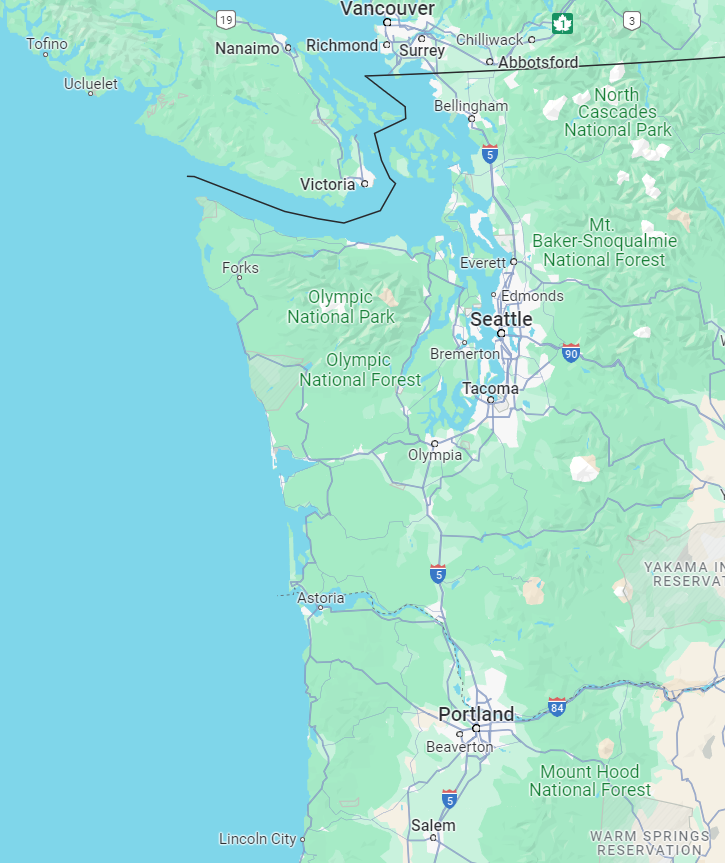
This is what I plan for the map to cover.
Re: Washington State Front, WIP
Posted: Fri May 03, 2024 12:42 am
by Platoonist
That territory was pretty much a roadless wilderness in 1862. Seattle would have barely qualified as a settlement back then.

Re: Washington State Front, WIP
Posted: Fri May 03, 2024 4:52 am
by OldCrowBalthazor
I suggest you look up about the UK-US conflict called the Pig War of 1859. There are YT videos and a great Wiki.
Incidentally, George Pickett of 'Pickets Charge' fame was posted at Fort Whatcom, and was in charge of the US response there on San Juan Island.
Also, I grew up in the San Juan Islands, which are beautiful with thick forests, hills and mountains. I know this whole area well, including the history going back at least 24,000 years.
There's much about this area's history that is relatively unknown to non-locals, and things you won't find easily.
The Pig War is pretty well documented...and this area almost blew up in both the UK's and USA's faces.
Could of easily happened in a Trent War scenario..............
Re: Washington State Front, WIP
Posted: Fri May 03, 2024 9:56 am
by BiteNibbleChomp
I would love to see this made! Indeed, both this campaign and an 1846-era "54*40' or Fight" war were two designs I considered making as part of Wars in the Americas - unfortunately never came to pass as I didn't manage to think of a design for them I was happy with.
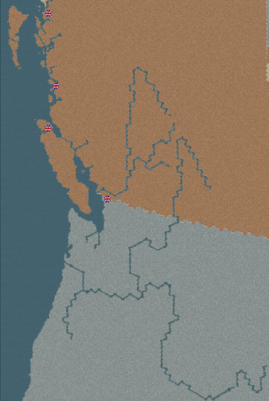
I did sketch out a map grid keeping the scale the same as the main ACW map, the faint red X on the 49th parallel being hex 0,0 on the current map. The below is just a cropping of one of my files - I've got a few resources that might be helpful for this if you're interested (shoot me a PM, most of the files would be too big for the forum).

- 5440.png (878.1 KiB) Viewed 3044 times
- BNC
Re: Washington State Front, WIP
Posted: Fri May 03, 2024 12:47 pm
by PharaohVirgoCompy
Depending on how things go I'm interested in doing an "54*40 or Fight" and a Trent War scenario. As a Pennsylvanian I don't know much about the area but willing to learn.
This is the map I have already made after making my first post (Columbia and Fraser Rivers WIP)
Re: Washington State Front, WIP
Posted: Fri May 03, 2024 1:21 pm
by Platoonist
Portland, Oregon could be considered a town at the time. However, most of the major cities on Puget Sound like Tacoma, Everett, and Bremerton didn't exist yet. Seattle was essentially a logging operation with some houses and shacks.
Even Fort Nisqually was just a wooden palisade fort. It was really more of a trading post for furs than a military post and might be considered a settlement.
Re: Washington State Front, WIP
Posted: Fri May 03, 2024 9:42 pm
by OldCrowBalthazor
Platoonist wrote: Fri May 03, 2024 1:21 pm
Portland, Oregon could be considered a town at the time. However, most of the major cities on Puget Sound like Tacoma, Everett, and Bremerton didn't exist yet. Seattle was essentially a logging operation with some houses and shacks.
Even Fort Nisqually was just a wooden palisade fort. It was really more of a trading post for furs than a military post and might be considered a settlement.
That's correct about Nisqually.
Re: Washington State Front, WIP
Posted: Fri May 03, 2024 9:59 pm
by OldCrowBalthazor
If you use this map I would extented it further north by about 150 miles north of the current US-Canada boundary and place the entire Columbia River on the map. That would be the main route of advance either way east of the Cascades,
Mind you there are two major climatic zones here. Everything west of the Cascades is temperate. East of the Cascade Mountains (2/3s of this map) is semi-desert with the farthest east edge mountains.
Also...there are virtually no roads here (at this time). There would be some around present day Vancouver (Canada)..but even that would be sparse. Supply would be extremely bad!
There were (and are still) numerous Native American/First Nation groups in the area. In the south-east, the group that could be hostile to any interlopers would be the Nez Perce' on the Snake River and Blue Mountains.
Two other groups that may cause trouble for either side could be the Yakima Nation east of the Cascades and the Duwamish League in lower Puget Sound. The Makah Nation on the NW tip of Washington Territory had strong ties with the First Nations on Vancouver Island, and traded with them across the Strait of Juan de Fuca, which is the entrance to Puget Sound.
Another thing to consider would be the possibility of the RN showing up in considerable strength, as they did in the Pig War. The USA would not be able to contend with them on the open waters. Royal Marines would be able to land anywhere with relative impunity..but once on land, could possibly be resisted by US land forces.
included is an image of the Columbia River going up into Canada...its not accurate as I penned it in.
In addition...the main focus would be the Puget Sound and Columbia River. At this scale on this map, operations on the Columbia look fine, but Puget Sound is too constricted for moving units. I would consider making the map bigger. San Juan Island, Whidbey Island and the Kitsap Peninsula and Puget Sound would be key areas to defend for the USA. The scale of the map I see here may not be able to cover that too well.
Re: Washington State Front, WIP
Posted: Fri May 03, 2024 11:53 pm
by PharaohVirgoCompy
I have also made this based off CNB's map, smaller scale but goes all the way up to 45'40. I'm honestly not sure which to go with as I can see each working well.

I am looking forward to how the supply situation will end up, also I do plan to add in Amerindians nations to the map.
Re: Washington State Front, WIP
Posted: Sat May 04, 2024 1:30 am
by Platoonist
So far, all the proposed Washington maps seem to be more accurate than this one.


- Washington Territory 1939.jpg (280.05 KiB) Viewed 2942 times
Re: Washington State Front, WIP
Posted: Sat May 04, 2024 4:54 am
by OldCrowBalthazor
Platoonist wrote: Sat May 04, 2024 1:30 am
So far, all the proposed Washington maps seem to be more accurate than this one.
Washington Territory 1939.jpg
As a Cascadian I can easily say this map has butchered the great PNW.

Re: Washington State Front, WIP
Posted: Sat May 04, 2024 8:45 pm
by PharaohVirgoCompy
I have decided to go with the map based of what BNC had and have done the navigable rivers. I'm currently doing a 1861 version of the map, when I finish everything on the map I plan to make a copy of it and use that copy for an Oregon Dispute scenario.
Re: Puget Sound Area
Posted: Tue May 07, 2024 1:58 pm
by PharaohVirgoCompy
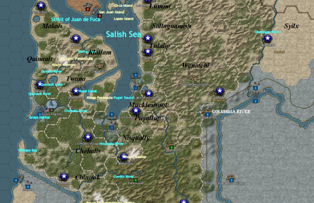
I done the Puget Sound Area, not fully sure what I'm doing so feedback would be appreciated
Re: Puget Sound Area
Posted: Wed May 08, 2024 9:09 am
by OldCrowBalthazor
PharaohVirgoCompy wrote: Tue May 07, 2024 1:58 pm
I done the Puget Sound Area, not fully sure what I'm doing so feedback would be appreciated
Brilliant. It's late and I look at this more later.

You got the tribal areas and names right also. My native heritage is Skagit, just south of the Lummi and north of the Stillaguamish. They are all part of the greater Salish language and cultural group. Note none of these native groups would have cavalry, and by the 1850's had suffered considerable losses introduced by diseases that swept in waves from the south (Mexico) in the 1780s onwards.
The Nez Perce in NE Oregon would have cavalry. They were the first to breed appaloosa, and had trade ties between the Chinook in the west and the interior stretching to the Great Plains across the Rockies.
The image is cut off but you will need Fort Whatcom (present day Bellingham Wa.) George Picket was stationed there. That Fort was intended to establish a US presence near Vancouver.
Well done
Re: Eastern Washington State
Posted: Fri May 10, 2024 8:32 pm
by PharaohVirgoCompy
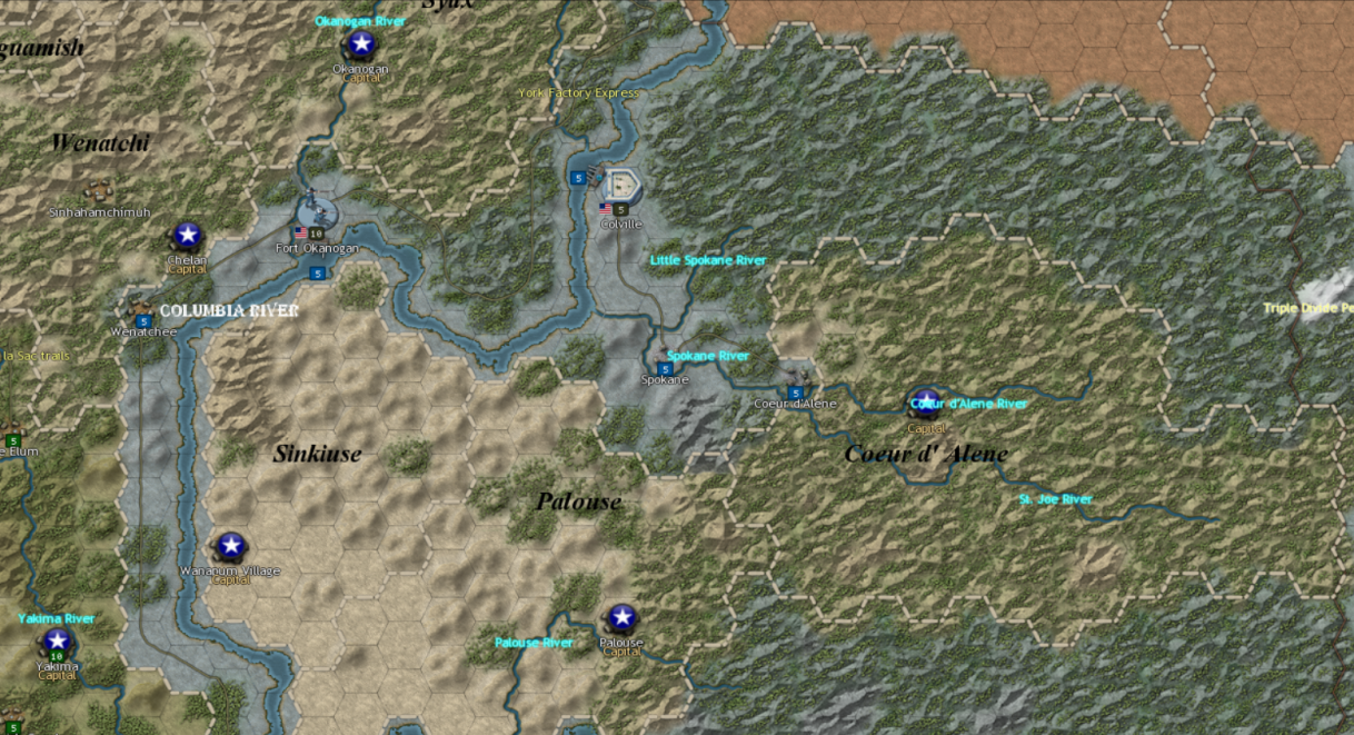
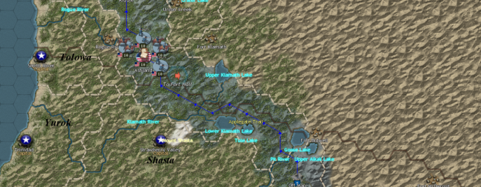
I now present Eastern Washington State, I still need to work on settlements but proud on how it turning out.
Re: Washington State Front, WIP
Posted: Sat May 11, 2024 11:15 pm
by PharaohVirgoCompy
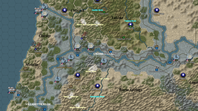
Since I been having the motivation; here is the area around the mouth of the Columbia River.
Also Molalla has an enclave due to the Willamette Valley being under American control.
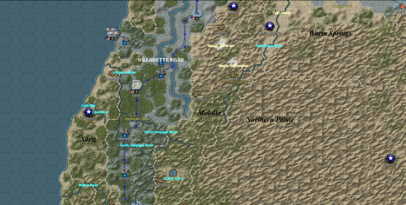
Re: Southern Cascadia
Posted: Thu May 16, 2024 1:46 pm
by PharaohVirgoCompy
Here some more progress, this time on Southern Oregon and Northern California/Nevada.
I also added a convoy route from California to Oregon City.
Re: Washington State Front, WIP
Posted: Sat May 25, 2024 2:40 am
by PharaohVirgoCompy
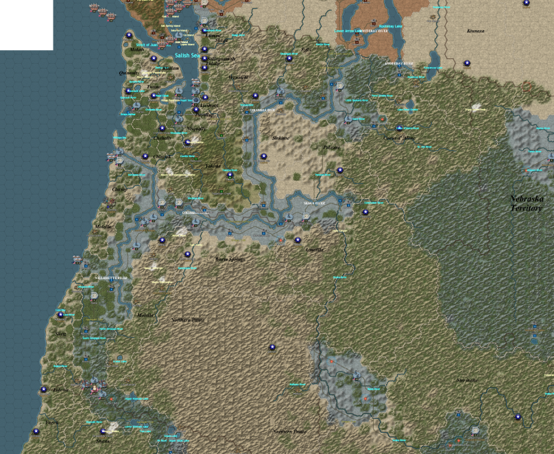
I more or lest done all of the USA part of the map, just want to go over and add more rivers and settlements.
I took multiple screenshots and put them together in MSpaint which is why it pixelated
Re: Washington State Front, WIP
Posted: Wed Jun 26, 2024 3:01 am
by PharaohVirgoCompy
It been a month so I just want to say I still plan to finish this, just that having to do graduation and now preparing for a job has taken some time from me and I decided to take a break but do plan to get back to this soon-ish.
Re: Washington State Front, WIP
Posted: Thu Jun 27, 2024 9:24 am
by OldCrowBalthazor
PharaohVirgoCompy wrote: Wed Jun 26, 2024 3:01 am
It been a month so I just want to say I still plan to finish this, just that having to do graduation and now preparing for a job has taken some time from me and I decided to take a break but do plan to get back to this soon-ish.
It's looking great! I would be willing to test this out when you get finished. No rush. The best mods take a lot of time.

