Page 1 of 1
[WAD] Northern Taiwan Land Areas Underwater
Posted: Thu Dec 19, 2024 4:14 pm
by rahjoth
Greetings!
When attempting to place some camps and buildings along northern Taiwan, I was hindered by large areas that were considered underwater, including mountains and a port city. See the attachments for visuals, a text file of the RPs in the visuals that might help delineate the erroneously underwater area, and the scenario file I documented this on.
Be advised that there is likely more of this in the area, but for purposes of time, I stopped here. If time permits, I might write an RP inserting "pathfinding" script to find these in a more comprehensive area.
Obviously, there are small areas here and there on the map where this happens, but these are one area that I, at least, find prohibitive to exclude with specific scenarios and working theories for them in mind.
Best Regards,
Lee
Re: Northern Taiwan Land Areas Underwater
Posted: Thu Dec 19, 2024 4:33 pm
by rahjoth
I was unable to add this to the first post for some reason, so hopefully this works.

-Lee
Re: Northern Taiwan Land Areas Underwater
Posted: Fri Dec 20, 2024 8:59 am
by Quark73
rahjoth wrote: Thu Dec 19, 2024 4:33 pm
I was unable to add this to the first post for some reason, so hopefully this works.
-Lee
The reason is the forum is limited to max. 4 attachments per post.
The problem you encountered is caused by CMOs elevation resolution. It consists of roughly 900 x 900 m wide tiles with a certain elevation/depth. All map layers, beside Land Cover map which defines terrain details, are more or less wallpapers on these tiles. That means they have no influence on the elevation.
I see two options: Either you move your units a little that they are on land on the original layer or you draw your desired coastline by using Custom Environmental Zones.
Re: Northern Taiwan Land Areas Underwater
Posted: Fri Dec 20, 2024 9:39 am
by blu3s
As Quark73 explained, the issue is related to the resolution of the terrain data.
Another option is create the units in land, and then move it to the correct location.
Re: Northern Taiwan Land Areas Underwater
Posted: Fri Dec 20, 2024 11:12 am
by Quark73
blu3s wrote: Fri Dec 20, 2024 9:39 am
Another option is create the units in land, and then move it to the correct location.
Is this a useful glitch or a feature?
Re: Northern Taiwan Land Areas Underwater
Posted: Fri Dec 20, 2024 12:19 pm
by thewood1
Its been a feature for as long as I can remember. I have used since the CMNAO days.
Re: Northern Taiwan Land Areas Underwater
Posted: Fri Dec 20, 2024 2:04 pm
by rahjoth
Thank you for your help!
Re: Northern Taiwan Land Areas Underwater
Posted: Fri Dec 20, 2024 5:51 pm
by Quark73
blu3s wrote: Fri Dec 20, 2024 9:39 am
Another option is create the units in land, and then move it to the correct location.
There is to say that this just circumvents the plausibility check. If facilities are just meant as target this is no problem. Functional facilities e.g. coastal radars may not work below sea level.
Re: Northern Taiwan Land Areas Underwater
Posted: Fri Dec 20, 2024 6:25 pm
by thewood1
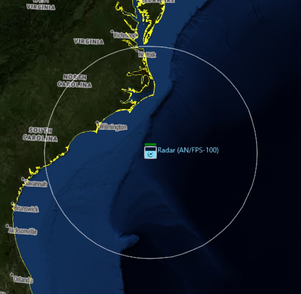
Last time I checked sensors worked. I think aircraft can land and take off also. I'll check both tonight.
Re: Northern Taiwan Land Areas Underwater
Posted: Fri Dec 20, 2024 6:26 pm
by blu3s
Radars will have an altitude of 0
Re: Northern Taiwan Land Areas Underwater
Posted: Fri Dec 20, 2024 6:30 pm
by thewood1
Decided to just do it...
- Screenshot 2024-12-20 132939.jpg (113.14 KiB) Viewed 550 times
Re: Northern Taiwan Land Areas Underwater
Posted: Fri Dec 20, 2024 6:39 pm
by Quark73
Hm, I remember a case where coastal radar did not work because it was below 0 ft during a beta scenario test. Maybe it was fixed in between. So just disregard my post above.
Re: Northern Taiwan Land Areas Underwater
Posted: Fri Dec 20, 2024 7:00 pm
by thewood1
I used to use this a lot and have never had it so the radar wouldn't work. I'm curious which radar it was.
Re: Northern Taiwan Land Areas Underwater
Posted: Fri Dec 20, 2024 7:19 pm
by Quark73
I've sent it via discord
Re: Northern Taiwan Land Areas Underwater
Posted: Sat Dec 21, 2024 3:17 am
by thewood1
I did some testing on this. Its a little more nuanced than I thought. Sensors work in water, but only to about 100 ft depth. Once past 100 ft, the sensor stops working.
This might be by design for situations like the OP has. The resolution is such that the devs couldn't guarantee that the terrain would align perfectly.
Re: Northern Taiwan Land Areas Underwater
Posted: Fri Dec 27, 2024 2:33 am
by rahjoth
Thank you for all of the great checking and testing!