Dev Diary #1 - Terrain Features
Posted: Wed Nov 18, 2026 4:28 pm
Welcome to our first dev diary for Strategic Command: Korea.
With nearly 40,000 hexes at a 7km scale, the map in Strategic Command: Korea is the most detailed map ever offered by a Strategic Command grand campaign. This new scale allows us to represent several geographic features and infrastructure never previously seen in Strategic Command, with the landscape now playing a greater role in your strategies than ever before!
Rice Fields
The first US ground combat of the war – Task Force Smith’s stand against a column of North Korean tanks on July 5, 1950 – took place in a rice field, demonstrating within a couple of hours the challenges that would be posed by Korea’s difficult terrain throughout the war.
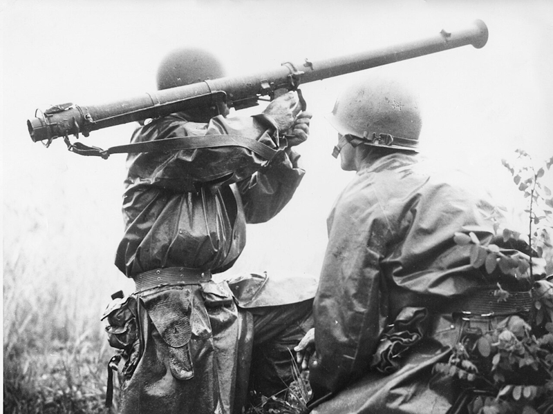
Ubiquitous across Korea’s lowlands, Rice Fields are a common obstacle on the map of Strategic Command: Korea. Offering little firm ground on which to dig in, troops ordered to defend Rice Fields will find themselves exposed compared to their counterparts in clear or hilly terrain. Units that are Entrenched in a Rice Field will incur a penalty to the maximum Entrenchment level that they can reach; those that have not dug in will receive no benefit from Ground Cover at all.
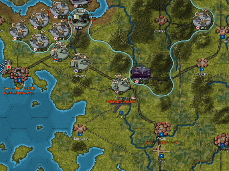
Moving through Rice Fields will also be a challenge: while units in Strategic Command: Korea have been given significantly greater Action Point ranges than previous games (which can lead to some spectacularly rapid offensives!), attempting to slog through Rice Fields will slow your units to a crawl. Units travelling on Roads through Rice Fields will be able to move more quickly than those attempting to travel cross-country, but most of the Roads in Korea are not weather-proof, and with no cover to speak of, they may leave your units exposed to air attack or a well-placed ambush.
Bridges
The bridges carrying road and rail traffic across large rivers – including the Han, Naktong and of course the Yalu – are now represented as a distinct terrain feature on the map.
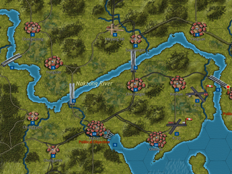
Like cities, mines and other map resources, each Bridge is given a strength rating – in this case between 0 and 5. At strength 5, a Bridge is considered to be intact, with the road or railroad it carries being fully functional and units able to cross the river without suffering any penalty. At strength 4 or below, the Bridge is considered damaged, with the damage showing as a cut bridge on your map. While damaged, no benefit is derived from the road or railroad on that hex: units will incur the same Action Point penalty for crossing the river as they would if there were no road at all, while units cannot be Operated to settlements on the other bank unless another intact rail route can be found.

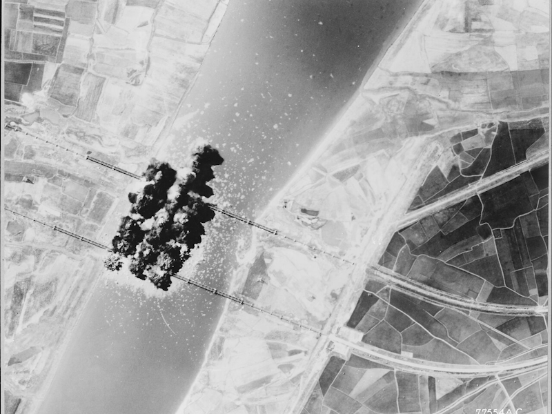
Bridges may be targeted and damaged in combat, particularly by air attacks, and may also experience damage as a result of “scorched earth” – though this is not a guarantee, and the lucky capture of an intact bridge can prove a significant advantage to an offensive. Numerous game events can also result in Bridges being damaged, from the destruction of the Han River bridges in the war’s opening days, to B-29 raids targeting North Korea’s rail network, to summer floods washing the bridges away.
Terrain at Sea
Like their counterparts in Strategic Command: American Civil War, naval units in Korea are divided into coastal (Torpedo Boats, short range Amphibious Transports) and ocean-going vessels (all other ships). In most cases, coastal warships, being generally smaller vessels with a shallow draft, are limited to operating within four hexes of the shoreline.

The extensive mudflats surrounding the Korean coastline pose a problem for larger ocean-going ships. While these ships can sail through the deep ocean freely, the presence of mudflats prevents these ships from entering the hexes immediately on the shoreline. Not only does this restrict the range of warships attempting to bombard land units onshore (although it should be noted that the scale of the map allows large warships to attack units several hexes away), but it also limits their ability to conduct reconnaissance along the shore – it may therefore be wise to bring some smaller ships of your own to support your Cruisers and Battleships.

Naval geography will also determine which ports your ships may use for repair and resupply. Major Ports, such as Pusan, Inchon or Sasebo in Japan, may be used by all naval units, and hexes directly adjacent to these ports are considered exempt from usual movement limitations, as are any other hexes whose passage is required to access the port (it is assumed that all ships use the known navigable channels in the vicinity of these ports).
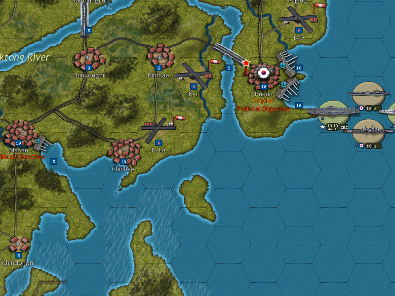
Small Ports, on the other hand, can only be accessed by coastal warships and all types of Transport ship (including Amphibious Transports) – examples of these include Pohang, which formed the northeastern corner of the Pusan Perimeter, and Iwon in North Korea. Larger warships may still obtain a supply benefit from these ports (with smaller vessels being used to carry supplies to the warships), however they cannot enter these ports, either to escape storms at sea or to dock for repairs – a limitation that may force them to return to a better equipped Port far from the battlefield for an extended period of time.
Airfields
First introduced in Strategic Command: War in the Pacific, Airfields will play a vital role in your strategy in Korea. As is the case in some of the Pacific mini-campaigns, all aircraft in Korea are required to be based at an airfield at all times, with the increased logistical demands of jet aircraft also requiring a dedicated Operational move (and associated MPP cost) any time you wish to rebase your aircraft. The limited number of airfields in Korea provides a further challenge – as was the case historically, the UN may find itself forced to rely on air support operating from Japan as it battles to defend the Pusan Perimeter.
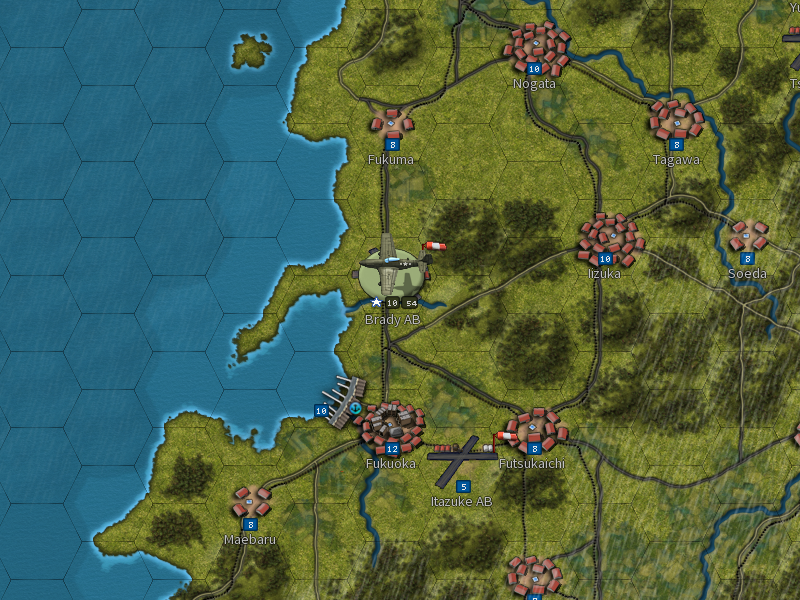
Two types of airfield are present in Korea. Paved Airfields represent larger, paved airstrips with the facilities required to operate jet aircraft – Kimpo airfield near Seoul, or the K-9 “Dogpatch” just north of Pusan are two examples. These will be among the most important hexes on your map, which can be used to base both Fighters and Bombers, and provide supply to ground units too.
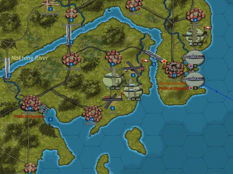
The other type of airfield is a Small Airfield, which typically represents a small dirt or grass airstrip with little in the way of supporting infrastructure. While these are relatively common throughout Korea (a marked contrast to Paved Airfields), these are much more limited in their capabilities – they cannot be used to base larger aircraft such as Fighters, although they can be used as a base for smaller aircraft, including Forward Air Control units and Helicopters, while also providing supply to ground units in the same way as their Paved counterparts.
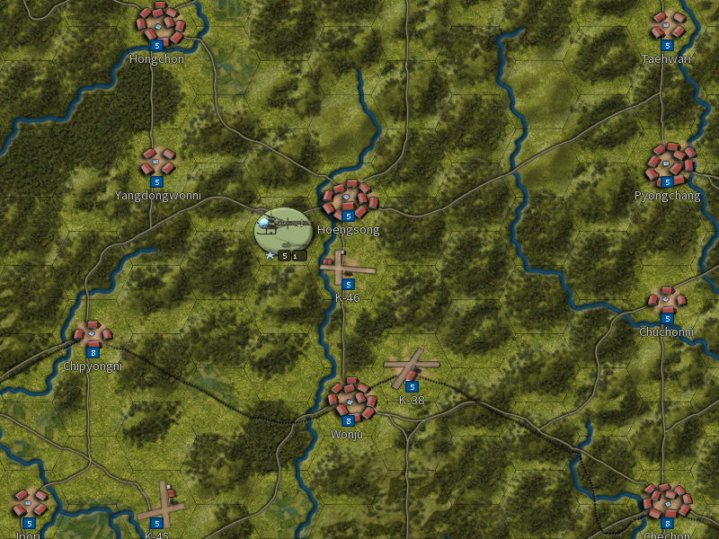
And just what do Forward Air Control units and Helicopters do, I hear you ask? We’ll have more to say about them, and the other new units appearing in Strategic Command: Korea, in our next dev diary…

- Ryan “BiteNibbleChomp” O’Shea
Designer – Strategic Command: Korea
With nearly 40,000 hexes at a 7km scale, the map in Strategic Command: Korea is the most detailed map ever offered by a Strategic Command grand campaign. This new scale allows us to represent several geographic features and infrastructure never previously seen in Strategic Command, with the landscape now playing a greater role in your strategies than ever before!
Rice Fields
The first US ground combat of the war – Task Force Smith’s stand against a column of North Korean tanks on July 5, 1950 – took place in a rice field, demonstrating within a couple of hours the challenges that would be posed by Korea’s difficult terrain throughout the war.
Ubiquitous across Korea’s lowlands, Rice Fields are a common obstacle on the map of Strategic Command: Korea. Offering little firm ground on which to dig in, troops ordered to defend Rice Fields will find themselves exposed compared to their counterparts in clear or hilly terrain. Units that are Entrenched in a Rice Field will incur a penalty to the maximum Entrenchment level that they can reach; those that have not dug in will receive no benefit from Ground Cover at all.
Moving through Rice Fields will also be a challenge: while units in Strategic Command: Korea have been given significantly greater Action Point ranges than previous games (which can lead to some spectacularly rapid offensives!), attempting to slog through Rice Fields will slow your units to a crawl. Units travelling on Roads through Rice Fields will be able to move more quickly than those attempting to travel cross-country, but most of the Roads in Korea are not weather-proof, and with no cover to speak of, they may leave your units exposed to air attack or a well-placed ambush.
Bridges
The bridges carrying road and rail traffic across large rivers – including the Han, Naktong and of course the Yalu – are now represented as a distinct terrain feature on the map.
Like cities, mines and other map resources, each Bridge is given a strength rating – in this case between 0 and 5. At strength 5, a Bridge is considered to be intact, with the road or railroad it carries being fully functional and units able to cross the river without suffering any penalty. At strength 4 or below, the Bridge is considered damaged, with the damage showing as a cut bridge on your map. While damaged, no benefit is derived from the road or railroad on that hex: units will incur the same Action Point penalty for crossing the river as they would if there were no road at all, while units cannot be Operated to settlements on the other bank unless another intact rail route can be found.
Bridges may be targeted and damaged in combat, particularly by air attacks, and may also experience damage as a result of “scorched earth” – though this is not a guarantee, and the lucky capture of an intact bridge can prove a significant advantage to an offensive. Numerous game events can also result in Bridges being damaged, from the destruction of the Han River bridges in the war’s opening days, to B-29 raids targeting North Korea’s rail network, to summer floods washing the bridges away.
Terrain at Sea
Like their counterparts in Strategic Command: American Civil War, naval units in Korea are divided into coastal (Torpedo Boats, short range Amphibious Transports) and ocean-going vessels (all other ships). In most cases, coastal warships, being generally smaller vessels with a shallow draft, are limited to operating within four hexes of the shoreline.
The extensive mudflats surrounding the Korean coastline pose a problem for larger ocean-going ships. While these ships can sail through the deep ocean freely, the presence of mudflats prevents these ships from entering the hexes immediately on the shoreline. Not only does this restrict the range of warships attempting to bombard land units onshore (although it should be noted that the scale of the map allows large warships to attack units several hexes away), but it also limits their ability to conduct reconnaissance along the shore – it may therefore be wise to bring some smaller ships of your own to support your Cruisers and Battleships.
Naval geography will also determine which ports your ships may use for repair and resupply. Major Ports, such as Pusan, Inchon or Sasebo in Japan, may be used by all naval units, and hexes directly adjacent to these ports are considered exempt from usual movement limitations, as are any other hexes whose passage is required to access the port (it is assumed that all ships use the known navigable channels in the vicinity of these ports).
Small Ports, on the other hand, can only be accessed by coastal warships and all types of Transport ship (including Amphibious Transports) – examples of these include Pohang, which formed the northeastern corner of the Pusan Perimeter, and Iwon in North Korea. Larger warships may still obtain a supply benefit from these ports (with smaller vessels being used to carry supplies to the warships), however they cannot enter these ports, either to escape storms at sea or to dock for repairs – a limitation that may force them to return to a better equipped Port far from the battlefield for an extended period of time.
Airfields
First introduced in Strategic Command: War in the Pacific, Airfields will play a vital role in your strategy in Korea. As is the case in some of the Pacific mini-campaigns, all aircraft in Korea are required to be based at an airfield at all times, with the increased logistical demands of jet aircraft also requiring a dedicated Operational move (and associated MPP cost) any time you wish to rebase your aircraft. The limited number of airfields in Korea provides a further challenge – as was the case historically, the UN may find itself forced to rely on air support operating from Japan as it battles to defend the Pusan Perimeter.
Two types of airfield are present in Korea. Paved Airfields represent larger, paved airstrips with the facilities required to operate jet aircraft – Kimpo airfield near Seoul, or the K-9 “Dogpatch” just north of Pusan are two examples. These will be among the most important hexes on your map, which can be used to base both Fighters and Bombers, and provide supply to ground units too.
The other type of airfield is a Small Airfield, which typically represents a small dirt or grass airstrip with little in the way of supporting infrastructure. While these are relatively common throughout Korea (a marked contrast to Paved Airfields), these are much more limited in their capabilities – they cannot be used to base larger aircraft such as Fighters, although they can be used as a base for smaller aircraft, including Forward Air Control units and Helicopters, while also providing supply to ground units in the same way as their Paved counterparts.
And just what do Forward Air Control units and Helicopters do, I hear you ask? We’ll have more to say about them, and the other new units appearing in Strategic Command: Korea, in our next dev diary…
- Ryan “BiteNibbleChomp” O’Shea
Designer – Strategic Command: Korea