new map: NTC Ft. Irwin

Post new mods and scenarios here.

Moderator: MOD_Flashpoint

User avatar
WildCatNL
Posts: 836
Joined: Fri Mar 27, 2009 5:21 pm
Location: Eindhoven, the Netherlands

new map: NTC Ft. Irwin

Post by WildCatNL »

(20140823 - Map released)

NTC Central Corridor 199x map for Flashpoint Campaigns: Red Storm
20140823 - 1.0
ntc_central_corridor_199x.zip, 58MB


The above archive contains a map representing the Central Corridor part of the Fort Irwin National Training Center (NTC), California, USA. The map is intended for use with the Flashpoint Campaigns: Red Storm game, 2.04 and later.
No scenarios are included, but you are invited to create them.


NTC
The NTC at Fort Irwin, covering 1000+ square miles, is the US Army's premier large scale maneuver training area. Located in the Mojave desert, the NTC offers barren terrain, wadis, mountains and mountain passes. And desert turtles*.
From its activation the early 80's, the NTC has been the (critical) host for many of the army's new weapon systems (M1 Abrams, M2 Bradley, Stryker) and new fighting concepts.

The following books provide great stories (and analysis) about battles "fought" at the NTC:
- Dan Bolger's "Dragons at War: Land Battle in the Desert" (1986, about rotation 1-83), also published as "Dragons at War: 2-34 Infantry in the Mojave",
available cheaply as 2nd hand pocket and as ebook.
- US Army's A. Frame, J.W. Lussier (eds), "66 Stories of Battle Command" (2000, mainly covering rotations of the 90's),
available from: http://www.au.af.mil/au/awc/awcgate/army/66stories.pdf


Map
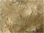
The map is huge (93x72 hexes - 40x36km), but the NTC is even bigger. The map covers most of the NTC's width: from Alpine Pass and Crash Hill in the Northwest all the way to the Red Pass in the Southeast. It extends beyond the Central Corridor with enough of the Northern and Southern Corridors to offer alternative routes around and into the Central Corridor.
The map might be too large for older hardware to run it smoothly in the Flashpoint Campaigns - I wasn't able to test this.

The map represents the late 80's and the 90's, before the introduction of the (mock) villages. This to match the 80's order-of-battles of the Red Storm game, and to better cover the stories and maneuvers from the "Dragons at War" and the "66 Stories" books.

The map comes with two map graphics:
- plain: elevation color coded hexes (lighter-is-higher), with a sniff of dust, hill shading and contour lines blended in. Active by default upon installation.
- satellite: as the plain map, but with additional (201x) satellite images mixed in.

The elevation in the plain graphics probably is easier to read. However, the satellite graphics offers more insight into the actual terrain, and may reveal many of the frequently traveled routes if you look carefully. It's your choice.

The yellow borders (dashed lines) rendered on the map indicate barriers to vehicles. The barriers aim to prevent units from driving to the top of a mountain, or up the side of a canyon. The barriers make it critical to control key mountain passes in your maneuvers.
Lacking true barriers in Flashpoint Campaigns 2.0x, I've followed up on the developer's suggestion: terrain on the high side of the barriers is first covered with an invisible stream (at the yellow border) and subsequently by "9" mobility restrictions.
Nevertheless, you are able to place units inside these inaccessible areas when designing scenarios. This might be useful to represent dug-in scout teams. (If you allow the unit to move, they might do so but slowly. And if amphibious the unit might even make it off the mountain).


Production
The map has been created based on actual elevation data and (very incomplete) OpenStreetMap data. Using the QGIS tool, elevation data and OpenStreetMap data were read, manually enhanced with roads and urban areas, and rendered as valid input for the FCRS Map Values tool.
From QGIS, also matching hill shades, contour lines and satellite images were exported.

Using a custom tool the .fp9 map file was rendered as a stack of pancakes, mixing in hill shades, contours and satellite image, and topped off with smoothed roads, location labels, the yellow dashed borders, and a 1km grid overlay.

In a last pass in the FCRS Map Values tool, all 6696 hexes were manually assigned appropriate mobility and visibility/cover ratings, by eye- balling the satellite images for these hexes.

For the sake of gameplay, some elevation values deviate from the actual terrain. Elevation color steps are smaller (more accurate) for lower elevation levels, to better capture those parts of the terrain that are accessible to units.
I've also created a set of sunken hexes in the Washboard section to represent the cover (wadis) available there.

Not having visited NTC myself, I'm counting on those members in our community who experienced the NTC to offer corrections.


Revision History
1.0 Initial version (20140823)
Known issues:
- Fort Irwin's urban area covers too much terrain, especially in an '80s setting. I could solve it by rescanning the terrain, but that would reset 6696 visibility values and wipe the road network. Maybe later...
- Desert turtles not included.

Enjoy!

William

Image
Attachments
ntc_centra..overview.jpg
ntc_centra..overview.jpg (212.12 KiB) Viewed 1655 times
William
On Target Simulations LLC
User avatar
zakblood
Posts: 22747
Joined: Thu Oct 04, 2012 11:19 am

RE: new map: NTC Ft. Irwin

Post by zakblood »

looking good :)
Windows 11 Pro 64-bit (10.0, Build 26100) (26100.ge_release.240331-1435) 24H2
User avatar
CapnDarwin
Posts: 9526
Joined: Sat Feb 12, 2005 3:34 pm
Location: Newark, OH
Contact:

RE: new map: NTC Ft. Irwin

Post by CapnDarwin »

William for larger maps you will need to stitch 1 or more hexdarw "maps" together into a larger image file. Our editor for values will work with the larger map. of course you have to hand enter all of the map values.
OTS is looking forward to Southern Storm getting released!

Cap'n Darwin aka Jim Snyder
On Target Simulations LTD
User avatar
CapnDarwin
Posts: 9526
Joined: Sat Feb 12, 2005 3:34 pm
Location: Newark, OH
Contact:

RE: new map: NTC Ft. Irwin

Post by CapnDarwin »

We have yet to add in a cliff side type terrain edge. We really need to add that to the 2.1 list so maps with those kind of edges can't be moved across.
OTS is looking forward to Southern Storm getting released!

Cap'n Darwin aka Jim Snyder
On Target Simulations LTD
User avatar
WildCatNL
Posts: 836
Joined: Fri Mar 27, 2009 5:21 pm
Location: Eindhoven, the Netherlands

RE: new map: NTC Ft. Irwin

Post by WildCatNL »

ORIGINAL: Capn Darwin
William for larger maps you will need to stitch 1 or more hexdarw "maps" together into a larger image file. Our editor for values will work with the larger map. of course you have to hand enter all of the map values.
Thanks for the suggestion. Stitching shouldn't be too much of hassle. I don't expect problems with the Map values editor - it is working fine for me as long as I feed it clean Hexdraw maps.
ORIGINAL: Capn Darwin
We have yet to add in a cliff side type terrain edge. We really need to add that to the 2.1 list so maps with those kind of edges can't be moved across.
Now you mention it, I might be able to block movement across ridges by placing obstacle id's. Or would that solely block non-amphibious units?
Please note that ideally, I'd like to exclude vehicles from entering mountain hexes but allow dismounts to move in and across them. I'm not sure the cliff is allowing dismounts to move across.

William
William
On Target Simulations LLC
User avatar
CapnDarwin
Posts: 9526
Joined: Sat Feb 12, 2005 3:34 pm
Location: Newark, OH
Contact:

RE: new map: NTC Ft. Irwin

Post by CapnDarwin »

We probably need two types of "cliffs". First stops ground vehicles but grunts can cross with a time hit and the second only allowing mountain type troops to traverse ay a time cost.
OTS is looking forward to Southern Storm getting released!

Cap'n Darwin aka Jim Snyder
On Target Simulations LTD
Elfastball7
Posts: 36
Joined: Tue Sep 24, 2013 2:40 am

RE: new map: NTC Ft. Irwin

Post by Elfastball7 »

ORIGINAL: Capn Darwin

We probably need two types of "cliffs". First stops ground vehicles but grunts can cross with a time hit and the second only allowing mountain type troops to traverse ay a time cost.

I agree. That would be awesome. Austrian/Bavarian Alp combat with West Ger. Gebrigjagers(spelling?). In Sir John Hackett's scenario, WP does invade Austria and from the maps in the 1st edition, it seems like there had to be some sort of mountain combat.

Thanks.
User avatar
Mad Russian
Posts: 13255
Joined: Sat Mar 15, 2008 9:29 pm
Location: Texas

RE: new map: NTC Ft. Irwin

Post by Mad Russian »

ORIGINAL: Elfastball7

... it seems like there had to be some sort of mountain combat.

Thanks.

Only if the Soviets are crazy, would they fight in the Alps, when they can drive across the North German Plains.

I'm not saying they aren't but there better have been a really strong Vodka ration that week! [:D]

Good Hunting.

MR
The most expensive thing in the world is free time.

Founder of HSG scenario design group for Combat Mission.
Panzer Command Ostfront Development Team.
Flashpoint Campaigns: Red Storm Development Team.
Elfastball7
Posts: 36
Joined: Tue Sep 24, 2013 2:40 am

RE: new map: NTC Ft. Irwin

Post by Elfastball7 »

ORIGINAL: Mad Russian
ORIGINAL: Elfastball7

... it seems like there had to be some sort of mountain combat.

Thanks.

Only if the Soviets are crazy, would they fight in the Alps, when they can drive across the North German Plains.

I'm not saying they aren't but there better have been a really strong Vodka ration that week! [:D]

Good Hunting.

MR

Good point. But IMO, I think it would be fun to abstract/wargame a battle in the mountains/alps in this game. As I stated before, Sir John Hackett has it in his scenario.
pzgndr
Posts: 3683
Joined: Thu Mar 18, 2004 12:51 am
Location: Delaware

RE: new map: NTC Ft. Irwin

Post by pzgndr »

How about a map for Hohenfels next? [8D]

Image
Attachments
Hohenfels.jpg
Hohenfels.jpg (450.54 KiB) Viewed 1492 times
Bill Macon
Empires in Arms Developer
Strategic Command Developer
Elfastball7
Posts: 36
Joined: Tue Sep 24, 2013 2:40 am

RE: new map: NTC Ft. Irwin

Post by Elfastball7 »

That would be aweseome.

Thanks
User avatar
DoubleDeuce
Posts: 1236
Joined: Fri Jun 23, 2000 8:00 am
Location: Crossville, TN
Contact:

RE: new map: NTC Ft. Irwin

Post by DoubleDeuce »

A Hohenfels map would be great! Spent many a rotation there in the mid 80's.
MikeAP
Posts: 266
Joined: Fri Mar 07, 2008 2:28 am

RE: new map: NTC Ft. Irwin

Post by MikeAP »

Outstanding work.

My company is preparing for an NTC rotation now.

Also worth mentioning, NTC is now littered with small Iraq style towns and cities. The main city, which is massive, is located on Barstow road intersection, west of Division hill.
User avatar
WildCatNL
Posts: 836
Joined: Fri Mar 27, 2009 5:21 pm
Location: Eindhoven, the Netherlands

RE: new map: NTC Ft. Irwin

Post by WildCatNL »

More progress than fits on a single screen : )

More detail and a finished map will follow soon.

William

p.s. The map should be large enough for Iron Mike Golf to use doctrinal 5-10km distances with his Soviet Forward Security Elements.


Image
Attachments
ntc_centra..er_space.jpg
ntc_centra..er_space.jpg (393.84 KiB) Viewed 1498 times
William
On Target Simulations LLC
User avatar
CapnDarwin
Posts: 9526
Joined: Sat Feb 12, 2005 3:34 pm
Location: Newark, OH
Contact:

RE: new map: NTC Ft. Irwin

Post by CapnDarwin »

That looks awesome.
OTS is looking forward to Southern Storm getting released!

Cap'n Darwin aka Jim Snyder
On Target Simulations LTD
User avatar
cbelva
Posts: 2217
Joined: Sat Mar 26, 2005 8:11 pm
Location: Nevada USA

RE: new map: NTC Ft. Irwin

Post by cbelva »

Ok, I knew that this was going to happen. In fact I warned Rob and Jim about this before we released FPC. Once people realized how easy it is to make maps and the fact that you are not limited to the style of map, we were going to see some creative maps. Maps that would leave our pitiful efforts in the dust.

The beauty of this system is that it allows this. You are not limited to our art or style. Yes, we know our maps are not the prettiest. We went for function ability. Yes we know that some of you hate our maps. None of us are graphically talented. We understand that. We want to improve the look of our maps as we move forward. What that will look like, we don't know yet. But I knew we would have talented people who are not doing our work for us, but would be adding to an already great system.

I have only the following to say to W1ll14m and Plodder....[&o]
Charles Belva
On Target Simulations LLC
User avatar
budd
Posts: 3095
Joined: Sat Jul 04, 2009 3:16 pm
Location: Tacoma

RE: new map: NTC Ft. Irwin

Post by budd »

that is pretty awesome....wow.
Enjoy when you can, and endure when you must. ~Johann Wolfgang von Goethe

"Be Yourself; Everyone else is already taken" ~Oscar Wilde

*I'm in the Wargamer middle ground*
I don't buy all the wargames I want, I just buy more than I need.
User avatar
Plodder
Posts: 974
Joined: Mon Jul 28, 2003 3:56 pm
Location: New Zealand

RE: new map: NTC Ft. Irwin

Post by Plodder »

That is one seriously impressive map William, those contour's are superb. How did you get them? GIS data?
Gen. Montgomery: "Your men don't salute much."
Gen. Freyberg: "Well, if you wave at them they'll usually wave back."
MikeGER
Posts: 380
Joined: Tue Feb 01, 2011 10:18 am

RE: new map: NTC Ft. Irwin

Post by MikeGER »

stunned [&o]
User avatar
Jamm
Posts: 407
Joined: Fri Oct 02, 2009 1:58 pm

RE: new map: NTC Ft. Irwin

Post by Jamm »

Looks good.
Sat map overlay?
When the going gets weird,... the weird turn pro
Hunter S Thompson

https://www.facebook.com/pages/Jamm-wor ... =bookmarks
Post Reply

Return to “Mods and Scenarios”