


New QGIS Map and scenario Project Wittengen, FGR
Moderator: MOD_Flashpoint
-
BeirutDude

- Posts: 2799
- Joined: Sat Apr 27, 2013 9:44 am
- Location: Jacksonville, FL, USA
New QGIS Map and scenario Project Wittengen, FGR
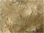
I decided that the map I really want to do, Kassel, FGR is a bit ambitious for my first QGIS project, so looked for a place with a bit of terrain that still meets some of the scenario ideas I wanted to try out. So I arrived at Wittengen, FGR along the Inter-German Frontier. Allows me to use the East German Mod in a scenario, with easy terrain for learning to create a map. win-win. so below are my QGIS Roads on a STRM3 Terrain map. Thanks to william for all of his help so far!!!!!!
- Attachments
-
- Wittengen_FGR.jpg (263.28 KiB) Viewed 596 times
"Some people spend an entire lifetime wondering if they made a difference. The Marines don't have that problem."
PRESIDENT RONALD REAGAN, 1985
I was Navy, but Assigned TAD to the 24th MAU Hq in Beirut. By far the finest period of my service!
PRESIDENT RONALD REAGAN, 1985
I was Navy, but Assigned TAD to the 24th MAU Hq in Beirut. By far the finest period of my service!
-
exsonic01
- Posts: 1133
- Joined: Tue Jul 26, 2016 6:45 pm
- Location: Somewhere deep in appalachian valley in PA
RE: New QGIS Map and scenario Project Wittengen, FGR
Looks great~! May I ask a question? Is ESRI road info available for other part of the Earth? Or only Europe?
-
BeirutDude
- Posts: 2799
- Joined: Sat Apr 27, 2013 9:44 am
- Location: Jacksonville, FL, USA
RE: New QGIS Map and scenario Project Wittengen, FGR
Exsonic01, Yes it's worldwide. Load the "search QMS" Plugin and then in the search bar search for "ESRI" Another good map is Osm2world. They will not save with your project, or at lest not that I have discovered so far. So you will have to reload when you come back to it
"Some people spend an entire lifetime wondering if they made a difference. The Marines don't have that problem."
PRESIDENT RONALD REAGAN, 1985
I was Navy, but Assigned TAD to the 24th MAU Hq in Beirut. By far the finest period of my service!
PRESIDENT RONALD REAGAN, 1985
I was Navy, but Assigned TAD to the 24th MAU Hq in Beirut. By far the finest period of my service!
-
BeirutDude
- Posts: 2799
- Joined: Sat Apr 27, 2013 9:44 am
- Location: Jacksonville, FL, USA
RE: New QGIS Map and scenario Project Wittengen, FGR
River (Canal) added, sort of!! Couldn't get William's style file to load to the line shapefile. William, are your rivers a polygon .shp file????? Othrwise not sure why they won't display.

- Attachments
-
- Wittengen2_FGR.jpg (245.05 KiB) Viewed 595 times
"Some people spend an entire lifetime wondering if they made a difference. The Marines don't have that problem."
PRESIDENT RONALD REAGAN, 1985
I was Navy, but Assigned TAD to the 24th MAU Hq in Beirut. By far the finest period of my service!
PRESIDENT RONALD REAGAN, 1985
I was Navy, but Assigned TAD to the 24th MAU Hq in Beirut. By far the finest period of my service!
-
BeirutDude
- Posts: 2799
- Joined: Sat Apr 27, 2013 9:44 am
- Location: Jacksonville, FL, USA
RE: New QGIS Map and scenario Project Wittengen, FGR
William, can I draw the Inter-German frontier boundary in magenta without it messing up the scanner?
"Some people spend an entire lifetime wondering if they made a difference. The Marines don't have that problem."
PRESIDENT RONALD REAGAN, 1985
I was Navy, but Assigned TAD to the 24th MAU Hq in Beirut. By far the finest period of my service!
PRESIDENT RONALD REAGAN, 1985
I was Navy, but Assigned TAD to the 24th MAU Hq in Beirut. By far the finest period of my service!
-
BeirutDude
- Posts: 2799
- Joined: Sat Apr 27, 2013 9:44 am
- Location: Jacksonville, FL, USA
RE: New QGIS Map and scenario Project Wittengen, FGR
Thanks to William, I was able to get this far, not as good as his maps but so far I'm pretty happy with this as a first attempt! So have the smoothed elevations in, the roads (but might need to edit the main/primary roads more), the N-S canal, towns/villages/farms and industrial sites. So need to add fields and woods.

- Attachments
-
- Wittengen3_FGR.jpg (286.9 KiB) Viewed 596 times
"Some people spend an entire lifetime wondering if they made a difference. The Marines don't have that problem."
PRESIDENT RONALD REAGAN, 1985
I was Navy, but Assigned TAD to the 24th MAU Hq in Beirut. By far the finest period of my service!
PRESIDENT RONALD REAGAN, 1985
I was Navy, but Assigned TAD to the 24th MAU Hq in Beirut. By far the finest period of my service!
-
BeirutDude
- Posts: 2799
- Joined: Sat Apr 27, 2013 9:44 am
- Location: Jacksonville, FL, USA
RE: New QGIS Map and scenario Project Wittengen, FGR
Now how are you getting the 3D effect for the elevations?
"Some people spend an entire lifetime wondering if they made a difference. The Marines don't have that problem."
PRESIDENT RONALD REAGAN, 1985
I was Navy, but Assigned TAD to the 24th MAU Hq in Beirut. By far the finest period of my service!
PRESIDENT RONALD REAGAN, 1985
I was Navy, but Assigned TAD to the 24th MAU Hq in Beirut. By far the finest period of my service!
RE: New QGIS Map and scenario Project Wittengen, FGR
Nice
I create the 3D effect separate from QGis, using a "homegrown" tool. It takes as input the .fp9 file (which you create with the FCRS map values scanner scanning the QGis map) and the QGis map.
If you send me the .fp9 and map values bitmap, I can send you the 3D effect layers back.
William
btw. I'm documenting how to export the QGis map to a bitmap in the right size (and alignment) for the FCRS map values scanner, and should be able to make it available here by the end of the weekend.
ORIGINAL: Beachinnole
Now how are you getting the 3D effect for the elevations?
I create the 3D effect separate from QGis, using a "homegrown" tool. It takes as input the .fp9 file (which you create with the FCRS map values scanner scanning the QGis map) and the QGis map.
If you send me the .fp9 and map values bitmap, I can send you the 3D effect layers back.
William
btw. I'm documenting how to export the QGis map to a bitmap in the right size (and alignment) for the FCRS map values scanner, and should be able to make it available here by the end of the weekend.
William
On Target Simulations LLC
On Target Simulations LLC
-
BeirutDude
- Posts: 2799
- Joined: Sat Apr 27, 2013 9:44 am
- Location: Jacksonville, FL, USA
RE: New QGIS Map and scenario Project Wittengen, FGR
Thanks!
questions...
1. I am 99 and 44/100 Sure I know the answer to this but, are you creating each of the elevation levels as its own separate shape file? That is the route I took here as it seemed easier than creating one elevation shape file and worrying about classification for the style files. does it matter, as the scanner just cares about the JPEG.
2. Is there any other post editing you are doing with that homegrown program? Text? Highway numbers? Highway colors?
3. The Highway "A#" and "N#" routes, should I have made them a separate shape file and colored with the new style? From my reading I took it the scanner could only handle the gray scale for roads right now and figured those were post edited after the FP9 file is produced
4. Does my magenta inter-German frontier line mess up the scanner? Can it stay for reference for scenario design and the players?
Thanks again!
Al
"Some people spend an entire lifetime wondering if they made a difference. The Marines don't have that problem."
PRESIDENT RONALD REAGAN, 1985
I was Navy, but Assigned TAD to the 24th MAU Hq in Beirut. By far the finest period of my service!
PRESIDENT RONALD REAGAN, 1985
I was Navy, but Assigned TAD to the 24th MAU Hq in Beirut. By far the finest period of my service!
RE: New QGIS Map and scenario Project Wittengen, FGR
I don't touch the DEM elevation, just render the raster layer with the right palette. For some maps, I do introduce a "elevation correction layer" where I place the occasional hex in one of the elevation colors to correct for the "rounding" falling the wrong way during map values scanning.ORIGINAL: Beachinnole
Thanks!
questions...
1. I am 99 and 44/100 Sure I know the answer to this but, are you creating each of the elevation levels as its own separate shape file? That is the route I took here as it seemed easier than creating one elevation shape file and worrying about classification for the style files. does it matter, as the scanner just cares about the JPEG.
In QGis, I just focus on the ugliest map that gets the job done the quickest for the map values scanner. Anything that looks pretty (other than the organic shape of the terrain itself) is just rendering after the map values bitmap has been created.
All labels are manually entered in a text file, and processed by the render tool. Also borders (such as the Inner German Border in the FGR Eiterfeld map, near Point Alpha).2. Is there any other post editing you are doing with that homegrown program? Text? Highway numbers? Highway colors?
In case of FCRS, yes, the roads are all grey in the map values bitmap, but afterwards rendered in different colors depending on the road labels. (In Southern Storm, the Map Values editor will recognize different road types and their colors and store these as part of the map file).
3. The Highway "A#" and "N#" routes, should I have made them a separate shape file and colored with the new style? From my reading I took it the scanner could only handle the gray scale for roads right now and figured those were post edited after the FP9 file is produced
Make sure you export a bitmap for the map values editor that doesn't have the numbers. The easy way to do this is in QGis is to create a separate layer (points, not polylines) that contains the number, and switch off this layer when export for the map values editor. Switch on the layer when exporting your "pretty" map.
4. Does my magenta inter-German frontier line mess up the scanner? Can it stay for reference for scenario design and the players?
Letting it stay won't hurt (but won't benefit you if you have to switch off certain layers for map values export, for example the road numbers). Sometimes the map values scanner gets confused sees a certain combination of colors as (urban) orange, so check for unexpected 'Urban' tags on those hexes.
Looking forward to your map!
William
William
On Target Simulations LLC
On Target Simulations LLC

RE: New QGIS Map and scenario Project Wittengen, FGR
Can't wait to see it when it's done. [:D] I have unfortunately run out of my own ideas at the moment [:(]
-
BeirutDude
- Posts: 2799
- Joined: Sat Apr 27, 2013 9:44 am
- Location: Jacksonville, FL, USA
RE: New QGIS Map and scenario Project Wittengen, FGR
Adding the woods now.
"Some people spend an entire lifetime wondering if they made a difference. The Marines don't have that problem."
PRESIDENT RONALD REAGAN, 1985
I was Navy, but Assigned TAD to the 24th MAU Hq in Beirut. By far the finest period of my service!
PRESIDENT RONALD REAGAN, 1985
I was Navy, but Assigned TAD to the 24th MAU Hq in Beirut. By far the finest period of my service!
-
BeirutDude
- Posts: 2799
- Joined: Sat Apr 27, 2013 9:44 am
- Location: Jacksonville, FL, USA
RE: New QGIS Map and scenario Project Wittengen, FGR
Woods added It may not look like I did much more, and maybe I'm getting too detailed, but the woods shapefile represents 262 polygons! Also fixed some snapping on the roads so they officially connect and added more village/town/farm areas. In any case learning a lot about QGIS!

- Attachments
-
- Wittengen4_FGR.jpg (266.32 KiB) Viewed 600 times
"Some people spend an entire lifetime wondering if they made a difference. The Marines don't have that problem."
PRESIDENT RONALD REAGAN, 1985
I was Navy, but Assigned TAD to the 24th MAU Hq in Beirut. By far the finest period of my service!
PRESIDENT RONALD REAGAN, 1985
I was Navy, but Assigned TAD to the 24th MAU Hq in Beirut. By far the finest period of my service!
-
BeirutDude
- Posts: 2799
- Joined: Sat Apr 27, 2013 9:44 am
- Location: Jacksonville, FL, USA
RE: New QGIS Map and scenario Project Wittengen, FGR
So this map more highlights the are for the Wittengen 1985 battle. Coming from the DDR (east of the Magenta line) elements of the GDR .8th MRD vs. elements of the FGR .11 PZ Div. Need to add the fields and clean up for william.

- Attachments
-
- Wittengen5_FGR.jpg (260.22 KiB) Viewed 600 times
"Some people spend an entire lifetime wondering if they made a difference. The Marines don't have that problem."
PRESIDENT RONALD REAGAN, 1985
I was Navy, but Assigned TAD to the 24th MAU Hq in Beirut. By far the finest period of my service!
PRESIDENT RONALD REAGAN, 1985
I was Navy, but Assigned TAD to the 24th MAU Hq in Beirut. By far the finest period of my service!
-
BeirutDude
- Posts: 2799
- Joined: Sat Apr 27, 2013 9:44 am
- Location: Jacksonville, FL, USA
RE: New QGIS Map and scenario Project Wittengen, FGR
OK I am confused! This is WAY different than ArcMap as in ArcMap the intention is to develop a finished product! So William, if I am understanding this correctly the QGIS map is a rough and the "pretty map" is rendered by what??????
"Some people spend an entire lifetime wondering if they made a difference. The Marines don't have that problem."
PRESIDENT RONALD REAGAN, 1985
I was Navy, but Assigned TAD to the 24th MAU Hq in Beirut. By far the finest period of my service!
PRESIDENT RONALD REAGAN, 1985
I was Navy, but Assigned TAD to the 24th MAU Hq in Beirut. By far the finest period of my service!
-
exsonic01
- Posts: 1133
- Joined: Tue Jul 26, 2016 6:45 pm
- Location: Somewhere deep in appalachian valley in PA
RE: New QGIS Map and scenario Project Wittengen, FGR
Hey Beachinnole, which map data did you used for the forest layer for QGIS? I'm looking for data file for woods but couldn't find any in OSM or ESRI... Also, are there any good city/town data from ESRI or OSM?
-
BeirutDude
- Posts: 2799
- Joined: Sat Apr 27, 2013 9:44 am
- Location: Jacksonville, FL, USA
RE: New QGIS Map and scenario Project Wittengen, FGR
Primarily ESRI Sarellite. Also OSM2World (helps with towns).
"Some people spend an entire lifetime wondering if they made a difference. The Marines don't have that problem."
PRESIDENT RONALD REAGAN, 1985
I was Navy, but Assigned TAD to the 24th MAU Hq in Beirut. By far the finest period of my service!
PRESIDENT RONALD REAGAN, 1985
I was Navy, but Assigned TAD to the 24th MAU Hq in Beirut. By far the finest period of my service!
-
BeirutDude
- Posts: 2799
- Joined: Sat Apr 27, 2013 9:44 am
- Location: Jacksonville, FL, USA
RE: New QGIS Map and scenario Project Wittengen, FGR
OSM2World seems to only be in Germany?
"Some people spend an entire lifetime wondering if they made a difference. The Marines don't have that problem."
PRESIDENT RONALD REAGAN, 1985
I was Navy, but Assigned TAD to the 24th MAU Hq in Beirut. By far the finest period of my service!
PRESIDENT RONALD REAGAN, 1985
I was Navy, but Assigned TAD to the 24th MAU Hq in Beirut. By far the finest period of my service!
RE: New QGIS Map and scenario Project Wittengen, FGR
The quality of OSM data for forests varies a lot (fields are worse). Some areas in Germany have there forests done well, others not so much. From what I've seen OSM data in Germany is better than those in France. I've done two maps relying on OSM data, then switched to drawing based on satellite imagery.
William
p.s. http://geofabrik.de/ is a great source for OSM data.
William
p.s. http://geofabrik.de/ is a great source for OSM data.
William
On Target Simulations LLC
On Target Simulations LLC
-
BeirutDude
- Posts: 2799
- Joined: Sat Apr 27, 2013 9:44 am
- Location: Jacksonville, FL, USA
RE: New QGIS Map and scenario Project Wittengen, FGR
So working on the Fields now (in yellow), about 60% done. Then the text file. Then to try the scanner...

- Attachments
-
- Wittengen6_FGR.jpg (332.87 KiB) Viewed 600 times
"Some people spend an entire lifetime wondering if they made a difference. The Marines don't have that problem."
PRESIDENT RONALD REAGAN, 1985
I was Navy, but Assigned TAD to the 24th MAU Hq in Beirut. By far the finest period of my service!
PRESIDENT RONALD REAGAN, 1985
I was Navy, but Assigned TAD to the 24th MAU Hq in Beirut. By far the finest period of my service!