ORIGINAL: W1ll14m
Here's a preview of what we are working towards for Southern Storm - it's the map used by Cap Darwin and Rob for the Origins 2015 event. You might like it...
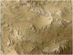
What you see is, from top to bottom:
- OpenStreetMap topo map of Plochingen (2015 data) with a 1989 Shell road atlas insert displaying the old trajectory of the B10 (which ran below the Fils stream for longer than today's B10)
- our 500m hex rendition of the 1989 Plochingen in 'topo' look.
- our 500m hex rendition of 1989 Plochingen in traditional hex look
IMO, it shows nicely how close we get to the real terrain and how we abstract to 500m hexes (notably the Neckar river, removal of tertiary roads, removal of ditches which aren't an obstacle to military vehicles).
Note that I'm not convinced working from GIS data results in better maps than Steve's approach of 'eyeballing' the Google maps with his military background. I do happen to be more productive starting from GIS data, and it allows for rapid prototyping of a new piece of terrain, and creating multiple looks.
William
p.s. and, yes, I've used one of my hex maps for navigation during my past holidays. Didn't actually have to use it, since I accidentally memorized the terrain while creating the map.

WHOA! Awesome and very clean work [&o]
Great job!
Topo map so clean and easy to understand.
but it seems to me, and there does not appear the elevation levels used in the game?
Will the choice of which map to display? I think it's pretty convenient to see the battlefield on the "photorealistic map" and planning on topographic (with all the navigation arrows and notes).
So now I have a couple questions:
— How about Industrial areas?In the north west of the Plochingen you can see the industrial zone, perhaps even a small port. It may be added in the future such additional graduation? For such zones are sometimes strategically important, and shelter in these areas are a little different from the shelter in residential areas.
— Whether you choose the width of the river? Some rivers are very significant in width, and some are so narrow that tanks or other vehicle are moving in the ford.
Just when I looked at the card and checks prior to the reality, it seems that some of the rivers on the map is too wide.
I understand that, technically, the game has only one type of the river, and one type of bridges, but sometimes I thought that it would be more realistic if the added gradation width of the rivers. Just imagine:
- Narrow streams can pass without building bridges, but with a fairly large delay in the movement, in this case the presence of the bridge on the road passing through the stream is not so important, but if it is not destroyed, the army can drive on the road without delay.
- Wider river passes just over the bridge and require guidance pontoon bridges or amphibious vehicles.
- Very wide river passes only with a very long bridge (more 1-2 Hex)
Also, you can add types of bridges: a small wood, stone, huge steel (almost impossible to repair them or maybe for a long time between battles)
I realize that everything I propose adding lines of code in the engine, but in this case, you can add some fun strategy game. (though perhaps you have all of this going to do)
— Well, I was still interested in shading of elevation levels. Since the main action takes in the Northern Hemisphere, it would be logical to see the lighting on the south side.
I understand that the current shading fron NW is essential for the style of the game, but I'll try to cover all the SW.
— Is there somewhere online version of the atlas roads for 1989?
Anyway. Great job guys!