World in Flames is the computer version of Australian Design Group classic board game. World In Flames is a highly detailed game covering the both Europe and Pacific Theaters of Operations during World War II. If you want grand strategy this game is for you.
Corrected.
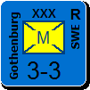
Is the position of the resource still OK (as "Gold"), or should it be moved a few hexes toward Rapid City (love that name), so that it is in the Black Hills ?
Is the resource near Spokane OK as "Lead" ?
-The Wallace looks good now, though I wouldn't name it Wallace (Wallace has about 2000 population, it was just a referance point for the area). I'd call it Bitterroot Mines = Lead. That way it encompasses the entire mining region.
-For the Black Hills resource, you are correct, the forest area there is closer to the real location of the Black Hills. My recommendation is this: Move the resource 1hex NW of Rapid City, change that one hex from forest to hills (the Black Hills are very rugged with 2000+ meter peaks). The resource would be Gold.
For fun you could even add "Mount Rushmore" label to the hex South West of Rapid City. Imagine the propaganda coup that would be the Axis capture of Mount Rushmore! Was it completed pre-WW2?
ORIGINAL: Norman42
-The Wallace looks good now, though I wouldn't name it Wallace (Wallace has about 2000 population, it was just a referance point for the area). I'd call it Bitterroot Mines = Lead. That way it encompasses the entire mining region.
I only name the place as a reference point, so I think that it is OK.
-For the Black Hills resource, you are correct, the forest area there is closer to the real location of the Black Hills. My recommendation is this: Move the resource 1hex NW of Rapid City, change that one hex from forest to hills (the Black Hills are very rugged with 2000+ meter peaks). The resource would be Gold.
Good. I moved it west of where you said, so that it is not that close to Rapid City. However, I can't change the terrain for the hex, as there is the river graphic on in (unless Steve tells me that the underlying terrain can be changed regardless of the river graphic). However, the Black Hills seems quite far from real mountains, and there are places on the map where we put forest to simulate rugged terrain not as accidented as a real mountain. So maybe it is goo as it is ?
For fun you could even add "Mount Rushmore" label to the hex South West of Rapid City. Imagine the propaganda coup that would be the Axis capture of Mount Rushmore! Was it completed pre-WW2?
Great Idea.
However, it is not on the hex SW, it is in the same hex, as it is in South Dakota as Rapid City, and very close to Rapid City.
You can change the underlying terrain of non-coastal hexes with no affect bitmaps whatsoever.
Here are the 16 colors available for drawing labels. I could add more but I do not see the point. It is hard enough to tell some of the colors apart already. More subtle distinctions are likely to be impossible to detect.
Most of the color are not being used currently. I have put in a few recommendations (copper = orange, mercury = silver). There are lot of other mineral resources I have not assigned a color.
============
// ****************************************************************************
// New colors.
// ****************************************************************************
clLightBlue = $02FFB060; // Add $0200000 to make it a palette color.
clAlmostWhite = $FEFEFE; // Almost pure white, but not quite.
clBrown = $02004080;
clPink = $00A09BEE; // A special color - pink.
// ****************************************************************************
// Colors for map names/labels.
// ****************************************************************************
MWIFStandardColors: array[0..15] of TColor = (
clBlack, // 0 - city, port, and historical site names, coal.
clMaroon, // 1 - country and island names, country borders.
clGreen, // 2 - food.
clOrange, // 3 - copper.
clNavy, // 4 - sea area borders, canal names.
clPurple, // 5 -
clTeal, // 6 -
clSilver, // 7 - mercury.
clGray, // 8 - iron.
clRed, // 9 - objective hex names.
clLime, // 10 -
clYellow, // 11 - sulphur.
clBlue, // 12 - river names (exclusively!).
clFuchsia, // 13 -
clAqua, // 14 -
clWhite); // 15 - weather zone borders, mountain names.
I planned on having the names size 4 (or 3) color black. I'm not sure using varying colors would be a good idea.
I would have liked the text to be not longer that the width of the resource icon, or maybe a little more, only ledgible at very high level of zooms (6-8).
Personally, I think adding different colours to different resource labels is a bit over the top, and will give the impression that they are important. Just a nice italic in an unusual font (perhaps even 'brush'?) should do the trick ... and then we can get on with something else.
I agree, the colours are a bit much, a simple (small) label in perhaps italics would suffice.
Marcus: The problem with the Calgary resource is there isnt a predominant mineral there (other then Oil). I would suggest either "Livestock" or "Grain" as these were the main resources of Alberta aside from Oil. Personally, I'd go with Livestock. Gotta feed those GI's.
ORIGINAL: Norman42
I agree, the colours are a bit much, a simple (small) label in perhaps italics would suffice.
Marcus: The problem with the Calgary resource is there isnt a predominant mineral there (other then Oil). I would suggest either "Livestock" or "Grain" as these were the main resources of Alberta aside from Oil. Personally, I'd go with Livestock. Gotta feed those GI's.
I planned on having the names size 4 (or 3) color black. I'm not sure using varying colors would be a good idea.
I would have liked the text to be not longer that the width of the resource icon, or maybe a little more, only ledgible at very high level of zooms (6-8).
I think size 4 would be better than 3. If the name is longer than the width of the icon, it won't be that bad. More than half of the resources have labels that are 6 or less characters.
I do not want to change fonts. The one we are using (Verdana) was chosen to have minimal loss of legibility through different levels of zoom. I don't want to go through that again for another font (even if it is only used for zoom 6, 7, and 8).
Italics may or may not work. If you want to do that, then you need to assign a unique color (not used else where) so the program can detect that it is suppose to be italicized - that is how the rivers are done.
I suggested the different colors primarily because of the different terrain backgrounds and wanting something that contrasts better. If we use just one color, that won't be possible. Some backgrounds are light (clear) and other dark (mountains and forest). The point is that we are using a small font with low contrast, which might make the label difficult to read.
ORIGINAL: Norman42
I agree, the colours are a bit much, a simple (small) label in perhaps italics would suffice.
Marcus: The problem with the Calgary resource is there isnt a predominant mineral there (other then Oil). I would suggest either "Livestock" or "Grain" as these were the main resources of Alberta aside from Oil. Personally, I'd go with Livestock. Gotta feed those GI's.
Or simply "Food", as for the Netherlands ?
I like "Livestock" personally, that way it covers not just food, but other animal products that were used in war industy, ie Nitrates, Leather, Wool, Glue, Fertilizer, Medical Supplies, and most importantly, Horses... which were used in WW2 by every single nation. The Wehrmact alone used 3 million+ horses throughout the war.
-Little known fact #1: WW2 saw an estimated 17 million horses killed.
-Little known fact #2: The wool linings of every cold-weather flight suit used by Bomber Command was produced by a single Scottish sheep farm that became known as "Lancaster Farms" and was awarded a citation by the British Govt post war.
Could probably use the same "Livestock" term for the Netherlands.
My brother-in-law started his academic career at Calgary and I well remember him telling me years ago about the famous rodeo there (biggest in the world?). So, I suggest it is labelled simply 'cattle' as I'm sure that is what most people associate with the place.
But 'livestock' might be better to include horses.
The Netherlands main export was dairy products (milk and especially cheese) so 'livestock' would not be appropriate. I suggested 'Food' just because it is shorter than 'Dairy Products' and it is at a very crowded point of the map.
ORIGINAL: marcuswatney
The Netherlands main export was dairy products (milk and especially cheese) so 'livestock' would not be appropriate. I suggested 'Food' just because it is shorter than 'Dairy Products' and it is at a very crowded point of the map.
Pie is even shorter! [:D]
PBEMgames played
- Korea 50-51 MV as communist
- Agonia y Victoria xx as Republican
- Plan Blau OV as Soviet
- The great war xx as Central Powers
- DNO XX as Soviet
Main Entry: 1vict·ual
Pronunciation: \ˈvi-təl\
Function: noun
Etymology: Middle English vitaille, victuayle, from Anglo-French, from Late Latin victualia, plural, provisions, victuals, from neuter plural of victualis of nourishment, from Latin victus nourishment, way of living, from vivere to live.
Date: 15th century
I've been to a couple. The second one I was at tallied 1.1 million tourists during the 10 day long festivities. Do those cowboys know how to party or what?
Main Entry: 1vict·ual
Pronunciation: \ˈvi-təl\
Function: noun
Etymology: Middle English vitaille, victuayle, from Anglo-French, from Late Latin victualia, plural, provisions, victuals, from neuter plural of victualis of nourishment, from Latin victus nourishment, way of living, from vivere to live.
Date: 15th century
Well, 'victuals' (I have never seen the singular used in print) always makes me think of Daniel Boone in the wilds of Tennessee circa 1700's. Perhaps for a game about the French & Indian War (sorry for the 'misnomer' Patrice) or the American Revolution, but by WW II they were using C-rations.[:)]
Well, 'victuals' (I have never seen the singular used in print) always makes me think of Daniel Boone in the wilds of Tennessee circa 1700's. Perhaps for a game about the French & Indian War (sorry for the 'misnomer' Patrice) or the American Revolution, but by WW II they were using C-rations.[:)]
1940 where it was subjected to stern field trials. From that test emerged a range of criticisms: the cans were too large and bulky; the meat lacked variety, was too rich, and contained too many beans. Yet, there was agreement that the new C ration was nutritionally adequate and was "one of the best field rations . . . ever issued to the Army."
But the K Ration was more popular.
The Army quickly noted the success of the new ration with the paratroops and in 1942 the item was adopted for all-service use as Field Ration, Type K.39 The instantaneous success of the ration with attendant popular publicity, was a source of amazement to the developers.