

Marine Traffic
Moderator: MOD_Command
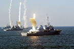
Marine Traffic
- Attachments
-
- mt.jpg (572.27 KiB) Viewed 3423 times
RE: Marine Traffic
Wow! Excellent site. Very useful too for making scenarios.
Here's some more links:
US Navy Region Southwest Ship Locator
http://www.public.navy.mil/surfor/Pages ... oUBd-Lgy8c
Military ship spotting
http://www.shipspotting.com/support/faq ... ry%20ships
Here's some more links:
US Navy Region Southwest Ship Locator
http://www.public.navy.mil/surfor/Pages ... oUBd-Lgy8c
Military ship spotting
http://www.shipspotting.com/support/faq ... ry%20ships
El Savior
-
Agathosdaimon

- Posts: 1051
- Joined: Sun Jul 08, 2012 2:42 am
RE: Marine Traffic
wow just checking this out now, its fun just looking over all the activity going on in the world - so busy all the time, too bad we cant see any military ships with this
RE: Marine Traffic
Bumping this, it's a great resource for creators who want accurate scenarios.
RE: Marine Traffic
Dang it! Now I can't be lazy when adding merchants! [:D]
RE: Marine Traffic
I haven't tried, but you could probably use the KML-INST tool tm.asp?m=3471768 to help with some of it, still would take some work though

RE: Marine Traffic
Wow! This is great. Thanks!!
----------------
Dave A.
"When the Boogeyman goes to sleep he checks his closet for paratroopers"
Dave A.
"When the Boogeyman goes to sleep he checks his closet for paratroopers"
-
Jakob Wedman
- Posts: 125
- Joined: Wed Mar 20, 2013 6:57 pm
RE: Marine Traffic
Since the tool is made for adding facilities; don't forget to change to "Command_Core.Ship" from "Command_Core.Facility".ORIGINAL: Rudd
I haven't tried, but you could probably use the KML-INST tool tm.asp?m=3471768 to help with some of it, still would take some work though
RE: Marine Traffic
Good callORIGINAL: Jakob Wedman
Since the tool is made for adding facilities; don't forget to change to "Command_Core.Ship" from "Command_Core.Facility".ORIGINAL: Rudd
I haven't tried, but you could probably use the KML-INST tool tm.asp?m=3471768 to help with some of it, still would take some work though


RE: Marine Traffic
Does the link still work?
My Top Matrix Games 1) CMO MP?? 2) WITP/AE 3) SOW 4) Combat Mission 5) Armor Brigade
Twitter
https://twitter.com/TacticWargamer
https://twitter.com/TacticWargamer
-
Enigma6584
- Posts: 306
- Joined: Thu Sep 23, 2010 1:44 am
RE: Marine Traffic
That is a very cool find! Interesting to look at the traffic in the Black Sea considering what is going on there now. Odessa in the Ukraine seems to be a rather busy port.
-
Splinter00S
- Posts: 9
- Joined: Wed Jul 15, 2015 11:40 pm
RE: Marine Traffic
That's really cool! It'd be nice if there was a way to import merchant traffic data for a particular region/time and automatically import the relevant ships and navigational paths every time you started a scenario. Would be a good way to easily add a little randomness and realism to scenarios, although I imagine developing such a tool/plugin would be difficult.
RE: Marine Traffic
Well, i guess that, for future releases/versions, an Import option for the Editor would be precisely one of "Commercial Marine Traffic" and another of "Commercial Air Traffic", with options ranging from "restricted/daunting" to "dense".
Left appart the possibility of randomly positioning the plattforms along their plotted courses, such courses (the MAIN ones) are pretty standard, as are the types of ships which use those routes/courses.
For instance: Developpers would just need to add the OCEANIC LINES(for ships).These are pretty much condensed in relatively few known and optimised routes from BIG Hub-Port to another along which big cargoes circulate back and forth . Those lines are the ones exploited by MSC, Schenker/DB and other big freight companies, which rent/hire the normally big ships to the owners of the vessels.
Of course, besides that, there are the "FEEDER-Ships" which, usually navigating along the coast and making lots of escales/stops in less important ports make short-range distribution, but mostly collect cargoes to take them to the BIG Hub-Ports referred above (Antwerp, Rotterdam, Qindao, NY, etc.). Those FEEDER-ships are obviously smaller and less important targets militarily speaking. Therefore, the small trawlers, fishing boats, etc. would not need be included in that addition, and it would be up to the users to position and plotting the courses of those minor plattforms for any specific scenario.
Similary, this could apply to commercial air-traffic, randomly generated between all MAJOR civil airports.
RE: Marine Traffic
darn.... ijust saw this.... thank you....
RE: Marine Traffic
Marine Traffic deprecated this in 2015 -- I just tried to load into Google Earth Pro desktop and I don't think it loaded correctly. Anyone successfully using this nowadays?
Side note, I do think the previous suggestion of this being a feature in CMO sounds like an awesome idea. I'd imagine this is a pretty common need to include some level of merchant traffic.
Side note, I do think the previous suggestion of this being a feature in CMO sounds like an awesome idea. I'd imagine this is a pretty common need to include some level of merchant traffic.
RE: Marine Traffic
I can't seem to post numbers > 99....
I'd seen the randomized traffic scripts of occasional merchants, but due to the effort required scenarios seldom include the clutter and complexity encountered in the world. I decided an approach to generate sea lanes and then randomly populate them was necessary. This was not too hard and I expect to make the github repo public after some refactoring, testing, and review to cite sources.
The transport and exchange of world commerce is a complicated process with a wide variety of variation and scope, but a number of resources are available publicly to guide the scenario developer. The World-Seaborne-Trade_-UNCTAD-2018 and WorldPortTraffic-Data-for-IAPH are some guides to help identify major ports and the distribution of the freight across ports and traffic types in a sea lane.
I sourced ports from the National Geospatial-Intelligence Agency World Port Index (WPI) due to properties such as Facilities_RoRo, Facilities_Container, Facilities_OilTerminal, Facilities_LNGTerminal, Cranes_Fixed, and Cranes_Container and added both harbor and shore locations for ship and facility placement.(approximately [guess I can't post the number] entries)
{ name='Alexandria', country='United States', Facilities_RoRo='Unk', Facilities_Container='Unk', Facilities_OilTerminal='Unk', Facilities_LNGTerminal='Unk', Cranes_Fixed='No', Cranes_Container='Unk', harbor={ latitude=38.71 , longitude=-76.43}, shore={ latitude=38.72, longitude=-76.52}}
I pulled ships from a public DB that gave type, flag, and size and then went and assigned the closest DBID to the entry. A lua table was created composed of [number > 99 ] commercial ships in ... classes:
| Class | ____ | Class |
|-----------|-----------|--|
|Anchor handling supply tug||General cargo vessel|
|Auxiliary ship||Heavy Lift Vessel|
|Barge||Liquefied gas carrier|
|Bulk carrier||Offshore Installation/Maintenance/Repair|
|Cable ship||Oil Products Tanker|
|Cargo and passenger||Oil tanker|
|Cargo ship||Ore carrier|
|Container ship||Passenger ship|
|Cruise Liner||Platform|
|Drilling unit||Platform supply vessel||Pusher/Tug|
|Factory ship||RoRo ship|
|Ferry||Supply vessel|
|Fishing vessel||Trawler|
{type ='Ship', class = 'Supply vessel', dbid = [sorry number > 99] , flag = 'Canada', unitname = 'ANNE RISLEY' }
The primary function is GenerateSealanesAndTracks(sealanegen, allports, CONST_SEALANE_SIDE, {
{source ='Izmir', destination = 'Marseille'},
{source ='Marseille', destination = 'Trieste'},
{source ='Odesa', destination = 'Marseille'},
{source ='Istanbul', destination = 'Odesa'},
{source ='Istanbul', destination = 'Batumi'},
{source ='Haifa', destination = 'Marseille'}
})
- Attachments
-
- samplesealane.jpg (139.99 KiB) Viewed 3350 times
RE: Marine Traffic
The files should be loaded in the lua scripts folder under CommercialShipping and the following run in the Lua Script Console
ScenEdit_RunScript(" CommercialShipping slash LuaInit.lua")
SeaLaneMainMenu()
This builds upon the works at
CivilianShippingLua used in stand alone scenarios Canarys Cage, Green Tide, North Pacific, South China Clash, Stand Up, and Tiger & Drgon.
Mike Bond; Python and Lua Scripts for Building Scenarios in Command Modern Air Naval Operations
Forum Thread Script To Generate Random Merchant Location + Traffic
Weapons Release Wiki is a repository of CMO related knowledge
This runs demos the functions in the lua files used to generate commercial traffic and is definitely a work in progress.
- Attachments
-
- CommercialShipping.zip
- (211.98 KiB) Downloaded 106 times