


Dear debuggers but especially DB owners:
Here is something I noticed (and reported) about satellite altitudes in ANW
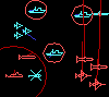
Used scen Approach (Russian side). I can recommend this scen by the way [:)]
In it there are satellite start/end stations at edges of the map and a RORSAT is on a ferry mission from one to the other. Many designers have used this kind of setup to mimmick semi-realistic satellite recon. The scen was built with PlayerDB.
- In 3.6.3 the sat takes off, rises to about 140km altitude, and very slow descends as it crossed North to South. At that altitude RORSAT radar sweeps 400nm or so.
- In ANW (same scn, DB) the sat rises to 2010 meters (Med) and decends rapidly to 110m. Of course its radar horizon is now very small.
It was pointed out to me this is most likely a DB issue, but given the DB was identical, I suspect a difference in altitude behaviour of the take-off and then Ferry mission between ANW and 3.6.
Have other DB-owners/players seen such behaviour of Ferry missions with Sats?
The manual seems to suggest Ferry missions go High, and that would certainly be most appropriate I think; for example for passenger planes like 747 on Ferry. So solution and improvement for many (if not all) ferry missions is to change its behaviour to stay at high altitude for most of its course. No idea how hard this is; and I understand it is fully up to AGSI/Matrix.
Hope that on something technical, non controversial and cross-DB the various enthausiasts of the game can make a joint recommendation to Matrix/AGSI?
Regards Freek
Bug Discussion: satellite altitudes on ferry mission
Post bug reports, technical support request and store or installation issue reports here.
Moderator: Harpoon 3
RE: Bug Discussion: satellite altitudes on ferry mission
I'd like satellites platforms/units with real behaviors if possible [:)] The satellites in the DB now are really "aircraft" units mod'd to behave like satellites. So changing the behavior of mission meant for an aircraft (like your 747) for the sake of making a satellite work isn't ideal as you may screw up aircraft behaviors.Although if no addition is possible making it work like 3.6. might be nice and make folks happy.
As far as the manual most of the mission behaviors reflect 3.6. As far as I know no additions have been made for 3.7 behaviors. My guess is AGSI/Matrix might take on the endeavor as soon as they figure out what the behaviors are and whats changed.
As far as the manual most of the mission behaviors reflect 3.6. As far as I know no additions have been made for 3.7 behaviors. My guess is AGSI/Matrix might take on the endeavor as soon as they figure out what the behaviors are and whats changed.

RE: Bug Discussion: satellite altitudes on ferry mission
Can you help me out with some of the terminology - CEC and SO?
Intel Monkey: https://sites.google.com/view/staffmonkeys/home
RE: Bug Discussion: satellite altitudes on ferry mission
Dale:
SO - special operations... you mean it in a land warfare sense?
by the way... is 3.8 going to include waypoints for cruise missiles?
would be also nice to have a new Air Tasking Order and improved flight/strike planning functionality... I remember there was a good brainstorming session regarding this aspect a few yearsago over the HHQ... I wasn't even a Harpoon 3 owner back then but enjoyed the thread and the article that appeared in Waypoint magazine nevertheless.
cheers,
-E
RE: Bug Discussion: satellite altitudes on ferry mission
Special Operations forces are currently abstractly modelled as weapons, usually delivered from submarines and aircraft. The plan is to further expand upon their concept and if possible flesh them out in a more realistic manner.
Waypoints for cruise missiles are a bit further down the priority stack at the moment, regretably.
OTOH, a new ATO & strike planner are among the hot items under consideration. I have something "in the shipyard" that works as a separate application and allows useful things like combat range, endurance & flight duration calculations depending on a user-selected mission profile & loadout. Not quite as integrated with the sim as most would like but it's a start [:)]

RE: Bug Discussion: satellite altitudes on ferry mission
Thanks for the information guys...
you threw a few bits of information in there that now has me wondering...
let's begin:
Dimitris' strike tools:
those sound very interesting... however I can't see any download link [:D] [;)]
are those for in-house use until mature enough for release? are they being developed by yourself for AGSI or as a HHQ product? what about the tools per se... are they a stand alone program, a prototype for later integration with the H3 game engine or an access/excel kind of tool?
Screenshots please!! [:D]
Dale:
special operations sound promising... the capability of deattaching/spawning units from a "parent" unit will sure help implementing mine warfare. Hope it makes it into 3.8, like you mentioned above.
However the more interesting aspect of this is the amphibious operations. I understand it is beyond Harpoon's scope to model land warfare, but modeling an amphibious disembark and "taking a beach" requires land opponents and their respective AI logic, so you may end up developing and modeling lots of things just to accomplish that...things that maybe make the jump into full scale modeling of land warfare a matter of one or two releases. Hey now! try to get funding for developing those aspects from a military customer and backport it into the public version [;)].
I don't own the Harpoon rules books so I'd like to know if they model amphibious assaults or any kind of land warfare?
Thanks for reading
cheers,
-E
ps: hope waypoints for missiles become a reality in 3.8...
RE: Bug Discussion: satellite altitudes on ferry mission
Freek Schepers made up a simulated beach landing in his Old vs. New battleset. It is the third scenario of the group. You can get it on StrategyZoneOnline
It requires the PlayersDB and has not been tested for Harpoon ANW, yet. It has been tested for v3.6.3.
It requires the PlayersDB and has not been tested for Harpoon ANW, yet. It has been tested for v3.6.3.
RE: Bug Discussion: satellite altitudes on ferry mission
There's a reason I said "in the shipyard" [:)]ORIGINAL: evaamo2
Dimitris' strike tools:
those sound very interesting... however I can't see any download link [:D] [;)]
Developed by yours truly, tested in-house and then released to the community freely. This has been the standard path for all utilities & applications developed in the past and it's worked well.are those for in-house use until mature enough for release?
HHQ-hosted product, freely available.are they being developed by yourself for AGSI or as a HHQ product?
Probably web application similar to (and probably tied to) the online encyclopedia already present at HHQ. Not yet pretty enough for screenshots [:D]what about the tools per se... are they a stand alone program, a prototype for later integration with the H3 game engine or an access/excel kind of tool?
Screenshots please!! [:D]
RE: Bug Discussion: satellite altitudes on ferry mission
Sounds promising... didn't know it was going to be a web enabled app tho'.
Yeah I'm familiar with that approach... just pushing luck for a community beta kind of release [;)]
Well... we software developers usually suck at UI design ... so don't let that hold your release back [:D]
thanks for the answers... like I said, sounds promising.
cheers,
-E
ORIGINAL: Sunburn
Developed by yours truly, tested in-house and then released to the community freely. This has been the standard path for all utilities & applications developed in the past and it's worked well.
Yeah I'm familiar with that approach... just pushing luck for a community beta kind of release [;)]
Not yet pretty enough for screenshots
Well... we software developers usually suck at UI design ... so don't let that hold your release back [:D]
thanks for the answers... like I said, sounds promising.
cheers,
-E
Return to “Harpoon 3 ANW Support”
Jump to
- General
- ↳ Press Releases, News and Events from Matrix
- ↳ General Discussion
- ↳ Quizzes, Trivial and other Interesting Information
- ↳ Site Feedback
- ↳ Latest Matrix Downloads
- ↳ Official Matrix Games Discord Server
- ↳ Official Support: Matrix Games Help Desk
- ↳ Automated Purchased Game Re-Downloads (Members Club My Orders)
- ↳ FAQ
- ↳ Unofficial Tech Support By Gamers for Gamers
- Regional
- ↳ Español
- ↳ Français
- Coming Soon
- ↳ Modern Naval Warfare
- ↳ Commander: Europe at War
- New Releases from Matrix Games
- ↳ Strategic Command WWII: War in the Pacific
- ↳ Tech Support
- ↳ After Action Report
- ↳ Scenario Design and Modding
- ↳ Feature Suggestions
- ↳ The War Room
- ↳ Opponents Wanted
- ↳ Strategic Command WWII: War in the Pacific Buy Now
- ↳ Strategic Command WWII: War in the Pacific Discord Server
- ↳ Manual
- ↳ Armored Brigade II
- ↳ Manual
- ↳ Armored Brigade II: Tech Support Forum
- ↳ Armored Brigade II: Mods
- ↳ Armored Brigade II: Maps and Map Making
- ↳ Armored Brigade II: Scenarios
- ↳ Distant Worlds 2
- ↳ Distant Worlds 2: Tech Support
- ↳ After Action Reports
- ↳ The War Room
- ↳ Design and Modding
- ↳ Distant Worlds 2 Product Page
- ↳ Official Distant World 2 Discord Server
- ↳ Campaign Series: Middle East 1948-1985
- ↳ Tech Support
- ↳ After Action Reports
- ↳ The War Room
- ↳ Mods and Scenarios
- ↳ Opponents Wanted
- ↳ Buy Campaign Series: Middle East 1948-1985 Now!
- ↳ Campaign Series: Middle East 1948-1985 Product Info
- ↳ Command: Modern Operations series
- ↳ Command: DLCs
- ↳ Command: Desert Storm
- ↳ Command: Shifting Sands
- ↳ Command: Chains of War
- ↳ Command: Northern Inferno
- ↳ Tech Support
- ↳ Multiplayer PBEM - Unofficial
- ↳ After Action Report
- ↳ Mods and Scenarios
- ↳ WarfareSims Mods and Scenarios Archive
- ↳ Useful Material
- ↳ Lua Legion
- ↳ The War Room
- ↳ Command: Modern Operations Product Info
- ↳ Buy Command: Modern Operations Now!
- ↳ CMO PDF Manual
- ↳ Official Discord Command Modern Operations
- ↳ Campaign Series: Vietnam
- ↳ Tech Support
- ↳ Features Suggestions
- ↳ Scenario Design and Modding
- ↳ The War Room
- ↳ After Action Report
- ↳ Opponents Wanted
- ↳ Campaign Series Vietnam Product Page
- ↳ Campaign Series Vietnam Official Discord Server
- ↳ Combat Mission Battle for Normandy
- ↳ Tech Support
- ↳ Feature Suggestions
- ↳ Scenario Design and Modding
- ↳ The War Room
- ↳ After Action Report
- ↳ Opponents Wanted
- ↳ Buy Now
- ↳ Combat Mission Official Discord Channel
- ↳ Combat Mission: Final Blitzkrieg
- ↳ Tech Support
- ↳ Feature Suggestions
- ↳ Scenario Design and Modding
- ↳ The War Room
- ↳ After Action Report
- ↳ Opponents Wanted
- ↳ Buy Base Game
- ↳ Buy Downfall DLC
- ↳ Combat Mission Official Discord Channel
- ↳ Downfall DLC Manual
- ↳ Valor & Victory
- ↳ Tech Support Forum
- ↳ Scenario Design
- ↳ Opponents Wanted
- ↳ The War Room
- ↳ After Action Reports
- ↳ Buy Valor & Victory Now
- ↳ Valor & Victory Official Discord Server
- ↳ Strategic Command Series
- ↳ Strategic Command: World War I
- ↳ PDF Manual
- ↳ Tech Support
- ↳ MODS and Scenarios
- ↳ AAR
- ↳ Multiplayer Sessions
- ↳ War Room
- ↳ Strategic Command: American Civil War
- ↳ Tech Support
- ↳ Features Suggestions
- ↳ Scenario Design and Modding
- ↳ The War Room
- ↳ After Action Report
- ↳ Opponents Wanted
- ↳ Strategic Command: American Civil War Buy now
- ↳ Strategic Command: American Civil War Discord
- ↳ Strategic Command WWII: World at War
- ↳ Tech Support
- ↳ MODS and Scenarios
- ↳ AAR
- ↳ Multiplayer Sessions
- ↳ War Room
- ↳ SC WWII World at War Manual (PDF EBOOK)
- ↳ Strategic Command WWII War in Europe
- ↳ Strategic Command WWII War in Europe Public Beta
- ↳ Tech Support
- ↳ After Action Reports
- ↳ Videos, Tutorials, Let's Plays
- ↳ Developer Blog
- ↳ The War Room
- ↳ Multiplayer (PBEM and head to head)
- ↳ Scenario Design and Modding
- ↳ Strategic Command WWII: War in Europe Product Page
- ↳ Buy Strategic Command WWII: War in Europe Now!
- ↳ Strategic Command Classic: WWI
- ↳ Tech Support
- ↳ Tech Support
- ↳ Strategic Command Classic: Global Conflict
- ↳ Tech Support
- ↳ Strategic Command Classic WWII
- ↳ Tech Support
- ↳ Combat Mission Fortress Italy
- ↳ Tech Support
- ↳ Feature Suggestions
- ↳ Scenario Design and Modding
- ↳ The War Room
- ↳ After Action Report
- ↳ Opponents Wanted
- ↳ Buy Now
- ↳ Combat Mission Official Discord Channel
- ↳ Base Game Manual
- ↳ Gustav Line DLC Manual
- ↳ Rome to Victory DLC manual
- ↳ Combat Mission Red Thunder
- ↳ Tech Support
- ↳ Feature Suggestions
- ↳ Scenario Design and Modding
- ↳ The War Room
- ↳ After Action Report
- ↳ Opponents Wanted
- ↳ Buy Now
- ↳ Combat Mission Official Discord Channel
- ↳ Fire and Rubble DLC Manual
- ↳ Base Game Manual
- ↳ Rule the Waves 3
- ↳ Rule the Waves 3: Tech Support
- ↳ After Action Reports
- ↳ The War Room
- ↳ Design and Modding
- ↳ Rule the Waves 3 Product Page
- ↳ Official Rule the Waves 3 Discord Server
- ↳ Rule the Waves 3 - Manual
- ↳ Flashpoint Campaigns Southern Storm
- ↳ Tech Support
- ↳ After Action Report
- ↳ Mods and Scenarios
- ↳ Scenario School
- ↳ The War Room
- ↳ Opponents Wanted
- ↳ Requested Features and Ideas
- ↳ Flashpoint Campaigns: Southern Storm Product Page
- ↳ Flashpoint Campaigns Southern Storm Official Discord
- ↳ Shadow Empire
- ↳ Tech Support
- ↳ AAR
- ↳ War Room
- ↳ Shadow Empire MATRIX VERSION Open Beta
- ↳ Suggestions and Feedback
- ↳ Graphic Mods
- ↳ Buy the Game
- ↳ Manual
- ↳ Story and Stratagem (S&S) Editor
- ↳ Nuclear War Simulator
- ↳ Gary Grigsby's War in the East 2
- ↳ Tech Support
- ↳ Scenario Data / Map Issues
- ↳ Feature Suggestions
- ↳ Scenario Design and Modding
- ↳ The War Room
- ↳ After Action Reports
- ↳ Opponents Wanted
- ↳ Buy Gary Grigsby's War in the East 2 Now!
- ↳ War in the East 2 Official Discord Server
- ↳ Race for the Caucasus Tournament
- ↳ Gary Grigsby's World at War: A World Divided
- ↳ Tech Support
- ↳ After Action Reports
- ↳ The War Room
- ↳ Mods and Scenarios
- ↳ Opponents Wanted
- ↳ Limited Public Beta Feedback
- ↳ Buy Gary Grigsby's World at War: A World Divided Now!
- ↳ World at War: A World Divided Official Discord Server
- ↳ WEGO World War II: Stalingrad
- ↳ WEGO World War II: Stalingrad: Tech Support
- ↳ WEGO World War II: Stalingrad: Multiplayer War Room
- ↳ WEGO World War II: Stalingrad: Mods and Scenarios
- ↳ WEGO World War II: Stalingrad: Editor and Campaign Editor
- ↳ WEGO World War II: Stalingrad - Scenario AAR
- ↳ WEGO World War II: Stalingrad Suggestions/Future Improvements
- ↳ Decisive Campaigns: Ardennes Offensive
- ↳ Open Beta
- ↳ Tech Support
- ↳ Scenario Design and Modding
- ↳ After Action Reports
- ↳ Opponents wanted
- ↳ Buy Decisive Campaigns: Ardennes Offensive Now!
- ↳ Combat Mission Cold War
- ↳ Public Beta Tournament
- ↳ Tech Support
- ↳ Feature Suggestions
- ↳ Scenario Design and Modding
- ↳ The War Room
- ↳ After Action Report
- ↳ Opponents Wanted
- ↳ Buy Combat Mission: Cold War Now!
- ↳ Combat Mission Official Discord Channel
- ↳ Warplan Pacific
- ↳ Warplan Pacific: Tech Support Forum
- ↳ Scenario Design and Modding
- ↳ The War Room
- ↳ After Action Reports
- ↳ Opponents Wanted
- ↳ Buy Warplan Pacific Now!
- ↳ WarPlan Pacific Beta
- ↳ Empires in Arms the Napoleonic Wars of 1805 - 1815
- ↳ Tech Support
- ↳ After Action Reports
- ↳ The War Room
- ↳ Opponents Wanted
- ↳ Mods and Scenarios
- ↳ Buy Empires in Arms Now!
- ↳ Advanced Tactics Series
- ↳ Advanced Tactics Support
- ↳ After Action Reports
- ↳ Mods and Scenarios
- ↳ The War Room
- ↳ Opponents Wanted
- ↳ Advanced Tactics Community Site
- ↳ Advanced Tactics Gold: Open Beta
- ↳ Buy Advanced Tactics: Gold Now!
- ↳ Armored Brigade
- ↳ Armored Brigade: Tech Support Forum
- ↳ Armored Brigade - Factions Overviews & Dev Diaries
- ↳ Armored Brigade - Dev Diaries
- ↳ AAR
- ↳ MODS and Scenarios
- ↳ Manual PDF
- ↳ Map Making Tutorial - PDF guide
- ↳ Tutorial Videos
- ↳ Armored Brigade Campaign Generator Guide
- ↳ Research
- ↳ France
- ↳ Belgium
- ↳ Czechoslovakia
- ↳ Canada
- ↳ Suggestions
- ↳ Close Combat – The Bloody First
- ↳ Close Combat: The Bloody First - Tech Support Forum
- ↳ Close Combat The Bloody First - Modding
- ↳ Close Combat Series
- ↳ Close Combat - Gateway to Caen
- ↳ Tech Support
- ↳ After Action Reports
- ↳ Mods and Scenarios
- ↳ The War Room
- ↳ Opponents Wanted
- ↳ Close Combat - Gateway to Caen Product Page
- ↳ Buy Close Combat - Gateway to Caen Now!
- ↳ Close Combat: Panthers in the Fog
- ↳ Tech Support
- ↳ After Action Reports
- ↳ Mods and Scenarios
- ↳ The War Room
- ↳ Opponents Wanted
- ↳ Close Combat: Panthers in the Fog Product Info
- ↳ Buy Close Combat: Panthers in the Fog Now!
- ↳ Close Combat: Last Stand Arnhem
- ↳ Tech Support
- ↳ After Action Reports
- ↳ Mods and Scenarios
- ↳ The War Room
- ↳ Opponents Wanted
- ↳ Close Combat Website
- ↳ Close Combat: Last Stand Arnhem Product Info
- ↳ Buy Close Combat: Last Stand Arnhem Now!
- ↳ Close Combat: Modern Tactics
- ↳ Tech Support
- ↳ After Action Reports
- ↳ Mods and Scenarios
- ↳ Opponents Wanted
- ↳ Close Combat Website
- ↳ Buy Close Combat: Modern Tactics Now!
- ↳ Close Combat - Cross of Iron
- ↳ Cross of Iron Support
- ↳ After Action Reports
- ↳ Opponents Wanted
- ↳ Scenario Design and Editing
- ↳ Cross of Iron Modding
- ↳ Close Combat Website
- ↳ Close Combat: Cross of Iron Product Info
- ↳ Buy Close Combat: Cross of Iron Now!
- ↳ Close Combat: The Longest Day
- ↳ Tech Support
- ↳ Mods and Scenarios
- ↳ The War Room
- ↳ After Action Reports
- ↳ Opponents Wanted
- ↳ Close Combat Website
- ↳ Close Combat: The Longest Day Product Info
- ↳ Buy Close Combat: The Longest Day Now!
- ↳ Close Combat: Wacht am Rhein
- ↳ Tech Support
- ↳ Mods and Scenarios
- ↳ The War Room
- ↳ After Action Reports
- ↳ Opponents Wanted
- ↳ Close Combat Website
- ↳ Close Combat: Wacht am Rhein Product Info
- ↳ Buy Close Combat - Wacht am Rhein Now!
- ↳ Combat Mission Black Sea
- ↳ Tech Support
- ↳ Feature Suggestions
- ↳ Scenario Design and Modding
- ↳ The War Room
- ↳ After Action Report
- ↳ Opponents Wanted
- ↳ Buy Combat Mission: Black Sea Now!
- ↳ Combat Mission Official Discord Channel
- ↳ Combat Mission Shock Force 2
- ↳ Tech Support
- ↳ Feature Suggestions
- ↳ Scenario Design and Modding
- ↳ The War Room
- ↳ After Action Report
- ↳ Opponents Wanted
- ↳ Buy Combat Mission: Shock Force 2 Now!
- ↳ Combat Mission Official Discord Channel
- ↳ Decisive Campaigns Series
- ↳ Decisive Campaigns: The Blitzkrieg from Warsaw to Paris
- ↳ Tech Support
- ↳ Historical Issues
- ↳ After Action Reports
- ↳ Mods and Tweaks
- ↳ The War Room
- ↳ Opponents Wanted
- ↳ Decisive Campaigns: The Blitzkrieg from Warsaw to Paris Product Info
- ↳ Buy Decisive Campaigns: The Blitzkrieg from Warsaw to Paris Now!
- ↳ Decisive Campaigns: Case Blue
- ↳ Tech Support
- ↳ After Action Reports
- ↳ Mods and Scenarios
- ↳ The War Room
- ↳ Opponents Wanted
- ↳ Decisive Campaigns: Case Blue Product Info
- ↳ Buy Decisive Campaigns: Case Blue Now!
- ↳ Decisive Campaigns: Barbarossa
- ↳ Tech Support
- ↳ After Action Report
- ↳ Mods
- ↳ Scenario Design with the Community Project
- ↳ Tech Forum
- ↳ The War Room
- ↳ Opponents Wanted
- ↳ Decisive Campaigns: Barbarossa Product Info
- ↳ Buy Decisive Campaigns: Barbarossa Now!
- ↳ Distant Worlds 1 Series
- ↳ Tech Support
- ↳ After Action Reports
- ↳ The War Room
- ↳ Design and Modding
- ↳ Distant Worlds: Universe Product Info
- ↳ Buy Distant Worlds: Universe Now!
- ↳ Flashpoint Campaigns Classic
- ↳ Tech Support
- ↳ After Action Report
- ↳ Mods and Scenarios
- ↳ Scenario School
- ↳ The War Room
- ↳ Opponents Wanted
- ↳ Requested Features and Ideas
- ↳ Flashpoint Campagns: Red Storm Product Info
- ↳ Buy Flashpoint Campaigns Red Storm Now!
- ↳ Gary Grigsby's Eagle Day to Bombing the Reich
- ↳ After Action Reports
- ↳ Tech Support
- ↳ The War Room
- ↳ Opponents Wanted
- ↳ Scenarios and Modding
- ↳ Buy Eagle Day to Bombing the Reich Now!
- ↳ Eagle Day to Bombing the Reich Discord server
- ↳ Gary Grigsby's War in the East Series
- ↳ Tech Support
- ↳ After Action Reports
- ↳ The War Room
- ↳ Opponents Wanted
- ↳ Scenario Design and Modding
- ↳ Buy Gary Grigsby's War in the East Now!
- ↳ Buy Gary Grigsby's Don to the Danube Now!
- ↳ Buy Gary Grigsby's War in the East: Lost Battles Now!
- ↳ War in the East Discord Server
- ↳ Gary Grigsby's War in the West
- ↳ Tech Support
- ↳ After Action Reports
- ↳ The War Room
- ↳ Buy Gary Grigsby's War in the West: Operation Torch Now!
- ↳ Opponents Wanted
- ↳ Scenario Design and Modding
- ↳ Buy Gary Grigsby's War in the West Now!
- ↳ Buy Gary Grigsby's Operation Torch Now!
- ↳ War in the West Discord Server
- ↳ Order of Battle : World War II
- ↳ Tech Support
- ↳ After Action Reports
- ↳ The War Room
- ↳ Opponents Wanted
- ↳ Scenario Design and Modding
- ↳ Order of Battle: Pacific Product Page
- ↳ Buy Order of Battle: Pacific Now!
- ↳ The Operational Art of War IV
- ↳ Mods and Scenarios
- ↳ Mods
- ↳ Tech Support
- ↳ After Action Reports
- ↳ The War Room
- ↳ Opponents Wanted
- ↳ The Operational Art of War IV Product Info
- ↳ Buy The Operational Art of War IV Now!
- ↳ Manual
- ↳ Victory and Glory: Napoleon
- ↳ Tech Support
- ↳ Victory and Glory: Napoleon - Buy Now!
- ↳ Victory and Glory: Napoleon AAR
- ↳ War in the Pacific: Admiral's Edition
- ↳ Tech Support
- ↳ After Action Reports
- ↳ The War Room
- ↳ Opponents Wanted
- ↳ Scenario Design and Modding
- ↳ Buy War in the Pacific: Admiral's Edition Now!
- ↳ War in the Pacific: Admiral's Edition Discord Server
- ↳ WarPlan
- ↳ War Plan: Tech Support
- ↳ WarPlan Manual
- ↳ AAR
- ↳ Opponents Wanted
- ↳ MODS and Scenarios
- ↳ War Room
- ↳ WarPlan Open Beta Versions
- ↳ North Africa Scenario Open Beta
- ↳ World in Flames
- ↳ Tech Support
- ↳ NetPlay Tech Support
- ↳ After Action Report
- ↳ Mods and Scenarios
- ↳ The War Room
- ↳ Opponents Wanted
- ↳ AI Opponent Discussion
- ↳ WIF School
- ↳ World in Flames Map Pack Product Info
- ↳ Buy World in Flames Map Pack Now!
- ↳ World in Flames Product Info
- ↳ Buy World in Flames Now!
- Current Games From Matrix.
- ↳ [Fantasy]
- ↳ Fantasy Kommander – Eukarion Wars
- ↳ Tech Support
- ↳ After Action Report
- ↳ Mods and Scenarios
- ↳ The War Room
- ↳ Fantasy Kommander - Eukarion Wars Product Info
- ↳ Buy Fantasy Kommander - Eukarion Wars Now!
- ↳ Drums of War
- ↳ Tech Support
- ↳ After Action Report
- ↳ Mods and Scenarios
- ↳ The War Room
- ↳ Opponents Wanted
- ↳ Drums of War Product Info.
- ↳ Buy Drums of War Now!
- ↳ Ravenmark: Scourge of Estellion
- ↳ Hell
- ↳ Sovereignty: Crown of Kings
- ↳ Tech Support
- ↳ Sovereignty: Crown of Kings Product Info
- ↳ Buy Sovereignty: Crown of Kings Now!
- ↳ Ancients
- ↳ Aggressors: Ancient Rome
- ↳ Alea Jacta Est Series
- ↳ Tech Support
- ↳ After Action Reports
- ↳ Mods and Scenarios
- ↳ The War Room
- ↳ Opponents Wanted
- ↳ AGEOD Official Forums
- ↳ Alea Jacta Est Product Info
- ↳ Birth of Rome Product Info
- ↳ Alea Jacta Est- The Spartacus Revolt 73 BC Product Info
- ↳ Alea Jacta Est- The Cantabrian Wars - 29BC Product Info
- ↳ Alea Jacta Est: Parthian Wars Product Info
- ↳ Hannibal: Terror of Rome Product Info
- ↳ Buy Alea Jacta Est Now!
- ↳ Buy Birth of Rome Now!
- ↳ Buy Alea Jacta Est- The Spartacus Revolt 73 BC Now!
- ↳ Buy Alea Jacta Est- The Cantabrian Wars - 29BC Now!
- ↳ Buy Alea Jacta Est: Parthian Wars Now!
- ↳ Buy Hannibal: Terror of Rome Now!
- ↳ Field of Glory Series
- ↳ Tech Support
- ↳ After Action Reports
- ↳ The War Room
- ↳ Scenario Design and Modding
- ↳ Opponents Wanted
- ↳ Official Slitherine Forum
- ↳ Field of Glory Product Info
- ↳ Field of Glory: Rise of Rome Product Info
- ↳ Field of Glory: Storm of Arrows Product Info
- ↳ Field of Glory: Immortal Fire Product Info
- ↳ Field of Glory: Swords and Scimitars Product Info
- ↳ Field of Glory: Legions Triumphant Product Info
- ↳ Field of Glory: Eternal Empire Product Info
- ↳ Field of Glory: Decline And Fall Product Info
- ↳ Field of Glory: Battle Pack Product Info
- ↳ Field of Glory: Wolves from the Sea Product Info
- ↳ Field of Glory: Oath of Fealty Product Info
- ↳ Buy Field of Glory Now!
- ↳ Buy Field of Glory: Rise of Rome Now!
- ↳ Buy Field of Glory: Storm of Arrows Now!
- ↳ Buy Field of Glory: Immortal Fire Now!
- ↳ Buy Field of Glory: Swords and Scimitars Now!
- ↳ Buy Field of Glory: Legions Triumphant Now!
- ↳ Buy Field of Glory: Eternal Empire Now!
- ↳ Buy Field of Glory: Decline And Fall Now!
- ↳ Buy Field of Glory: Battle Pack Now!
- ↳ Buy Field of Glory: Wolves from the Sea Now!
- ↳ Buy Field of Glory: Oath of Fealty Now!
- ↳ Field of Glory 2
- ↳ Field of Glory: Empires
- ↳ Hannibal: Rome and Carthage in the Second Punic War
- ↳ Tech Support
- ↳ After Action Reports
- ↳ The War Room
- ↳ Hannibal: Rome and Carthage in the Second Punic War Product Info
- ↳ Buy Hannibal: Rome and Carthage Now!
- ↳ Legion Arena Gold
- ↳ Legion Arena Gold Support
- ↳ After Action Reports
- ↳ Opponents Wanted
- ↳ Legion Arena Gold Developer Forum
- ↳ Buy Legion Arena Gold Now!
- ↳ Legion Gold, Gates of Troy, Spartan & Chariots of War
- ↳ Tech Support
- ↳ After Action Reports
- ↳ Opponents Wanted
- ↳ Mods and Scenarios
- ↳ Official Developer Forums
- ↳ Buy Gates of Troy Now!
- ↳ Buy Spartan Now!
- ↳ Buy Chariots of War Now!
- ↳ Buy Legion Gold Now!
- ↳ Legion for iPad Product Info
- ↳ Buy Legion for iPad Now!
- ↳ Mare Nostrvm
- ↳ Tech Support
- ↳ Tin Soldiers: Alexander the Great
- ↳ Tech Support
- ↳ After Action Reports
- ↳ Buy Tin Soldiers: Alexander The Great Now!
- ↳ Tin Soldiers: Julius Caesar
- ↳ Tech Support
- ↳ Buy Tin Soldiers: Julius Caesar Now!
- ↳ QVADRIGA
- ↳ Tech Support
- ↳ After Action Reports
- ↳ The War Room
- ↳ Qvadriga Product Info
- ↳ Buy Qvadriga Now!
- ↳ Medieval
- ↳ Conquest! Medieval Realms
- ↳ Tech Support
- ↳ After Action Reports
- ↳ The War Room
- ↳ Opponents Wanted
- ↳ Conquest! Product Info
- ↳ Buy Conquest! Medieval Realms Now!
- ↳ Conquest: Medieval Realms for iOS/Android
- ↳ Conquest! Medieval Realms for iOS/Android Product Info
- ↳ Buy Conquest Medieval Realms for iOS/Android Now!
- ↳ Field of Glory Series
- ↳ Great Invasions
- ↳ Tech Support
- ↳ The War Room
- ↳ After Action Reports
- ↳ Mods and Scenarios
- ↳ Official AGEOD Forum
- ↳ Buy "Great Invasions" Now!
- ↳ HISTORY Great Battles Medieval
- ↳ Tech Support
- ↳ Slitherine Tech Support for HISTORY Great Battles Medieval
- ↳ After Action Reports
- ↳ Mods and Scenarios
- ↳ The War Room
- ↳ Opponents Wanted
- ↳ Slitherine HISTORY Great Battle Medieval Forums
- ↳ HISTORY Great Battles Medieval Product Info
- ↳ HISTORY Great Battles Medieval - iPad Product Info
- ↳ Buy HISTORY Great Battles Medieval Now!
- ↳ Magnifico - Da Vinci’s Art of War
- ↳ Tech Support
- ↳ After Action Reports
- ↳ The War Room
- ↳ Magnifico Product Info
- ↳ Buy Magnifico Now!
- ↳ Thirty Years' War
- ↳ Tech Support
- ↳ Mods and Scenarios
- ↳ After Action Reports
- ↳ The War Room
- ↳ Opponents Wanted
- ↳ Product info
- ↳ Buy Thirty Years' War Now!
- ↳ Sengoku Jidai: Shadow of the Shogun
- ↳ Age of Muskets
- ↳ Birth of America
- ↳ Birth of America Support
- ↳ After Action Reports
- ↳ Birth of America Modding Forum
- ↳ Opponents Wanted
- ↳ Official AGEOD Forums
- ↳ Buy Birth of America Now!
- ↳ Birth of America 2: Wars in America
- ↳ Tech Support
- ↳ The War Room
- ↳ Mods and Scenarios
- ↳ After Action Reports
- ↳ Official AGEOD Forum
- ↳ Buy Wars in America Now!
- ↳ English Civil War
- ↳ Tech Support
- ↳ For Liberty! & 1848
- ↳ For Liberty! Support
- ↳ After Action Reports
- ↳ The War Room
- ↳ Opponents Wanted
- ↳ Buy For Liberty! Now!
- ↳ Horse and Musket: Volume I, Frederick the Great
- ↳ Tech Support
- ↳ Mods and Scenarios
- ↳ After Action Reports
- ↳ Opponents Wanted
- ↳ The War Room
- ↳ Buy Horse and Musket: Volume I Now!
- ↳ Rise of Prussia Gold
- ↳ Tech Support
- ↳ Ageod Rise of Prussia Tech Support Forum
- ↳ After Action Reports
- ↳ Mods and Scenarios
- ↳ The War Room
- ↳ Opponents Wanted
- ↳ Rise of Prussia Gold Upgrade Kit Product Info
- ↳ Buy Rise of Prussia Gold Upgrade Kit
- ↳ Rise of Prussia Gold Product Info
- ↳ Buy Rise of Prussia Gold Now!
- ↳ Pike & Shot Series
- ↳ Tech Support
- ↳ After Action Reports
- ↳ Mods and Scenarios
- ↳ The War Room
- ↳ Opponents Wanted
- ↳ Pike & Shot Product Info
- ↳ Buy Pike & Shot Now!
- ↳ Pike and Shot: Campaigns Product Product Info
- ↳ Pike and Shot - Tercio to Salvo Product Info
- ↳ Buy Pike and Shot - Tercio to Salvo Now!
- ↳ Buy Pike and Shot - Campaigns Now!
- ↳ Pride of Nations
- ↳ Tech Support
- ↳ Ageod PON Tech Support Forum
- ↳ After Action Reports
- ↳ Mods and Scenarios
- ↳ The War Room
- ↳ Opponents Wanted
- ↳ Pride of Nations Product Info
- ↳ Pride of Nations - The American Civil War 1862 Product Info
- ↳ Pride of Nations - The Franco-Prussian War 1870-1871 Product Info
- ↳ Pride of Nations - The Scramble for Africa Campaign 1880 Product Info
- ↳ Pride of Nations - The Spanish-American War 1898 Product Info
- ↳ Buy Pride of Nations Now!
- ↳ Buy Pride of Nations - The American Civil War 1862 Now!
- ↳ Buy Pride of Nations - The Franco-Prussian War 1870-1871 Now!
- ↳ Buy Pride of Nations - The Scramble for Africa Campaign 1880 Now!
- ↳ Buy Pride of Nations - The Spanish-American War 1898 Now!
- ↳ Wars of Succession
- ↳ Wars of Succession: Tech Support
- ↳ Napoleonics
- ↳ Campaigns on the Danube 1805 - 1809
- ↳ Campaigns on the Danube Support
- ↳ Mods and Scenarios
- ↳ After Action Reports
- ↳ Opponents Wanted
- ↳ Commander - Napoleon at War
- ↳ Tech Support
- ↳ The War Room
- ↳ Mods and Scenarios
- ↳ After Action Reports
- ↳ Public Beta Feedback
- ↳ Official Slitherine Forum
- ↳ Buy Commander - Napoleon at War Now!
- ↳ Crown of Glory
- ↳ Crown Of Glory Support
- ↳ After Action Report
- ↳ Opponents Wanted
- ↳ The War Room
- ↳ Limited Beta Feedback
- ↳ Games Depot at Wargamer.com
- ↳ BattleLeagues at Wargamer.com
- ↳ OpponentsWanted at Wargamer.com
- ↳ Buy Crown of Glory Now!
- ↳ Crown of Glory: Emperor's Edition
- ↳ Tech Support
- ↳ Napoleonic History
- ↳ Mods and Scenarios
- ↳ The War Room
- ↳ Opponents Wanted
- ↳ After Action Reports
- ↳ Buy Crown of Glory: Emperor's Edition Now!
- ↳ John Tiller's Battleground Napoleonic Wars
- ↳ March to Glory
- ↳ Napoleon in Italy
- ↳ Napoleon in Italy Support
- ↳ After Action Reports
- ↳ Mods and Scenarios
- ↳ Opponents Wanted
- ↳ Official Developer Site
- ↳ Buy Napoleon in Italy Now!
- ↳ Napoleon's Campaigns
- ↳ Tech Support
- ↳ Ageod Tech Support Forum
- ↳ After Action Reports
- ↳ Mods and Scenarios
- ↳ The War Room
- ↳ Opponents Wanted
- ↳ Napoleon's Campaigns Product Info
- ↳ Buy Napoleon's Campaigns Now!
- ↳ Scourge of War: Waterloo
- ↳ Tech Support
- ↳ After Action Report
- ↳ Mods and Scenarios
- ↳ The War Room
- ↳ Opponents Wanted
- ↳ Scourge of War: Waterloo Product Info
- ↳ Buy Scourge of War: Waterloo Now!
- ↳ Wars of Napoleon
- ↳ Tech Support
- ↳ Ageod Wars Of Napoleon Technical Support Forum
- ↳ After Action Report
- ↳ The War Room
- ↳ Opponents Wanted
- ↳ Wars of Napoleon Product Info
- ↳ Buy Wars of Napoleon Now!
- ↳ American Civil War
- ↳ American Civil War – The Blue and the Gray
- ↳ American Civil War – The Blue and the Gray Support
- ↳ After Action Reports
- ↳ Opponents Wanted
- ↳ Official AGEOD Forums
- ↳ Buy American Civil War – The Blue and the Gray Now!
- ↳ Brother against Brother: The Drawing of the Sword
- ↳ Tech Support
- ↳ After Action Report
- ↳ Mods and Scenarios
- ↳ The War Room
- ↳ Opponents Wanted
- ↳ Brother against Brother Product Info
- ↳ Buy Brother Against Brother Now!
- ↳ Forge of Freedom: The American Civil War 1861-1865
- ↳ Generals' Ratings
- ↳ Generals' Biographies Project
- ↳ Forge of Freedom - Support
- ↳ After Action Reports
- ↳ Mods and Scenarios
- ↳ Opponents Wanted
- ↳ The War Room
- ↳ Public Beta Feedback
- ↳ Buy Forge Of Freedom Now!
- ↳ Gary Grigsby's War Between the States
- ↳ Tech Support
- ↳ Mods and Scenarios
- ↳ The War Room
- ↳ Opponents Wanted
- ↳ After Action Reports
- ↳ Buy War Between the States Now!
- ↳ John Tiller's Battleground Series
- ↳ Battleground Series Support
- ↳ After Action Reports
- ↳ Mods and Scenarios
- ↳ Opponents Wanted
- ↳ Buy Battleground Civil War Now!
- ↳ Buy Battleground Napoleonic Wars Now!
- ↳ Scourge of War Gettysburg Series
- ↳ Tech Support
- ↳ Norb Software Development Tech Forum
- ↳ After Action Reports
- ↳ Mods and Scenarios
- ↳ The War Room
- ↳ Opponents Wanted
- ↳ NorbSoftDev Official Forums
- ↳ Scourge of War - Gettysburg Product Info
- ↳ Scourge of War - Pipe Creek Product Info
- ↳ Scourge of War - Antietam Product Info
- ↳ Scourge of War - Chancellorsville Product Info
- ↳ SoW - Brandy Station Product Info
- ↳ SoW - Gettysburg 150th Anniversary Collection Product Info
- ↳ Buy Scourge of War - Gettysburg Now!
- ↳ Buy Scourge of War - Pipe Creek Now!
- ↳ Buy Scourge of War - Antietam Now!
- ↳ Buy Scourge of War - Chancellorsville Now!
- ↳ Buy SoW - Brandy Station Now!
- ↳ Buy SoW - Gettysburg 150th Anniversary Collection Now!
- ↳ Civil War II
- ↳ Tech Support
- ↳ Ageod Tech Support Forum
- ↳ After Action Report
- ↳ Mods and Scenarios
- ↳ The War Room
- ↳ Opponents Wanted
- ↳ Civil War II Product Info
- ↳ Civil War II: The Bloody Road South Product Info
- ↳ Buy Civil War II Now!
- ↳ Buy Civil War II: The Bloody Road South Now!
- ↳ Gettysburg: The Tide Turns
- ↳ World War I
- ↳ Advanced Tactics
- ↳ Flyboys Squadron and Warbirds
- ↳ Tech Support
- ↳ Official Totalsims Forums
- ↳ Buy Flyboys Squadron Now!
- ↳ Guns of August 1914 - 1918
- ↳ Guns of August Support
- ↳ After Action Reports
- ↳ Opponents Wanted
- ↳ Buy Guns of August Now!
- ↳ War Plan Orange: Dreadnoughts in the Pacific 1922 - 1930
- ↳ Tech Support
- ↳ After Action Reports
- ↳ The War Room
- ↳ Opponents Wanted
- ↳ Scenario Design
- ↳ Buy War Plan Orange Now!
- ↳ World War One Gold
- ↳ Tech Support
- ↳ The War Room
- ↳ Mods and Scenarios
- ↳ After Action Reports
- ↳ Opponents Wanted
- ↳ Official AGEOD Forums
- ↳ World War One Gold Product Info
- ↳ Discount for Owners of World War One
- ↳ Buy World War One Gold Now!
- ↳ Revolution Under Siege Gold
- ↳ Tech Support
- ↳ Mods and Scenarios
- ↳ After Action Reports
- ↳ The War Room
- ↳ Opponents Wanted
- ↳ Official Developer Site
- ↳ Revolution Under Siege Gold Product Info
- ↳ Buy Revolution Under Siege Gold Now!
- ↳ To End All Wars Series
- ↳ Tech Support
- ↳ After Action Reports
- ↳ Mods and Scenarios
- ↳ The War Room
- ↳ Opponents Wanted
- ↳ To End All Wars Product Page
- ↳ Buy To End All Wars Now!!
- ↳ To End All Wars: Breaking the Deadlock Product Info
- ↳ Buy To End All Wars: Breaking the Deadlock Now!
- ↳ Commander - The Great War
- ↳ Tech Support
- ↳ After Action Reports
- ↳ Mods and Scenarios
- ↳ The War Room
- ↳ Opponents Wanted
- ↳ Commander - The Great War Product Info
- ↳ Buy Commander: The Great War Now!
- ↳ World War II
- ↳ Achtung Panzer Operation Star
- ↳ Tech Support
- ↳ After Action Reports
- ↳ Mods and Operations
- ↳ The War Room
- ↳ Achtung Panzer Operation Star Product Info
- ↳ Buy Achtung Panzer Operation Star Now!
- ↳ Across the Dnepr - Second Edition
- ↳ Tech Support
- ↳ After Action Reports
- ↳ The War Room
- ↳ Design and Modding
- ↳ Across the Dnepr Second Edition Product Info
- ↳ SSG Run5 Site and Forums
- ↳ Buy Across the Dnepr Second Edition Now!
- ↳ Battle Academy Series
- ↳ Battle Academy
- ↳ Tech Support
- ↳ After Action Reports
- ↳ Mods and Scenarios
- ↳ The War Room
- ↳ Opponents Wanted
- ↳ Official Slitherine Support Forum
- ↳ Battle Academy Product Info
- ↳ Battle Academy - Blitzkrieg France Product Info
- ↳ Battle Academy - Market Garden Product Info
- ↳ Battle Academy - Operation Sealion Product Info
- ↳ Battle Academy - Operation Husky Product Info
- ↳ Battle Academy - Rommel in Normandy Product Info
- ↳ Battle Academy - Fortress Metz Product Info!
- ↳ Battle Academy Mega Pack Product Info
- ↳ Buy Battle Academy Now!
- ↳ Buy Battle Academy - Blitzkrieg France Now!
- ↳ Buy Battle Academy - Market Garden Now!
- ↳ Buy Battle Academy - Operation Sealion Now!
- ↳ Buy Battle Academy for iPad Now!
- ↳ Buy Battle Academy - Operation Husky Now!
- ↳ Buy Battle Academy - Rommel in Normandy Now!
- ↳ Buy Battle Academy - Fortress Metz Now!
- ↳ Buy Battle Academy Mega Pack Now!
- ↳ Battle Academy 2
- ↳ Tech Support
- ↳ After Action Reports
- ↳ Mods and Scenarios
- ↳ The War Room
- ↳ Opponents Wanted
- ↳ Battle Academy 2 Product Page!
- ↳ Buy Battle Academy 2 Now!!
- ↳ Battle Academy 2 Battle of Kursk Product Info
- ↳ Buy Battle Academy 2 Battle of Kursk Now!
- ↳ Battlefront
- ↳ Battlefront Support
- ↳ After Action Reports
- ↳ Opponents Wanted
- ↳ Scenario Design and Editing
- ↳ The Official SSG Run5 Site
- ↳ Buy Battlefront Now!
- ↳ Battle For Korsun
- ↳ Battle for Korsun - Tech Support
- ↳ Battle of Britain 2: Wings of Victory
- ↳ Tech Support
- ↳ Official Developer Forum
- ↳ Buy Battle of Britain 2 Now! (North America Only)
- ↳ Battle of the Bulge
- ↳ Carriers At War
- ↳ Carriers at War Support
- ↳ After Action Reports
- ↳ Opponents Wanted
- ↳ Mods and Scenarios
- ↳ Buy Carriers at War Now!
- ↳ Check Your 6!
- ↳ Combat Command Series
- ↳ Tech Support
- ↳ After Action Reports
- ↳ Mods and Scenarios
- ↳ The War Room
- ↳ Opponents Wanted
- ↳ Combat Command: The Matrix Edition Product Info
- ↳ Buy Combat Command: The Matrix Edition Now!
- ↳ Commander - Europe at War Gold
- ↳ Tech Support
- ↳ Mods and Scenarios
- ↳ After Action Reports
- ↳ Opponents Wanted
- ↳ The War Room
- ↳ Commander - Europe At War Gold Developer Forum
- ↳ Buy Commander - Europe at War Gold Now!
- ↳ Conflict of Heroes Series
- ↳ Tech Support
- ↳ After Action Reports
- ↳ Mods and Scenarios
- ↳ The War Room
- ↳ Opponents Wanted
- ↳ Link to In-Game Multiplayer Forum
- ↳ Buy Conflict of Heroes - Storms of Steel Now!!
- ↳ Conflict of Heroes: Awakening the Bear! Product Info
- ↳ Buy Conflict of Heroes; Awakening the Bear Now!
- ↳ Conflict of Heroes: Ghost Divisions Product Info
- ↳ Buy Conflict of Heroes Ghost Divisions Now!
- ↳ Conflict of Heroes - Storms of Steel Product Info
- ↳ Decisive Battles: Battles In Italy
- ↳ Battles In Italy Support
- ↳ After Action Reports
- ↳ Opponents Wanted
- ↳ Scenario Design and Editing
- ↳ Games Depot at Wargamer.com
- ↳ BattleLeagues at Wargamer.com
- ↳ OpponentsWanted at Wargamer.com
- ↳ The Official SSG Run5 Site
- ↳ Buy Battles In Italy Now!
- ↳ Decisive Battles: Battles in Normandy
- ↳ Battles In Normandy Support
- ↳ After Action Reports
- ↳ Opponents Wanted
- ↳ Scenario Design and Editing
- ↳ Games Depot at Wargamer.com
- ↳ BattleLeagues at Wargamer.com
- ↳ OpponentsWanted at Wargamer.com
- ↳ The Official SSG Run5 Site
- ↳ Buy Battles In Normandy Now!
- ↳ Decisive Battles: Korsun Pocket
- ↳ Opponents wanted
- ↳ Korsun Pocket Support
- ↳ The War Room
- ↳ After Action Reports
- ↳ Games Depot at Wargamer.com
- ↳ BattleLeagues at Wargamer.com
- ↳ OpponentsWanted at Wargamer.com
- ↳ The Official SSG Run5 Site
- ↳ Buy Korsun Pocket Now!
- ↳ Desert War 1940 - 1942
- ↳ After Action Reports
- ↳ Tech Support
- ↳ Mods and Scenarios
- ↳ Future Ideas
- ↳ Drive on Moscow
- ↳ España: 1936
- ↳ Tech Support
- ↳ Ageod Espana 1936 Tech Support Forums
- ↳ After Action Report
- ↳ Mods and Scenarios
- ↳ The War Room
- ↳ Opponents Wanted
- ↳ Espana 1936 Product Info
- ↳ Buy Espana 1936 Now!
- ↳ Frontline Series
- ↳ Tech Support
- ↳ After Action Reports
- ↳ Mods and Scenarios
- ↳ The War Room
- ↳ Frontline: Road to Moscow Product Info
- ↳ Frontline: The Longest Day Product Info
- ↳ Buy Frontline: Road to Moscow Now!
- ↳ Buy Frontline: The Longest Day Now!
- ↳ Germany at War: Barbarossa 1941
- ↳ Tech Support
- ↳ After Action Reports
- ↳ Mods and Scenarios
- ↳ The War Room
- ↳ Opponents Wanted
- ↳ Germany at War: Barbarossa 1941 Product Info
- ↳ Buy Germany at War: Barbarossa 1941 Now!
- ↳ Heroes of Normandie
- ↳ John Tiller's Campaign Series
- ↳ John Tiller’s Campaign Series Support
- ↳ After Action Reports
- ↳ Opponents Wanted
- ↳ Mods and Scenarios
- ↳ Buy John Tiller's Campaign Series Now!
- ↳ Kharkov: Disaster on the Donets
- ↳ Tech Support
- ↳ Mods and Scenarios
- ↳ The War Room
- ↳ Opponents Wanted
- ↳ After Action Reports
- ↳ The Official SSG Site
- ↳ User-Created Scenarios
- ↳ Buy Kharkov: Disaster on the Donets Now!
- ↳ Kursk - Battle at Prochorovka
- ↳ Legends of War
- ↳ Tech Support
- ↳ After Action Reports
- ↳ The War Room
- ↳ Opponents Wanted
- ↳ Legends of War Product Info
- ↳ Buy HISTORY Legends of War Now!
- ↳ Lock ‘n Load: Heroes of Stalingrad
- ↳ Tech Support
- ↳ After Action Reports
- ↳ The War Room
- ↳ Opponents Wanted
- ↳ Mods and Scenarios
- ↳ Lock 'n Load: Heroes of Stalingrad Product Info
- ↳ Buy Lock n' Load Heroes of Stalingrad Now!
- ↳ Making History II: The War of the World
- ↳ Tech Support
- ↳ Mods and Scenarios
- ↳ After Action Reports
- ↳ The War Room
- ↳ Opponents Wanted
- ↳ Official Developer Site
- ↳ Making History II: The War of the World Product info
- ↳ Buy Making History II: The War of the World Now!
- ↳ Norm Koger's The Operational Art Of War III
- ↳ TOAW III Support
- ↳ After Action Reports
- ↳ Opponents Wanted
- ↳ The War Room
- ↳ Scenario Design
- ↳ Public Beta Feedback
- ↳ Games Depot at Wargamer.com
- ↳ BattleLeagues at Wargamer.com
- ↳ OpponentsWanted at Wargamer.com
- ↳ Buy TOAW III Now!
- ↳ Officers - The Matrix Edition
- ↳ Tech Support
- ↳ After Action Reports
- ↳ The War Room
- ↳ Opponents Wanted
- ↳ Scenario Design and Modding
- ↳ Officers Product Info
- ↳ Buy Officers - The Matrix Edition Now!
- ↳ Operation Barbarossa: The Struggle for Russia
- ↳ Tech Support
- ↳ After Action Reports
- ↳ The War Room
- ↳ Opponents Wanted
- ↳ Scenario Design and Modding
- ↳ Operation Barbarossa Product Info
- ↳ Buy Operation Barbarossa Now!
- ↳ Panzer Command: Ostfront
- ↳ Tech Support
- ↳ After Action Reports
- ↳ Scenarios and Campaigns
- ↳ Maps, Models and Mods
- ↳ The War Room
- ↳ Opponents Wanted
- ↳ Free Download of Panzer Command: Ostfront if you own Panzer Command: Kharkov
- ↳ Panzer Command: Ostfront Product Info
- ↳ Buy Panzer Command: Ostfront Now!
- ↳ Panzer & Land Doctrine
- ↳ Panzer Doctrine
- ↳ Tech Support
- ↳ Land Doctrine
- ↳ Tech Support
- ↳ Panzer Corps
- ↳ Tech Support
- ↳ After Action Reports
- ↳ Mods and Scenarios
- ↳ The War Room
- ↳ Opponents Wanted
- ↳ Panzer Corps Product Info
- ↳ Panzer Corps Afrika Korps Product Info
- ↳ Panzer Corps Grand Campaign MegaPack '39.-'45 Product info
- ↳ Panzer Corps: Allied Corps Product Info
- ↳ Buy Panzer Corps:Wehrmacht Now!
- ↳ Buy Panzer Corps: Afrika Korps Now!
- ↳ Buy Panzer Corps Grand Campaign Mega Pack '39-'45 Now!
- ↳ Buy Panzer Corps: Allied Corps Now!
- ↳ Buy Panzer Corps for IPAD Now!
- ↳ Piercing Fortress Europa
- ↳ Tech Support
- ↳ After Action Reports
- ↳ The War Room
- ↳ Opponents Wanted
- ↳ Mods and Scenarios
- ↳ Piercing Fortress Europa Product Info
- ↳ Buy Piercing Fortress Europa Now!
- ↳ Steel Panthers World At War & Mega Campaigns
- ↳ SPWaW Thread Hall of Fame
- ↳ SP:WaW Training Center
- ↳ Mega-Campaigns for SP:WaW
- ↳ SP:WaW Scenarios/Campaigns
- ↳ SP:WaW Opponents Wanted
- ↳ SPWaW AAR/DAR
- ↳ Games Depot at Wargamer.com
- ↳ BattleLeagues at Wargamer.com
- ↳ OpponentsWanted at Wargamer.com
- ↳ Buy Steel Panthers World At War Now!
- ↳ Storm over the Pacific
- ↳ Tech Support
- ↳ The War Room
- ↳ Mods and Scenarios
- ↳ After Action Reports
- ↳ Opponents Wanted
- ↳ Storm over the Pacific Product Info
- ↳ Buy Storm over the Pacific Now!
- ↳ Strategic War in Europe
- ↳ Tech Support
- ↳ After Action Reports
- ↳ Mods and Scenarios
- ↳ The War Room
- ↳ Opponents Wanted
- ↳ Strategic War in Europe Product Info
- ↳ Buy Strategic War in Europe Now!
- ↳ Team Assault: Baptism of Fire
- ↳ Tech Support
- ↳ After Action Reports
- ↳ Mods and Scenarios
- ↳ The War Room
- ↳ Opponents Wanted
- ↳ Team Assault: Baptism of Fire Product Info
- ↳ Buy Team Assault: Baptism of Fire Now!
- ↳ Tigers on the Hunt
- ↳ Tech Support
- ↳ After Action Report
- ↳ Tigers on the Hunt - Buy Now!
- ↳ Mods and Scenarios
- ↳ Time of Fury
- ↳ Tech Support
- ↳ After Action Reports
- ↳ The War Room
- ↳ Design and Modding
- ↳ Opponents Wanted
- ↳ Time of Fury Product Info
- ↳ Buy Time of Fury Now!
- ↳ Uncommon Valor - Campaign for the South Pacific
- ↳ Buy Uncommon Valor Now!
- ↳ Opponents wanted
- ↳ After Action Reports
- ↳ The War Room
- ↳ Tech Support
- ↳ Unity of Command Series
- ↳ Tech Support
- ↳ After Action Reports
- ↳ The War Room
- ↳ Design and Modding
- ↳ Opponents Wanted
- ↳ Official Developer Site
- ↳ Unity of Command Product Info
- ↳ Buy Unity of Command Now!
- ↳ Unity of Command Red Turn Product Info
- ↳ Buy Unity of Command Red Turn (Mac) Now!
- ↳ Buy Unity of Command Red Turn Now!
- ↳ Unity of Command Black Turn Product Info.
- ↳ Buy Unity of Command Black Turn Now!
- ↳ Unity of Command Black Turn MAC Product Info
- ↳ Buy Unity of Command Black Turn MAC Now!
- ↳ War In The Pacific - Struggle Against Japan 1941 - 1945
- ↳ Tech Support
- ↳ After Action Reports
- ↳ The War Room
- ↳ Opponents wanted
- ↳ Scenario Design
- ↳ War in the Pacific: Admiral's Edition Forum
- ↳ Buy War In The Pacific Now!
- ↳ War Plan Orange: Dreadnoughts in the Pacific 1922-1930
- ↳ World War II: General Commander
- ↳ Tech Support
- ↳ After Action Reports
- ↳ Mods and Scenarios
- ↳ The War Room
- ↳ Opponents Wanted
- ↳ Buy World War II: General Commander Now!
- ↳ WW2: Road to Victory
- ↳ Tech Support
- ↳ Mods and Scenarios
- ↳ The War Room
- ↳ After Action Reports
- ↳ WW2: Time of Wrath
- ↳ Tech Support
- ↳ Scenarios and Mods
- ↳ The War Room
- ↳ After Action Reports
- ↳ Opponents Wanted
- ↳ Buy WW2: Time of Wrath Now!
- ↳ Modern
- ↳ Afghanistan '11
- ↳ Carrier Deck
- ↳ Democracy
- ↳ Tech Support
- ↳ Buy Democracy Now!
- ↳ FlashPoint Germany
- ↳ Flashpoint Germany Support
- ↳ After Action Reports
- ↳ Opponents Wanted
- ↳ Scenario Design and Editing
- ↳ Games Depot at Wargamer.com
- ↳ BattleLeagues at Wargamer.com
- ↳ OpponentsWanted at Wargamer.com
- ↳ Buy Flashpoint Germany Now!!
- ↳ Frozen Synapse
- ↳ Tech Support
- ↳ Official Support Forum
- ↳ After Action Reports
- ↳ The War Room
- ↳ Official Developer Forums
- ↳ Frozen Synapse Product Info
- ↳ Buy Frozen Synapse Now!
- ↳ Harpoon 3 - Advanced Naval Warfare
- ↳ Harpoon 3 ANW Support
- ↳ After Action Reports
- ↳ Opponents Wanted
- ↳ Scenario Design and Modding
- ↳ Games Depot at Wargamer.com
- ↳ BattleLeagues at Wargamer.com
- ↳ OpponentsWanted at Wargamer.com
- ↳ Hired Guns: The Jagged Edge
- ↳ Tech Support
- ↳ The War Room
- ↳ Mods
- ↳ After Action Reports
- ↳ Buy Hired Guns Now!
- ↳ Hornet Leader PC
- ↳ Hornet Leader PC Support
- ↳ After Action Reports
- ↳ Opponents Wanted
- ↳ Buy Hornet Leader PC Now!
- ↳ Larry Bond's Harpoon - Commander's Edition
- ↳ Tech Support
- ↳ After Action Reports
- ↳ Mods and Scenarios
- ↳ Official Harpoon Commander's Edition Website
- ↳ Larry Bond's Harpoon - Ultimate Edition
- ↳ Tech Support
- ↳ After Action Reports
- ↳ The War Room
- ↳ Opponents Wanted
- ↳ ANW / Legacy Database and Scenarios
- ↳ H3 Database and Scenarios
- ↳ HC Databases and Scenarios
- ↳ Game Mods
- ↳ Official Harpoon Developer Site
- ↳ Harpoon - Ultimate Edition Product Info
- ↳ $25 Discount for Owners of H3ANW or HCE
- ↳ Buy Larry Bond's Harpoon - Ultimate Edition Now!
- ↳ Vietnam ’65
- ↳ Buzz Aldrin's Space Program Manager
- ↳ Tech Support
- ↳ After Action Report
- ↳ The War Room
- ↳ Opponents Wanted
- ↳ Buzz Aldrin's Space Program Manager : Early Access Beta Forum
- ↳ Buzz Aldrin's Space Program Manager Product Info
- ↳ Buy Buzz Aldrin's Space Program Manager Now!
- ↳ Science Fiction
- ↳ AI War Alien Bundle
- ↳ Tech Support
- ↳ Official Support Forum
- ↳ After Action Reports
- ↳ The War Room
- ↳ Mods and Scenarios
- ↳ Opponents Wanted
- ↳ Official Developers Forums
- ↳ AI War Alien Bundle Product Info
- ↳ Buy AI War Alien Bundle Now!
- ↳ Armada 2526 Series
- ↳ Tech Support
- ↳ After Action Reports
- ↳ The War Room
- ↳ Scenario Design and Modding
- ↳ Developer's Site
- ↳ Armada 2526 Product Info
- ↳ Buy Armada 2526 Now!
- ↳ Armada 2526 Supernova Product Info
- ↳ Buy Armada 2526 Supernova Now!
- ↳ Last Days of Old Earth
- ↳ Legions of Steel
- ↳ Pandora Series
- ↳ Tech Support
- ↳ Mods and Scenarios
- ↳ After Action Report
- ↳ The War Room
- ↳ Opponents Wanted
- ↳ Pandora: First Contact Product Info
- ↳ Pandora: First Contact Mac Product Info
- ↳ Pandora: First Contact Linux Product Info
- ↳ Pandora: Eclipse of Nashira Product Info
- ↳ Buy Pandora: First Contact Linux Now!!
- ↳ Buy Pandora: First Contact Mac Now!!
- ↳ Buy Pandora: First Contact Now!!
- ↳ Buy Pandora: Eclipse of Nashira
- ↳ Polaris Sector
- ↳ Smugglers IV - Doomsday
- ↳ Tech Support
- ↳ After Action Reports
- ↳ Smugglers IV Product Info
- ↳ Buy Smugglers IV Now!
- ↳ Star Hammer: The Vanguard Prophecy
- ↳ Starships Unlimited v3
- ↳ Tech Support
- ↳ Buy Starships Unlimited v3 Now!
- ↳ Star Sentinel Tactics
- ↳ Tech Support
- ↳ Mods and Scenarios
- ↳ The War Room
- ↳ After Action Reports
- ↳ Star Sentinel Tactics Product Info
- ↳ Buy Star Sentinel Tactics Now!
- ↳ Warhammer® 40,000® Armageddon™
- ↳ Tech Support
- ↳ After Action Reports
- ↳ Mods and Scenarios
- ↳ The War Room
- ↳ Opponents Wanted
- ↳ Warhammer 40,000: Armageddon Product Info
- ↳ Warhammer 40,000: Armageddon Vulkan's Wrath Product Info
- ↳ Warhammer 40,000: Armageddon - Angels of Death Product Info
- ↳ Warhammer 40,000: Armageddon - Glory of Macragge Product Info
- ↳ Warhammer 40,000: Armageddon - Ork Hunters Product Info
- ↳ Warhammer 40,000: Armageddon - Golgotha Product Info
- ↳ Warhammer 40,000: Armageddon - Da Orks Product Info
- ↳ Buy Warhammer 40,000: Armageddon Now!
- ↳ Buy Warhammer 40,000: Armageddon Vulkan's Wrath Now!
- ↳ Buy Warhammer 40,000: Armageddon - Angels of Death Now!
- ↳ Buy Warhammer 40,000: Armageddon - Glory of Macragge Now!
- ↳ Buy Warhammer 40,000: Armageddon - Ork Hunters Now!
- ↳ Buy Warhammer 40,000: Armageddon - Golgotha Now!
- ↳ Buy Warhammer 40,000: Armageddon - Da Orks Now!
- ↳ Warhammer 40,000: Gladius - Relics of War
- ↳ Warhammer 40,000: Sanctus Reach
- ↳ Battlestar Galactica Deadlock
- ↳ Sports
- ↳ Maximum-Football 2.0
- ↳ Maximum-Football Support
- ↳ Public Beta Forum
- ↳ Play Development System (PDS)
- ↳ Graphics Related
- ↳ Rules
- ↳ Suggestions / Wishlist
- ↳ Online Leagues
- ↳ 3rd Party Developers Area
- ↳ The Red Zone!
- ↳ The Official Maximum-Football Site
- ↳ Buy Maximum-Football 2.0 Now!
- ↳ PureSim Baseball
- ↳ Tech Support
- ↳ Opponents Wanted
- ↳ The Locker
- ↳ Multi-player Leagues
- ↳ 3rd Party Add-ons Area
- ↳ Public Beta Feedback
- ↳ The Official PureSim Baseball Site
- ↳ Buy Puresim Baseball 2007 Now!
- ↳ Discontinued Games
- ↳ Banzai!, Case Blue, The Last Days IL2 Expansion Packs
- ↳ BZ, CB, TLD & OPB Add-Ons Support
- ↳ Battleground Europe: WWII Online
- ↳ Official Battleground Europe Forums
- ↳ World War II Online at Playnet.com
- ↳ Blitzkrieg: War in Europe 1939-1945
- ↳ Blitzkrieg Support
- ↳ Gary Grigsby's World at War
- ↳ Gary Grigsby's World at War - Support
- ↳ After Action Reports
- ↳ The War Room
- ↳ Opponents Wanted
- ↳ Mods and Scenarios
- ↳ GGWaW Ladder
- ↳ Limited Public Beta Feedback
- ↳ Games Depot at Wargamer.com
- ↳ BattleLeagues at Wargamer.com
- ↳ OpponentsWanted at Wargamer.com
- ↳ Buy Gary Grigsby's World At War Now!
- ↳ I of the Enemy
- ↳ I of the Enemy Support
- ↳ Reach For The Stars
- ↳ Tech Support
- ↳ Starshatter: The Gathering Storm
- ↳ Tech Support
- ↳ After Action Reports
- ↳ Starshatter Modding Forum
- ↳ Opponents wanted
- ↳ Buy Starshatter Now!
- ↳ Supremacy: Four Paths To Power
- ↳ Tech Support
- ↳ UFO: Extraterrestrials
- ↳ UFO: Extraterrestrials Support
- ↳ After Action Reports
- ↳ Mods and Tweaks
- ↳ The War Room
- ↳ UFO Developer Forum
- ↳ Panzer Command: Kharkov
- ↳ Tech Support
- ↳ After Action Reports
- ↳ Scenarios and Campaigns
- ↳ Maps, Models and Mods
- ↳ The War Room
- ↳ Opponents Wanted
- ↳ Buy Panzer Command: Kharkov Now!
- ↳ Panzer Command: Operation Winter Storm
- ↳ Panzer Command Support
- ↳ After Action Reports
- ↳ Opponents Wanted
- ↳ Scenario Design and Modding
- ↳ Games Depot at Wargamer.com
- ↳ BattleLeagues at Wargamer.com
- ↳ OpponentsWanted at Wargamer.com
- ↳ Buy Panzer Command: Operation Winter Storm Now!
- ↳ Command Ops Series
- ↳ Tech Support
- ↳ The War Room
- ↳ Mods and Scenarios
- ↳ After Action Reports
- ↳ Opponents Wanted
- ↳ Command Ops: Battles from the Bulge Product Info
- ↳ Command Ops: Highway to the Reich Product Info
- ↳ CO: Battles for Greece Product Info
- ↳ Buy Command Ops: Battles from the Bulge Now!
- ↳ Buy Command Ops: Highway to the Reich Now!
- ↳ Buy CO: Battles for Greece Now!
- ↳ Conquest of the Aegean
- ↳ Conquest of the Aegean Support
- ↳ After Action Reports
- ↳ Opponents Wanted
- ↳ Scenario Design and Modding
- ↳ Panther War College
- ↳ Games Depot at Wargamer.com
- ↳ BattleLeagues at Wargamer.com
- ↳ OpponentsWanted at Wargamer.com
- ↳ Official Conquest Of The Aegean Website
- ↳ Buy Conquest Of The Aegean Now!
- ↳ Highway to the Reich
- ↳ Highway to the Reich Support
- ↳ After Action Reports [HTTR]
- ↳ Scenario Design & Modding [HTTR]
- ↳ Games Depot at Wargamer.com
- ↳ BattleLeagues at Wargamer.com
- ↳ OpponentsWanted at Wargamer.com
- ↳ Buy Highway To The Reich Now!
- Classic (Free) Games
- ↳ Pacific War: The Matrix Edition
- ↳ The War Engine
- ↳ Titans of Steel - Warring Suns
- ↳ Tech Support
- ↳ After Action Reports
- ↳ The Titan Arena
- ↳ Opponents wanted
- ↳ Titan's Map Room
- ↳ War In Russia: The Matrix Edition
- Our Archives
- ↳ Official Star Chamber Forums
- ↳ Buy Star Chamber Now!