

Dear BBfanboy,
I just state that judging from the picture posted, no particular anti sub measure is evident (and sincerely is hard to believe that anti torp nets were not available for the main Combined Fleet's anchorage, but probably there is an explanation).
The good pictures brought by Makeeear and Geoff show indeed that Tawi was an anchorage provided with excellent natural features to harbor and protect the ships
If anyone has any information regarding Japanese precautions and measures in defense of his harbors in 1944, is please more than welcome to share... an appeal stretched in particular toward the Japanese/Japanese reading members.
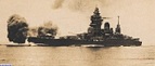
OT: Inedited picture of Japan Navy Power at Sea
Moderators: wdolson, MOD_War-in-the-Pacific-Admirals-Edition
-
adarbrauner
- Posts: 1531
- Joined: Thu Nov 03, 2016 3:40 am
- Location: Zichron Yaaqov, Israel; Before, Treviso, Italy
RE: OT: Inedited picture of Japan Navy Power at Sea
I think the IJN defences were kind of spotty. Sub USS Wahoo with Mush Morton in command entered Wewak harbour to do a recon and got close enough to see ships at the anchorage. Another sub was able to target the damaged CA Kumano anchored close to shore in Northern Luzon (Aparri?). It made more than one attack as the torps from the first attack hit a reef or shallows and did not reach Kumano, so the sub repositioned and tried again. IIRC it did get one hit, which kept Kumano from departing before a carrier strike sank her in the same location.
No matter how bad a situation is, you can always make it worse. - Chris Hadfield : An Astronaut's Guide To Life On Earth
RE: OT: Inedited picture of Japan Navy Power at Sea
As far as I know, Tawi Tawi Bay was only used as a forward anchorage for major IJN fleet units in May-Jun '44. Once the US was aware of
that fleet movement, USN submarines became almost a daily presence, patrolling just outside the anchorage, intercepting transiting IJN
vessels as well as observing numbers and types of IJN warships present in the anchorage.
At no point though do any of the USN subs appear to have attempted entry through the reef passages into the anchorage itself. Other than
the reefs themselves, obstacles to entry included constant (day and night) enemy float plane patrols, heavy barrier patrols by small surface
escorts of the passages, fast currents around the entrances, "glass-like" water surfaces (making periscope use risky) and finally a maximum
water depth within the 5 mile wide anchorage of only 120 feet.
As for the Kumano, according to CombinedFleet.com, she was torpedoed by US submarines at sea (accompanying a convoy) and only then made for
the anchorage at Santa Cruz where she was later sunk by USN aircraft.
that fleet movement, USN submarines became almost a daily presence, patrolling just outside the anchorage, intercepting transiting IJN
vessels as well as observing numbers and types of IJN warships present in the anchorage.
At no point though do any of the USN subs appear to have attempted entry through the reef passages into the anchorage itself. Other than
the reefs themselves, obstacles to entry included constant (day and night) enemy float plane patrols, heavy barrier patrols by small surface
escorts of the passages, fast currents around the entrances, "glass-like" water surfaces (making periscope use risky) and finally a maximum
water depth within the 5 mile wide anchorage of only 120 feet.
As for the Kumano, according to CombinedFleet.com, she was torpedoed by US submarines at sea (accompanying a convoy) and only then made for
the anchorage at Santa Cruz where she was later sunk by USN aircraft.
This was the only sig line I could think of.
RE: OT: Inedited picture of Japan Navy Power at Sea
I am sure I read about a sub making a couple of tries while she was anchored, but might not have got the hit. I'll try and find the reference.ORIGINAL: Buckrock
As far as I know, Tawi Tawi Bay was only used as a forward anchorage for major IJN fleet units in May-Jun '44. Once the US was aware of
that fleet movement, USN submarines became almost a daily presence, patrolling just outside the anchorage, intercepting transiting IJN
vessels as well as observing numbers and types of IJN warships present in the anchorage.
At no point though do any of the USN subs appear to have attempted entry through the reef passages into the anchorage itself. Other than
the reefs themselves, obstacles to entry included constant (day and night) enemy float plane patrols, heavy barrier patrols by small surface
escorts of the passages, fast currents around the entrances, "glass-like" water surfaces (making periscope use risky) and finally a maximum
water depth within the 5 mile wide anchorage of only 120 feet.
As for the Kumano, according to CombinedFleet.com, she was torpedoed by US submarines at sea (accompanying a convoy) and only then made for
the anchorage at Santa Cruz where she was later sunk by USN aircraft.
Edit: Could not find the reference, but the Combined Fleet article ( http://www.combinedfleet.com/atully04.htm ) says the subs attacking the TA convoy had three attacks in which torpedoes hit reefs or shore before Kumano took two hits. This makes me think whoever wrote the account I read may have thought the ship was already anchored when those attacks were made or that the sub attacking Kumano at her final resting place did not achieve any hits and was overlooked in the Combined Fleet account of her many lives.
No matter how bad a situation is, you can always make it worse. - Chris Hadfield : An Astronaut's Guide To Life On Earth
RE: OT: Inedited picture of Japan Navy Power at Sea
Tawi Tawi looks like a pretty location, but I never considered it in game so far as some base for my bigger IJN ships...[;)]
I googled the name and this map came up on Wiki, wonder if something is wrong with it?

here looks like out of a movie... but perhaps it is real [:D]
https://www.google.de/search?q=Tawi+Taw ... fuAE9_E7tM:
I googled the name and this map came up on Wiki, wonder if something is wrong with it?
here looks like out of a movie... but perhaps it is real [:D]
https://www.google.de/search?q=Tawi+Taw ... fuAE9_E7tM:

RE: OT: Inedited picture of Japan Navy Power at Sea
With Menado and Morotai it more or less closes off the Moluccans from the north
Fred
Fred
River Wide, Ocean Deep - a book on Operation Sea Lion - www.fredleander.com
Saving MacArthur - a book series on how The Philippines were saved - in 1942! https://www.amazon.com/gp/product/B07D3 ... rw_dp_labf
Saving MacArthur - a book series on how The Philippines were saved - in 1942! https://www.amazon.com/gp/product/B07D3 ... rw_dp_labf
RE: OT: Inedited picture of Japan Navy Power at Sea
ORIGINAL: Alpha77
Tawi Tawi looks like a pretty location, but I never considered it in game so far as some base for my bigger IJN ships...[;)]
I've never found much use for it in any of my games.
It's value to the historical Japanese was due to the circumstances they faced in early-mid '44. It was a sizable, protected natural anchorage that could be temporarily used by the fleet with little need for construction of facilities. It was close to the Borneo oil refineries for fleet refueling, could act as a forward anchorage for naval operations against the Allied offensive in Northern New Guinea or the anticipated ones against Palau or the Caroline Islands. It was also distant enough to be at low risk from US bombers or Fast Carrier strikes. After losing the Battle of the Philippine Sea, the Japanese effectively ceased using it as a major fleet anchorage. The Allies later used it as a support base for their 1945 operations against Borneo.
This was the only sig line I could think of.
-
adarbrauner
- Posts: 1531
- Joined: Thu Nov 03, 2016 3:40 am
- Location: Zichron Yaaqov, Israel; Before, Treviso, Italy
RE: OT: Inedited picture of Japan Navy Power at Sea
ORIGINAL: Buckrock
I've never found much use for it in any of my games.
It's value to the historical Japanese was due to the circumstances they faced in early-mid '44. It was a sizable, protected natural anchorage that could be temporarily used by the fleet with little need for construction of facilities. It was close to the Borneo oil refineries for fleet refueling, could act as a forward anchorage for naval operations against the Allied offensive in Northern New Guinea or the anticipated ones against Palau or the Caroline Islands. It was also distant enough to be at low risk from US bombers or Fast Carrier strikes. After losing the Battle of the Philippine Sea, the Japanese effectively ceased using it as a major fleet anchorage. The Allies later used it as a support base for their 1945 operations against Borneo.
+1
ORIGINAL: Buckrock
As far as I know, Tawi Tawi Bay was only used as a forward anchorage for major IJN fleet units in May-Jun '44. Once the US was aware of
that fleet movement, USN submarines became almost a daily presence, patrolling just outside the anchorage, intercepting transiting IJN
vessels as well as observing numbers and types of IJN warships present in the anchorage.
At no point though do any of the USN subs appear to have attempted entry through the reef passages into the anchorage itself. Other than
the reefs themselves, obstacles to entry included constant (day and night) enemy float plane patrols, heavy barrier patrols by small surface
escorts of the passages, fast currents around the entrances, "glass-like" water surfaces (making periscope use risky) and finally a maximum
water depth within the 5 mile wide anchorage of only 120 feet.
Please bring up the source(s)

RE: OT: Inedited picture of Japan Navy Power at Sea
Re: Tawi Tawi
Yes very interesting to me as well. Good posts.
I am equally unsure of all my sources... I "think" I recall my foremost source was "The Veterans edition of WW2 for Armed Services Members" published circa 1947.. a wonderful historical book I inherited.
I believe that I recall .... Japan staged most of its ships (late 1944 and in particular leading up to Leyte ) at Brunei or Jesselton.
Nominally at Singapore however Brunei had 'dirty oil' (??) supplies that was 'good enough' for fleet operations (?)
Perhaps others could opine if they recall something similar.
Yes very interesting to me as well. Good posts.
I am equally unsure of all my sources... I "think" I recall my foremost source was "The Veterans edition of WW2 for Armed Services Members" published circa 1947.. a wonderful historical book I inherited.
I believe that I recall .... Japan staged most of its ships (late 1944 and in particular leading up to Leyte ) at Brunei or Jesselton.
Nominally at Singapore however Brunei had 'dirty oil' (??) supplies that was 'good enough' for fleet operations (?)
Perhaps others could opine if they recall something similar.
A People that values its privileges above it's principles will soon loose both. Dwight D Eisenhower.
RE: OT: Inedited picture of Japan Navy Power at Sea
Also a good discussion here -> https://forum.axishistory.com//viewtopic.php?t=138054
Looks like a whole lot of experimentation to find the best place to place the bridge, funnels, reduce turbulence, operate in formations, etc.
Here's a further explanation:
Looks like a whole lot of experimentation to find the best place to place the bridge, funnels, reduce turbulence, operate in formations, etc.
Here's a further explanation:
Normal aviation practice is to fly left hand circuits which made having the island on the starboard side a logical choice, the aircraft turned away from the island if doing a closed circuit, continuing left turns to downwind, base and finals.
The Japanese carriers with islands on the port side were Hiryu and Akagi, after modernisation. The theory was that they could work in close formation with their sister ships, flying a right hand circuit, while the aircraft of the sister ship used left hand circuits, so that their respective air groups could operate together with minimal interference when landing and taking off.
Hiryu was supposed to work with her near sister Soryu, while Akagi worked with Kaga.
That was the theory anyway!
RE: OT: Inedited picture of Japan Navy Power at Sea
ORIGINAL: adarbrauner
Please bring up the source(s)
Anchorage conditions as described in War Diary of Task Force 71 (Submarine Force, 7th Fleet) for period May-Jun '44. Diary attachments
included the War Patrol Report(s) of the USN submarines that were tasked with close observation of Tawi Tawi anchorage during the period,
including somewhat famous patrol by the USS Harder.
This was the only sig line I could think of.
RE: OT: Inedited picture of Japan Navy Power at Sea
Very interesting - something I never heard before!ORIGINAL: DRF99
Also a good discussion here -> https://forum.axishistory.com//viewtopic.php?t=138054
Looks like a whole lot of experimentation to find the best place to place the bridge, funnels, reduce turbulence, operate in formations, etc.
Here's a further explanation:Normal aviation practice is to fly left hand circuits which made having the island on the starboard side a logical choice, the aircraft turned away from the island if doing a closed circuit, continuing left turns to downwind, base and finals.
The Japanese carriers with islands on the port side were Hiryu and Akagi, after modernisation. The theory was that they could work in close formation with their sister ships, flying a right hand circuit, while the aircraft of the sister ship used left hand circuits, so that their respective air groups could operate together with minimal interference when landing and taking off.
Hiryu was supposed to work with her near sister Soryu, while Akagi worked with Kaga.
That was the theory anyway!
No matter how bad a situation is, you can always make it worse. - Chris Hadfield : An Astronaut's Guide To Life On Earth