Designer's Notes: terrain interpretation: practical

Graphics, sound, and database mods.

Scenarios should still be posted in the main 'Mods and Scenarios' forum below
Post Reply
User avatar
cathar1244
Posts: 1342
Joined: Sat Sep 05, 2009 2:16 am

Designer's Notes: terrain interpretation: practical

Post by cathar1244 »

Image

I've been slowly working on a map, and it will serve as a practical demonstration of terrain interpretation as it relates to TOAW scenarios.

First up were design decisions. I wanted a map of Europe with some of the surrounding areas. The region I settled on stretches from the coast of Greenland to the Red Sea, and northwest Africa to Russia a bit beyond the Urals.

A key decision is hex scale, and that hinges upon the scenarios that may be able to employ the map. Scenarios I may work on using this map are intended to be corps-level with some smaller units, using turn durations of half a week to one week. For this, I opted to use 25 kilometers per hex as the scale. This scale allows for a fair depiction of items like coastlines while ensuring that places like Russia are still a huge sea of hexes.

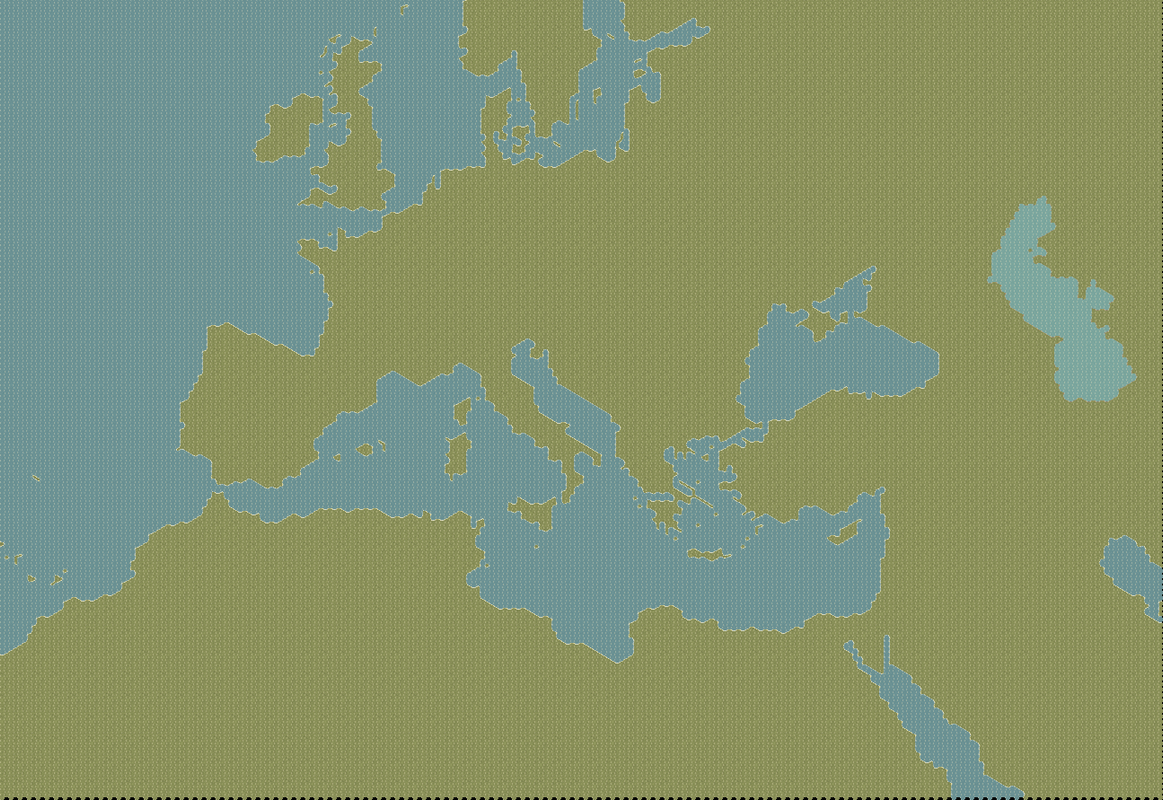
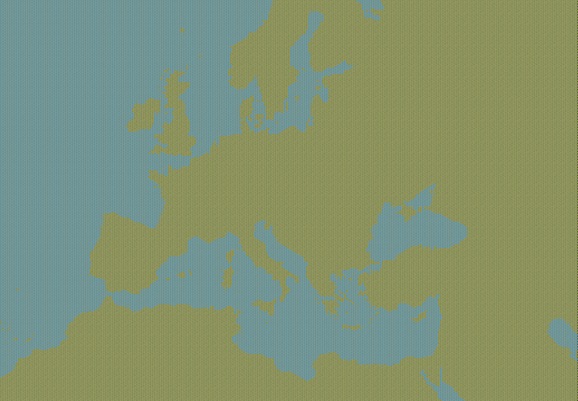
I can't get the map export to image file to work from the map editor, so here is a partial of the map, zoomed out. Note that this is the first stage of map-making: land and sea. I intend to keep different versions of the map reflecting the various "layers" that will be placed on it: arid and sand tiles, mountains and hills, inland waters, forestation, and finally, cities, transportation facilities, and international frontiers. The "why" of keeping these different versions is that it simplifies major edits if I wish to go back and start over on a given layer. Equally important, as Lobster noted, is that things change ... and more rapidly than we often realize. For example, the Zuider Zee in The Netherlands was considerably larger in World War II than it is today (the Dutch reclaimed land after the war). Cities grow in extent, road networks change, etc.
Image

Okay, as to interpretation for the first layer (arid and sand tiles), this isn't something that one might easily find on a standard map. But it is a topic that a good atlas will cover. My "good" atlas will be an older version of Goode's World Atlas, as well as satellite imagery to judge how "green" the regions are. Data on annual rainfall could be used as well to indicate the location of drier regions. Once I've finished applying the arid and sand tiles, I'll post in this thread again.

Cheers

Simon Edmonds
Posts: 218
Joined: Thu May 10, 2018 12:37 am

RE: Designer's Notes: terrain interpretation: practical

Post by Simon Edmonds »

Hey Cathar. Are you using hex thingy? At 25km the old GDW Europa maps would be a good resource to point you in the right direction terrain wise.
User avatar
cathar1244
Posts: 1342
Joined: Sat Sep 05, 2009 2:16 am

RE: Designer's Notes: terrain interpretation: practical

Post by cathar1244 »

ORIGINAL: Simon Edmonds

Hey Cathar. Are you using hex thingy? At 25km the old GDW Europa maps would be a good resource to point you in the right direction terrain wise.

Hi Simon, I used ODD to lay down the hex grid over a map made by software called "Map Creator".

Thanks for the tip on the GDW maps. I don't have the games, though. That's okay, as I prefer to check against real maps and sat data. Over the years, I've found many of the old wargames (no idea about Europa) were less than exact in depiction of terrain.

Cheers
Simon Edmonds
Posts: 218
Joined: Thu May 10, 2018 12:37 am

RE: Designer's Notes: terrain interpretation: practical

Post by Simon Edmonds »

You can find the GDW maps at a site called generalstab.org. I find them handy as a very general reference tool. Especially in Morocco where the American WW2 maps become a bit sparse on the ground. Best of luck with your project.
User avatar
cathar1244
Posts: 1342
Joined: Sat Sep 05, 2009 2:16 am

RE: Designer's Notes: terrain interpretation: practical

Post by cathar1244 »

Thanks Simon! I enjoy looking at the old game maps.

Cheers
User avatar
Curtis Lemay
Posts: 15410
Joined: Fri Sep 17, 2004 3:12 pm
Location: Houston, TX

RE: Designer's Notes: terrain interpretation: practical

Post by Curtis Lemay »

ORIGINAL: cathar1244

Hi Simon, I used ODD to lay down the hex grid over a map made by software called "Map Creator".

Do you know what the projection type was?
My TOAW web site:

Bob Cross's TOAW Site
User avatar
cathar1244
Posts: 1342
Joined: Sat Sep 05, 2009 2:16 am

RE: Designer's Notes: terrain interpretation: practical

Post by cathar1244 »

ORIGINAL: Curtis Lemay

ORIGINAL: cathar1244

Hi Simon, I used ODD to lay down the hex grid over a map made by software called "Map Creator".

Do you know what the projection type was?

Map Creator offers a few options for projection; for this map I used "orthographic azimuthal". One aspect of the projection I liked is that it "pushed" Greenland-Iceland and northern Russia high to the north -- useful, I thought, considering the weather zones in TOAW. Good/bad? Guess I'll find out!

Cheers
User avatar
cathar1244
Posts: 1342
Joined: Sat Sep 05, 2009 2:16 am

RE: Designer's Notes: terrain interpretation: practical

Post by cathar1244 »

Here is the map showing the full extent to the SE. Caspian Sea has been added. Not sure if I'm dealing with an old bug, but anytime I place deep water tiles east of hex row 207 or so, the color appears to be shallow water and no edging is applied to the coastline. Hex reports as deep water, though.

A question for other designers: The Aral Sea. I guess I should put in the coastline as it appeared in World War II since any scenarios I build using this map will probably be around that period of time. But for modern uses, the Aral Sea has practically disappeared because of bad water management practices by the USSR. Maybe a modern map should show what used to be the Aral Sea as mostly sand hexes?

Cheers

Image
Post Reply

Return to “Mods”