ORIGINAL: c92nichj
Option B
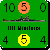
I am considering using a large asterisk after a land unit's movement # to indicate its elite status (aka "white print"). This would let me always use a white font for the major powers with dark backgrounds and a black font for those with light backgrounds. Indeed, I could do that for all the minor countries too. Then all the combat and movement factors for land units would be clearly visible all the time. This should rile the experienced WIF players, because it changes a fundamental definition in the game: white print units would no longer be white print! Taking a broader point of view, the asterisk (or some other symbol, E for Elite?) could communicate the same information. The gain in legibility would be enormous. I can do the same thing for the numbers in the corners of the air and naval units to make them more legible too.
This option is the best one I think, but please come up with a graphic detail to make the elite units look like elite, instead of just putting an asterix or a litte E.
Examples:
- fill the Nato symbol with a different colour (like you do with Para and Mar)
- outline the counter differently than with a normal unit use for example gold, silver or white. Instead of the normal black.
- add a golden star, crown, ironcross or something, but not an asterix.
- Only have the colour of the unit-size XXXX, XXX, XX in black or white if it is a white print unit.
It gives a much better feeling to move around units that looks like elite than if they only have an asterix.
You made me laugh at my own suggestion of an asterisk or E.
The NATO symbols are heavily modified for militia and territorial units. Check out the French and British territorial units for a cacaphony of colors (mixed methaphor). Any change to that would likely go unnoticed.
The counter outline also varies quite often for the same two unit types. But I still like the idea of a gold outline.
A gold star is clearly a better symbol for elite. Hey, that's why I post these things, so you guys can tell me when I have stupid thoughts. I am open to more suggestions for elite unit indicators. The white icon interior alone isn't sufficient because of countries with white as their primary color (e.g., Yugoslavia).
Even the coloring of the XXX's above the NATO symbols are colored differently already. This is why I have so many different colors associated with each country. Here is the color list for each country:
1 - basic unit background
2 - icon outline
3 - icon interior
4 - icon interior X (may be different from outline)
5 - icon interior letter
6 - unit strength, reorganization, and movement values
7 - unit name
8 - unit size (e.g., XXX)
9 - elite interior color
10 - elite font color
11 - divisional interior color
I am using the same coloring for #6 and #7 at all times. I am thinking of also using the same color for #8 for all non-militia, non-territorial units for major powers. Right now, #8 is always black except for militia, territorial, and minor country units.
I am using white for both #9 and #10. That gets overridden by marine and paratroop coloring.
I have to select new colors for #11 for each major power. They get overridden by marine, paratroop, and artillery unit type coloring (AA, AT, and all artillery unit types).