ORIGINAL: wodin
One thing that would be great is if your screenies didn't show all the units on map..
True.
@Sweeteye:
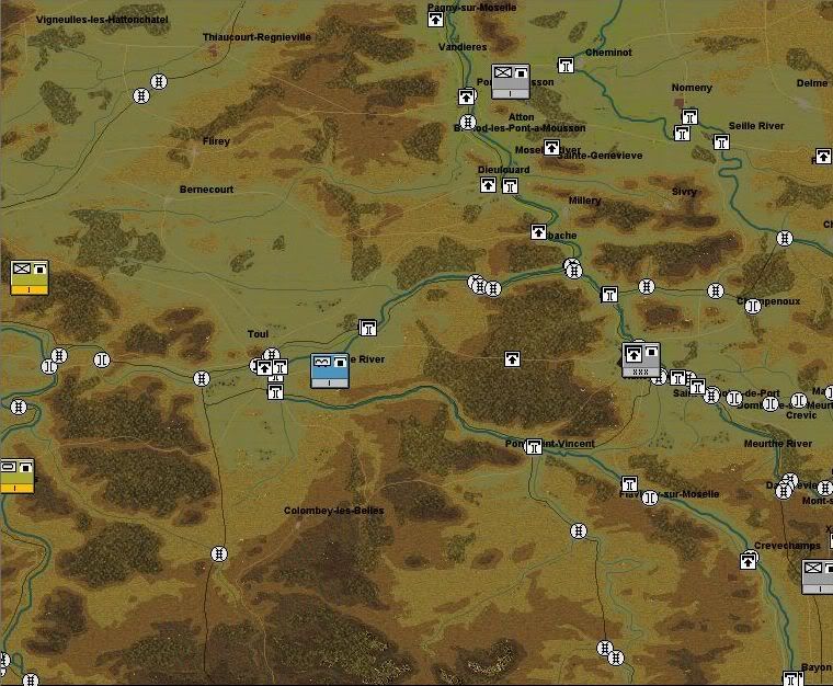
You can determine the level of intel/visibility in the scenario maker. You can even provide misleading info, like say "placing" false intel "footprints" of one or another unit north of Bernecourt, for example. With Allied air superiority, planes spotted retreating or scouting/spearheading German ground units and passed the info quickly. So, in this scenario, the Corps would then receive this info about either retreating units or say about German scouts.
Still, Intel would have been bad without recon on the ground. The campaigns in France offered probably the best intel of the war, as the Resistance kept delivering infos about troop movements, even down to the number of vehicles and unit designations (if visible). The buildup or composition of the defense in the woods around Nancy/Toul, outside the city/villages, was difficult to track, most likely, though.
Anyway, I recommend showing the "tip" of the German defense at Toul, one or another unit in the south east, and a rough layout of the defenses up north (say every 3rd unit). I would provide info about every 4th or 5th unit in the south east, to show the player that this line is occupied by the defenders, but be vague about strength. If I am not mistaken, the terrain allows for an attack from the south (means bypassing Toul south, then attacking towards unit 1119), so you might want to avoid giving out too many infos about the south east corner, and to provide enough infos about 1119 & Co., to show it's not an easy backdoor.
Just my 2 cents.